Gainesville Topo Map Missouri
To zoom in, hover over the map of Gainesville
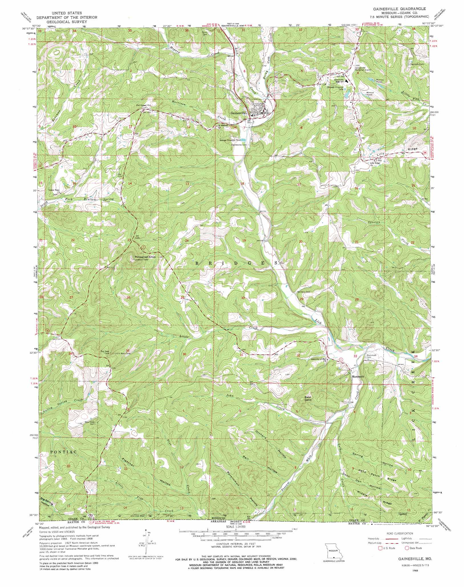
USGS Topo Quad 36092e4 - 1:24,000 scale
| Topo Map Name: | Gainesville |
| USGS Topo Quad ID: | 36092e4 |
| Print Size: | ca. 21 1/4" wide x 27" high |
| Southeast Coordinates: | 36.5° N latitude / 92.375° W longitude |
| Map Center Coordinates: | 36.5625° N latitude / 92.4375° W longitude |
| U.S. State: | MO |
| Filename: | o36092e4.jpg |
| Download Map JPG Image: | Gainesville topo map 1:24,000 scale |
| Map Type: | Topographic |
| Topo Series: | 7.5´ |
| Map Scale: | 1:24,000 |
| Source of Map Images: | United States Geological Survey (USGS) |
| Alternate Map Versions: |
Gainesville MO 1968, updated 1970 Download PDF Buy paper map Gainesville MO 1968, updated 1981 Download PDF Buy paper map Gainesville MO 2012 Download PDF Buy paper map Gainesville MO 2015 Download PDF Buy paper map |
1:24,000 Topo Quads surrounding Gainesville
Smallett |
Wasola |
Rockbridge |
Gentryville |
Dora |
Thornfield |
Willhoit |
Gainesville Nw |
Sycamore |
Cureall Nw |
Theodosia |
Isabella |
Gainesville |
Udall |
Bakersfield |
Cotter Nw |
Bull Shoals |
Midway |
Clarkridge |
Gamaliel |
Cotter Sw |
Cotter |
Mountain Home West |
Mountain Home East |
Norfork Dam North |
> Back to 36092e1 at 1:100,000 scale
> Back to 36092a1 at 1:250,000 scale
> Back to U.S. Topo Maps home
Gainesville topo map: Gazetteer
Gainesville: Airports
Gainesville Memorial Airport elevation 324m 1062′Gainesville: Dams
Merrell Lake Dam elevation 296m 971′Gainesville: Populated Places
Gainesville elevation 238m 780′Mammoth elevation 204m 669′
Gainesville: Reservoirs
Merrill Lake elevation 296m 971′Gainesville: Ridges
Cane Patch Ridge elevation 286m 938′Lily Ridge elevation 300m 984′
Middle Ridge elevation 282m 925′
Gainesville: Streams
Becky Cobb Creek elevation 231m 757′Harrison Creek elevation 220m 721′
Hogard Creek elevation 237m 777′
John Creek elevation 205m 672′
Little Creek elevation 201m 659′
Little Pine Creek elevation 247m 810′
Luther Creek elevation 206m 675′
Luther Creek elevation 246m 807′
Possum Walk Creek elevation 194m 636′
Possum Walk Creek elevation 189m 620′
Gainesville: Summits
Bald Dave elevation 331m 1085′Timbered Knob elevation 397m 1302′
Gainesville: Valleys
Coon Den Hollow elevation 225m 738′Fletcher Hollow elevation 259m 849′
Orchard Hollow elevation 220m 721′
Persimmon Hollow elevation 228m 748′
Rail Hollow elevation 223m 731′
Spring Hollow elevation 217m 711′
Gainesville digital topo map on disk
Buy this Gainesville topo map showing relief, roads, GPS coordinates and other geographical features, as a high-resolution digital map file on DVD: