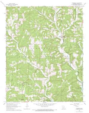
Thornfield Topo Map Missouri
To zoom in, hover over the map of Thornfield
USGS Topo Quad 36092f6 - 1:24,000 scale
| Topo Map Name: | Thornfield |
| USGS Topo Quad ID: | 36092f6 |
| Print Size: | ca. 21 1/4" wide x 27" high |
| Southeast Coordinates: | 36.625° N latitude / 92.625° W longitude |
| Map Center Coordinates: | 36.6875° N latitude / 92.6875° W longitude |
| U.S. State: | MO |
| Filename: | o36092f6.jpg |
| Download Map JPG Image: | Thornfield topo map 1:24,000 scale |
| Map Type: | Topographic |
| Topo Series: | 7.5´ |
| Map Scale: | 1:24,000 |
| Source of Map Images: | United States Geological Survey (USGS) |
| Alternate Map Versions: |
Thornfield MO 1968, updated 1970 Download PDF Buy paper map Thornfield MO 2004, updated 2006 Download PDF Buy paper map Thornfield MO 2012 Download PDF Buy paper map Thornfield MO 2015 Download PDF Buy paper map |
| FStopo: | US Forest Service topo Thornfield is available: Download FStopo PDF Download FStopo TIF |
1:24,000 Topo Quads surrounding Thornfield
> Back to 36092e1 at 1:100,000 scale
> Back to 36092a1 at 1:250,000 scale
> Back to U.S. Topo Maps home
Thornfield topo map: Gazetteer
Thornfield: Dams
Etuchee Dam elevation 319m 1046′Thornfield: Populated Places
Hammond elevation 233m 764′Longrun elevation 263m 862′
Pondfork elevation 294m 964′
Thornfield elevation 246m 807′
Thornfield: Reservoirs
Etuchee Lake elevation 319m 1046′Thornfield: Streams
Little Creek elevation 232m 761′Long Run elevation 217m 711′
Otter Creek elevation 244m 800′
Turkey Creek elevation 213m 698′
Thornfield: Summits
Washington Bald elevation 380m 1246′Thornfield: Valleys
Buttram Hollow elevation 269m 882′Buzzard Roost Hollow elevation 220m 721′
Caney Hollow elevation 266m 872′
Dry Hollow elevation 241m 790′
Hay Hollow elevation 238m 780′
Mount Lebanon Hollow elevation 256m 839′
Panther Hollow elevation 213m 698′
Pleasant Valley elevation 237m 777′
Thompson Hollow elevation 226m 741′
Wells Hollow elevation 216m 708′
Willhoit Hollow elevation 214m 702′
Thornfield digital topo map on disk
Buy this Thornfield topo map showing relief, roads, GPS coordinates and other geographical features, as a high-resolution digital map file on DVD:


