Vanzant Topo Map Missouri
To zoom in, hover over the map of Vanzant
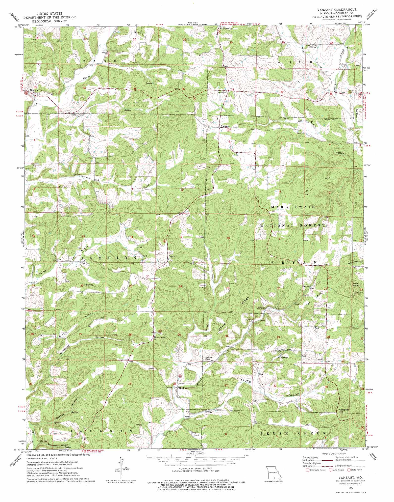
USGS Topo Quad 36092h3 - 1:24,000 scale
| Topo Map Name: | Vanzant |
| USGS Topo Quad ID: | 36092h3 |
| Print Size: | ca. 21 1/4" wide x 27" high |
| Southeast Coordinates: | 36.875° N latitude / 92.25° W longitude |
| Map Center Coordinates: | 36.9375° N latitude / 92.3125° W longitude |
| U.S. State: | MO |
| Filename: | o36092h3.jpg |
| Download Map JPG Image: | Vanzant topo map 1:24,000 scale |
| Map Type: | Topographic |
| Topo Series: | 7.5´ |
| Map Scale: | 1:24,000 |
| Source of Map Images: | United States Geological Survey (USGS) |
| Alternate Map Versions: |
Vanzant MO 1973, updated 1975 Download PDF Buy paper map Vanzant MO 2004, updated 2006 Download PDF Buy paper map Vanzant MO 2012 Download PDF Buy paper map Vanzant MO 2015 Download PDF Buy paper map |
| FStopo: | US Forest Service topo Vanzant is available: Download FStopo PDF Download FStopo TIF |
1:24,000 Topo Quads surrounding Vanzant
Mansfield Ne |
Owens |
Mountain Grove North |
Cabool Nw |
Cabool Ne |
Mansfield |
Norwood |
Mountain Grove South |
Cabool Sw |
Cabool Se |
Sweden |
Brushyknob |
Vanzant |
Nichols Knob |
Dyestone Mountain |
Wasola |
Rockbridge |
Gentryville |
Dora |
Siloam Springs |
Willhoit |
Gainesville Nw |
Sycamore |
Cureall Nw |
Pottersville |
> Back to 36092e1 at 1:100,000 scale
> Back to 36092a1 at 1:250,000 scale
> Back to U.S. Topo Maps home
Vanzant topo map: Gazetteer
Vanzant: Parks
Davis Roadside Park elevation 385m 1263′Vanzant: Populated Places
Buckhart elevation 267m 875′Denlow elevation 293m 961′
Drury elevation 368m 1207′
Holtville elevation 351m 1151′
Tedrick (historical) elevation 325m 1066′
Vanzant elevation 357m 1171′
Vanzant: Ridges
Nye Ridge elevation 355m 1164′White Ridge elevation 346m 1135′
Vanzant: Streams
Red Bank Creek elevation 291m 954′West Fork Brush Creek elevation 269m 882′
West Prong Clifty Creek elevation 299m 980′
Vanzant: Summits
Campbell Hill elevation 398m 1305′Twin Knobs elevation 428m 1404′
Vanzant: Valleys
Barker Hollow elevation 242m 793′Mushman Hollow elevation 246m 807′
Pedro Hollow elevation 264m 866′
Spicewood Hollow elevation 243m 797′
Toothpick Hollow elevation 286m 938′
Vanzant digital topo map on disk
Buy this Vanzant topo map showing relief, roads, GPS coordinates and other geographical features, as a high-resolution digital map file on DVD: