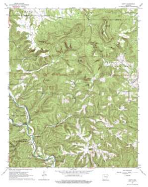
Hasty Topo Map Arkansas
To zoom in, hover over the map of Hasty
USGS Topo Quad 36093a1 - 1:24,000 scale
| Topo Map Name: | Hasty |
| USGS Topo Quad ID: | 36093a1 |
| Print Size: | ca. 21 1/4" wide x 27" high |
| Southeast Coordinates: | 36° N latitude / 93° W longitude |
| Map Center Coordinates: | 36.0625° N latitude / 93.0625° W longitude |
| U.S. State: | AR |
| Filename: | o36093a1.jpg |
| Download Map JPG Image: | Hasty topo map 1:24,000 scale |
| Map Type: | Topographic |
| Topo Series: | 7.5´ |
| Map Scale: | 1:24,000 |
| Source of Map Images: | United States Geological Survey (USGS) |
| Alternate Map Versions: |
Hasty AR 1967, updated 1968 Download PDF Buy paper map Hasty AR 1967, updated 1975 Download PDF Buy paper map Hasty AR 2011 Download PDF Buy paper map Hasty AR 2014 Download PDF Buy paper map |
| FStopo: | US Forest Service topo Hasty is available: Download FStopo PDF Download FStopo TIF |
1:24,000 Topo Quads surrounding Hasty
Alpena |
Batavia |
Bergman |
Zinc |
Pyatt |
Osage Ne |
Gaither |
Harrison |
Everton |
Bruno |
Ponca |
Jasper |
Hasty |
Western Grove |
Saint Joe |
Murray |
Parthenon |
Mount Judea |
Eula |
Snowball |
Swain |
Deer |
Lurton |
Moore |
Witts Spring |
> Back to 36093a1 at 1:100,000 scale
> Back to 36092a1 at 1:250,000 scale
> Back to U.S. Topo Maps home
Hasty topo map: Gazetteer
Hasty: Cliffs
Chimney Rock Bluff elevation 254m 833′Flatiron Bluff elevation 309m 1013′
Gray Bluff elevation 300m 984′
Hasty: Flats
P D Flat elevation 419m 1374′Hasty: Populated Places
Hasty elevation 373m 1223′Sulphur Spring (historical) elevation 472m 1548′
Wells Creek (historical) elevation 255m 836′
Yardelle elevation 274m 898′
Hasty: Post Offices
Hasty Post Office elevation 367m 1204′Hasty: Springs
Sulphur Spring elevation 477m 1564′Hasty: Streams
Bat House Branch elevation 293m 961′Cedar Creek elevation 300m 984′
Little Buffalo River elevation 227m 744′
Rock Creek elevation 221m 725′
Wells Creek elevation 233m 764′
Yardelle Branch elevation 275m 902′
Hasty: Summits
Boat Mountain elevation 674m 2211′Braden Mountain elevation 525m 1722′
Fodderstack Mountain elevation 513m 1683′
Lost Hill elevation 276m 905′
Pinnacle Mountain elevation 619m 2030′
Shirey Mountain elevation 485m 1591′
Sulphur Mountain elevation 653m 2142′
Hasty: Valleys
Bear Cave Hollow elevation 229m 751′Boomer Hollow elevation 245m 803′
Little Bear Cave Hollow elevation 261m 856′
Hasty digital topo map on disk
Buy this Hasty topo map showing relief, roads, GPS coordinates and other geographical features, as a high-resolution digital map file on DVD:


