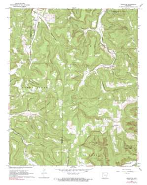
Osage Sw Topo Map Arkansas
To zoom in, hover over the map of Osage Sw
USGS Topo Quad 36093a4 - 1:24,000 scale
| Topo Map Name: | Osage Sw |
| USGS Topo Quad ID: | 36093a4 |
| Print Size: | ca. 21 1/4" wide x 27" high |
| Southeast Coordinates: | 36° N latitude / 93.375° W longitude |
| Map Center Coordinates: | 36.0625° N latitude / 93.4375° W longitude |
| U.S. State: | AR |
| Filename: | o36093a4.jpg |
| Download Map JPG Image: | Osage Sw topo map 1:24,000 scale |
| Map Type: | Topographic |
| Topo Series: | 7.5´ |
| Map Scale: | 1:24,000 |
| Source of Map Images: | United States Geological Survey (USGS) |
| Alternate Map Versions: |
Osage SW AR 1968, updated 1969 Download PDF Buy paper map Osage SW AR 1968, updated 1970 Download PDF Buy paper map Osage SW AR 1968, updated 1991 Download PDF Buy paper map Osage SW AR 2011 Download PDF Buy paper map Osage SW AR 2014 Download PDF Buy paper map |
1:24,000 Topo Quads surrounding Osage Sw
> Back to 36093a1 at 1:100,000 scale
> Back to 36092a1 at 1:250,000 scale
> Back to U.S. Topo Maps home
Osage Sw topo map: Gazetteer
Osage Sw: Arches
Lost Valley Natural Bridge elevation 376m 1233′Osage Sw: Falls
Eden Falls elevation 464m 1522′Osage Sw: Populated Places
Allfriend (historical) elevation 446m 1463′Dinsmore elevation 449m 1473′
George elevation 475m 1558′
Stoverville elevation 673m 2208′
Osage Sw: Streams
Bradley Branch elevation 473m 1551′Osage Sw: Summits
Arms Mountain elevation 644m 2112′Bradshaw Mountain elevation 581m 1906′
Logan Mountain elevation 611m 2004′
Osage Sw: Valleys
Bee Hollow elevation 599m 1965′Cockran Hollow elevation 448m 1469′
Cook Hollow elevation 460m 1509′
Cook Hollow elevation 443m 1453′
Cove Hollow elevation 436m 1430′
Grogans Hollow elevation 498m 1633′
Hamstring Hollow elevation 445m 1459′
Howe Hollow elevation 475m 1558′
Lawson Hollow elevation 451m 1479′
McCullough Hollow elevation 448m 1469′
Pickle Hollow elevation 442m 1450′
Smelley Hollow elevation 449m 1473′
Sugar Camp Hollow elevation 506m 1660′
Osage Sw digital topo map on disk
Buy this Osage Sw topo map showing relief, roads, GPS coordinates and other geographical features, as a high-resolution digital map file on DVD:


