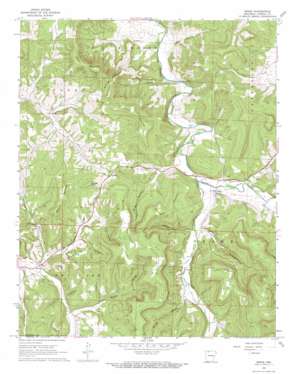
Osage Topo Map Arkansas
To zoom in, hover over the map of Osage
USGS Topo Quad 36093b4 - 1:24,000 scale
| Topo Map Name: | Osage |
| USGS Topo Quad ID: | 36093b4 |
| Print Size: | ca. 21 1/4" wide x 27" high |
| Southeast Coordinates: | 36.125° N latitude / 93.375° W longitude |
| Map Center Coordinates: | 36.1875° N latitude / 93.4375° W longitude |
| U.S. State: | AR |
| Filename: | o36093b4.jpg |
| Download Map JPG Image: | Osage topo map 1:24,000 scale |
| Map Type: | Topographic |
| Topo Series: | 7.5´ |
| Map Scale: | 1:24,000 |
| Source of Map Images: | United States Geological Survey (USGS) |
| Alternate Map Versions: |
Osage AR 1968, updated 1969 Download PDF Buy paper map Osage AR 1968, updated 1973 Download PDF Buy paper map Osage AR 2011 Download PDF Buy paper map Osage AR 2014 Download PDF Buy paper map |
1:24,000 Topo Quads surrounding Osage
> Back to 36093a1 at 1:100,000 scale
> Back to 36092a1 at 1:250,000 scale
> Back to U.S. Topo Maps home
Osage topo map: Gazetteer
Osage: Cliffs
Cedar Bluff elevation 470m 1541′Osage: Dams
Lake of No Return Dam elevation 473m 1551′Osage: Populated Places
Conner elevation 422m 1384′Dryfork elevation 424m 1391′
Gobbler elevation 499m 1637′
Osage elevation 401m 1315′
Rudd elevation 438m 1437′
Osage: Reservoirs
Lake of No Return elevation 473m 1551′Osage: Streams
Dog Branch elevation 401m 1315′Kenner Branch elevation 398m 1305′
Kenner Creek elevation 391m 1282′
North Fork Dry Fork elevation 417m 1368′
Tan Yard Branch elevation 420m 1377′
Osage: Summits
Black Mountain elevation 633m 2076′Coffman Mountain elevation 640m 2099′
Dewees Mountain elevation 605m 1984′
Fultz Mountain elevation 554m 1817′
Gobbler Point elevation 597m 1958′
Jim Fultz Mountain elevation 590m 1935′
Saffer Mountain elevation 573m 1879′
Usrey Mountain elevation 617m 2024′
Waldrop Mountain elevation 600m 1968′
Osage: Valleys
Brown Hollow elevation 445m 1459′Hurth Hollow elevation 476m 1561′
Jody Hollow elevation 447m 1466′
Miller Hollow elevation 403m 1322′
Miller Hollow elevation 422m 1384′
Pine Hollow elevation 386m 1266′
Sally Hollow elevation 405m 1328′
Osage digital topo map on disk
Buy this Osage topo map showing relief, roads, GPS coordinates and other geographical features, as a high-resolution digital map file on DVD:


