Forum Topo Map Arkansas
To zoom in, hover over the map of Forum
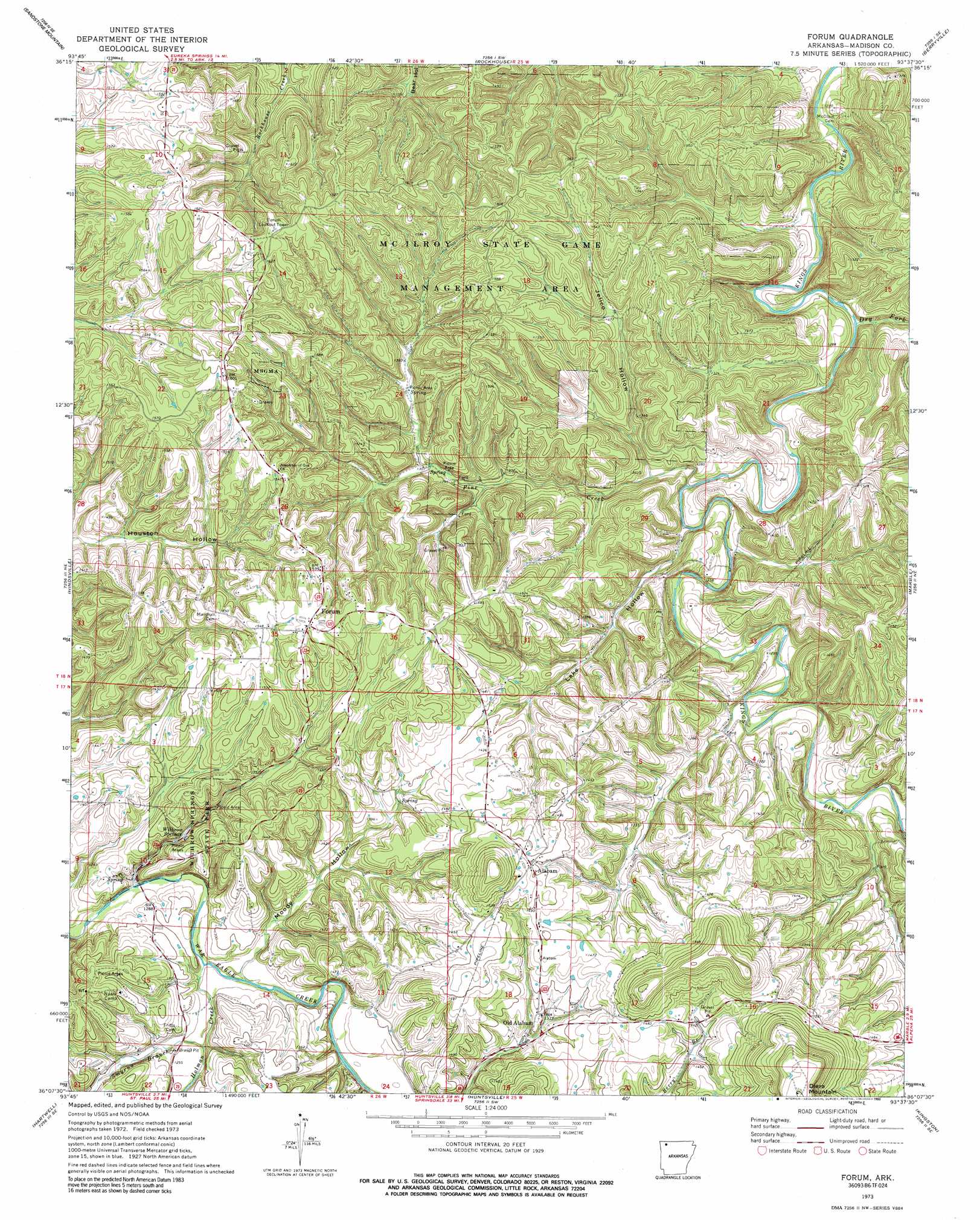
USGS Topo Quad 36093b6 - 1:24,000 scale
| Topo Map Name: | Forum |
| USGS Topo Quad ID: | 36093b6 |
| Print Size: | ca. 21 1/4" wide x 27" high |
| Southeast Coordinates: | 36.125° N latitude / 93.625° W longitude |
| Map Center Coordinates: | 36.1875° N latitude / 93.6875° W longitude |
| U.S. State: | AR |
| Filename: | o36093b6.jpg |
| Download Map JPG Image: | Forum topo map 1:24,000 scale |
| Map Type: | Topographic |
| Topo Series: | 7.5´ |
| Map Scale: | 1:24,000 |
| Source of Map Images: | United States Geological Survey (USGS) |
| Alternate Map Versions: |
Forum AR 1973, updated 1976 Download PDF Buy paper map Forum AR 1973, updated 1990 Download PDF Buy paper map Forum AR 1973, updated 1990 Download PDF Buy paper map Forum AR 2011 Download PDF Buy paper map Forum AR 2014 Download PDF Buy paper map |
1:24,000 Topo Quads surrounding Forum
Garfield |
Beaver |
Eureka Springs |
Grandview |
Blue Eye |
War Eagle |
Sandstone Mountain |
Rockhouse |
Berryville |
Green Forest |
Spring Valley |
Hindsville |
Forum |
Marble |
Osage |
Goshen |
Hartwell |
Huntsville |
Kingston |
Osage Sw |
Durham |
Japton |
Witter |
Weathers |
Boxley |
> Back to 36093a1 at 1:100,000 scale
> Back to 36092a1 at 1:250,000 scale
> Back to U.S. Topo Maps home
Forum topo map: Gazetteer
Forum: Gaps
Postoak Gap elevation 455m 1492′Forum: Parks
McIlroy State Game Management Area elevation 471m 1545′Withrow Springs State Park elevation 423m 1387′
Forum: Populated Places
Alabam elevation 456m 1496′Chaplin (historical) elevation 383m 1256′
Forum elevation 476m 1561′
Old Alabam elevation 417m 1368′
Forum: Post Offices
Forum Post Office elevation 475m 1558′Forum: Springs
Withrow Springs elevation 383m 1256′Forum: Streams
Dry Fork elevation 355m 1164′Holman Creek elevation 372m 1220′
Pine Creek elevation 361m 1184′
Smyrna Branch elevation 376m 1233′
Forum: Valleys
Jelico Hollow elevation 375m 1230′Lake Hollow elevation 363m 1190′
Moody Hollow elevation 376m 1233′
Forum digital topo map on disk
Buy this Forum topo map showing relief, roads, GPS coordinates and other geographical features, as a high-resolution digital map file on DVD: