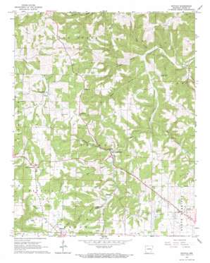
Batavia Topo Map Arkansas
To zoom in, hover over the map of Batavia
USGS Topo Quad 36093c2 - 1:24,000 scale
| Topo Map Name: | Batavia |
| USGS Topo Quad ID: | 36093c2 |
| Print Size: | ca. 21 1/4" wide x 27" high |
| Southeast Coordinates: | 36.25° N latitude / 93.125° W longitude |
| Map Center Coordinates: | 36.3125° N latitude / 93.1875° W longitude |
| U.S. State: | AR |
| Filename: | o36093c2.jpg |
| Download Map JPG Image: | Batavia topo map 1:24,000 scale |
| Map Type: | Topographic |
| Topo Series: | 7.5´ |
| Map Scale: | 1:24,000 |
| Source of Map Images: | United States Geological Survey (USGS) |
| Alternate Map Versions: |
Batavia AR 1967, updated 1969 Download PDF Buy paper map Batavia AR 2011 Download PDF Buy paper map Batavia AR 2014 Download PDF Buy paper map |
1:24,000 Topo Quads surrounding Batavia
> Back to 36093a1 at 1:100,000 scale
> Back to 36092a1 at 1:250,000 scale
> Back to U.S. Topo Maps home
Batavia topo map: Gazetteer
Batavia: Airports
Boone County Airport elevation 408m 1338′Batavia: Populated Places
Batavia elevation 453m 1486′Bear Creek Springs elevation 330m 1082′
Francis elevation 337m 1105′
Lick Branch elevation 354m 1161′
Little Arkansaw elevation 432m 1417′
Prosperity elevation 409m 1341′
Ridgeway elevation 416m 1364′
Batavia: Post Offices
John Paul Hammerschmidt Post Office Building elevation 345m 1131′Batavia: Springs
Rock Springs elevation 364m 1194′Batavia: Streams
Denning Creek elevation 330m 1082′Dry Fork elevation 338m 1108′
Rock Springs Branch elevation 355m 1164′
Rolands Fork elevation 343m 1125′
Wolf Creek elevation 310m 1017′
Batavia: Valleys
Kendall Hollow elevation 288m 944′Keys Hollow elevation 292m 958′
Mill Hollow elevation 279m 915′
Sweet Hollow elevation 295m 967′
Batavia digital topo map on disk
Buy this Batavia topo map showing relief, roads, GPS coordinates and other geographical features, as a high-resolution digital map file on DVD:


