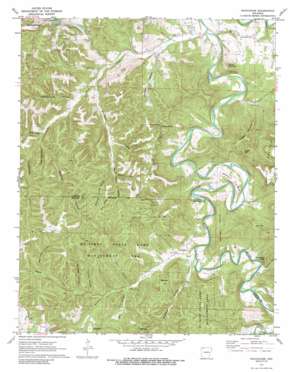
Rockhouse Topo Map Arkansas
To zoom in, hover over the map of Rockhouse
USGS Topo Quad 36093c6 - 1:24,000 scale
| Topo Map Name: | Rockhouse |
| USGS Topo Quad ID: | 36093c6 |
| Print Size: | ca. 21 1/4" wide x 27" high |
| Southeast Coordinates: | 36.25° N latitude / 93.625° W longitude |
| Map Center Coordinates: | 36.3125° N latitude / 93.6875° W longitude |
| U.S. State: | AR |
| Filename: | o36093c6.jpg |
| Download Map JPG Image: | Rockhouse topo map 1:24,000 scale |
| Map Type: | Topographic |
| Topo Series: | 7.5´ |
| Map Scale: | 1:24,000 |
| Source of Map Images: | United States Geological Survey (USGS) |
| Alternate Map Versions: |
Rockhouse AR 1972, updated 1973 Download PDF Buy paper map Rockhouse AR 1972, updated 1991 Download PDF Buy paper map Rockhouse AR 1972, updated 1991 Download PDF Buy paper map Rockhouse AR 2011 Download PDF Buy paper map Rockhouse AR 2014 Download PDF Buy paper map |
1:24,000 Topo Quads surrounding Rockhouse
> Back to 36093a1 at 1:100,000 scale
> Back to 36092a1 at 1:250,000 scale
> Back to U.S. Topo Maps home
Rockhouse topo map: Gazetteer
Rockhouse: Bends
Mason Bend elevation 372m 1220′Rockhouse: Dams
Lake Lucerene Dam elevation 433m 1420′Rockhouse: Gaps
Allen Gap elevation 417m 1368′Trigger Gap elevation 407m 1335′
Rockhouse: Populated Places
Rockhouse elevation 346m 1135′Winona Springs (historical) elevation 401m 1315′
Rockhouse: Reservoirs
Lake Lucerene elevation 433m 1420′Rockhouse: Ridges
Mill Ridge elevation 453m 1486′Turkey Wing Ridge elevation 454m 1489′
Rockhouse: Springs
Winona Springs elevation 415m 1361′Rockhouse: Streams
Keels Creek elevation 311m 1020′Piney Creek elevation 344m 1128′
Rockhouse Creek elevation 334m 1095′
Warm Fork elevation 364m 1194′
Rockhouse: Summits
Flower Pot Point elevation 471m 1545′Round Mountain elevation 452m 1482′
Stanley Mountain elevation 468m 1535′
Trigger Mountain elevation 485m 1591′
Rockhouse: Valleys
Bear Hollow elevation 355m 1164′Bear Hollow elevation 353m 1158′
Big Mill Hollow elevation 355m 1164′
Blowing Spring Hollow elevation 375m 1230′
Bradley Hollow elevation 354m 1161′
Dark Hole Hollow elevation 369m 1210′
Garver Hollow elevation 344m 1128′
Hollingsworth Hollow elevation 356m 1167′
Keg Hollow elevation 353m 1158′
Kettle Hollow elevation 383m 1256′
Reynolds Hollow elevation 375m 1230′
Sam Talen Hollow elevation 385m 1263′
Scotland Hollow elevation 341m 1118′
Turpentine Hollow elevation 358m 1174′
Wildcat Hollow elevation 385m 1263′
Williams Hollow elevation 335m 1099′
Winona Hollow elevation 328m 1076′
Rockhouse digital topo map on disk
Buy this Rockhouse topo map showing relief, roads, GPS coordinates and other geographical features, as a high-resolution digital map file on DVD:


