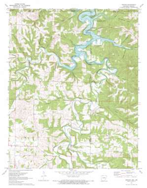
Denver Topo Map Arkansas
To zoom in, hover over the map of Denver
USGS Topo Quad 36093d3 - 1:24,000 scale
| Topo Map Name: | Denver |
| USGS Topo Quad ID: | 36093d3 |
| Print Size: | ca. 21 1/4" wide x 27" high |
| Southeast Coordinates: | 36.375° N latitude / 93.25° W longitude |
| Map Center Coordinates: | 36.4375° N latitude / 93.3125° W longitude |
| U.S. States: | AR, MO |
| Filename: | o36093d3.jpg |
| Download Map JPG Image: | Denver topo map 1:24,000 scale |
| Map Type: | Topographic |
| Topo Series: | 7.5´ |
| Map Scale: | 1:24,000 |
| Source of Map Images: | United States Geological Survey (USGS) |
| Alternate Map Versions: |
Denver AR 1972, updated 1973 Download PDF Buy paper map Denver AR 2012 Download PDF Buy paper map Denver AR 2014 Download PDF Buy paper map |
| FStopo: | US Forest Service topo Denver is available: Download FStopo PDF Download FStopo TIF |
1:24,000 Topo Quads surrounding Denver
> Back to 36093a1 at 1:100,000 scale
> Back to 36092a1 at 1:250,000 scale
> Back to U.S. Topo Maps home
Denver topo map: Gazetteer
Denver: Capes
Backbone Bluff elevation 283m 928′Kimhowart Hill elevation 345m 1131′
Denver: Cliffs
Davis Bluff elevation 353m 1158′Raven Bluff elevation 293m 961′
Red Bluff elevation 299m 980′
Denver: Parks
Cricket Creek Public Use Area elevation 279m 915′Denver: Populated Places
Denver elevation 307m 1007′Enon (historical) elevation 285m 935′
Farewell elevation 380m 1246′
Raum (historical) elevation 291m 954′
Denver: Post Offices
Denver Post Office (historical) elevation 307m 1007′Denver: Streams
Blair Branch elevation 279m 915′Blair Branch elevation 273m 895′
Callens Branch elevation 297m 974′
Cranenest Creek elevation 296m 971′
Cricket Creek elevation 274m 898′
Dry Creek elevation 305m 1000′
Mills Branch elevation 293m 961′
Spring Creek elevation 296m 971′
Stillhouse Creek elevation 301m 987′
Yocum Creek elevation 273m 895′
Denver: Valleys
Bear Hollow elevation 287m 941′Blevens Hollow elevation 289m 948′
Carpenter Hollow elevation 284m 931′
Cave Hollow elevation 298m 977′
Cove Hollow elevation 280m 918′
Fortner Hollow elevation 288m 944′
Gum Spring Hollow elevation 299m 980′
Hopper Hollow elevation 287m 941′
Hurt Hollow elevation 280m 918′
Jim Mill Hollow elevation 308m 1010′
Lee Hollow elevation 313m 1026′
May Hollow elevation 299m 980′
Pine Hollow elevation 299m 980′
Roberson Hollow elevation 283m 928′
Tereherst Hollow elevation 297m 974′
White Oak Hollow elevation 298m 977′
Denver digital topo map on disk
Buy this Denver topo map showing relief, roads, GPS coordinates and other geographical features, as a high-resolution digital map file on DVD:


