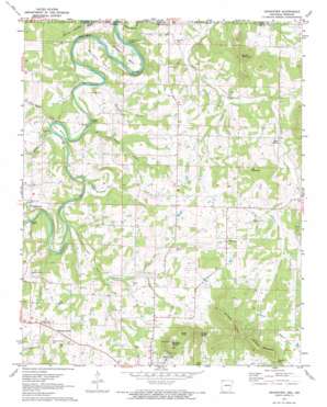
Grandview Topo Map Arkansas
To zoom in, hover over the map of Grandview
USGS Topo Quad 36093d5 - 1:24,000 scale
| Topo Map Name: | Grandview |
| USGS Topo Quad ID: | 36093d5 |
| Print Size: | ca. 21 1/4" wide x 27" high |
| Southeast Coordinates: | 36.375° N latitude / 93.5° W longitude |
| Map Center Coordinates: | 36.4375° N latitude / 93.5625° W longitude |
| U.S. States: | AR, MO |
| Filename: | o36093d5.jpg |
| Download Map JPG Image: | Grandview topo map 1:24,000 scale |
| Map Type: | Topographic |
| Topo Series: | 7.5´ |
| Map Scale: | 1:24,000 |
| Source of Map Images: | United States Geological Survey (USGS) |
| Alternate Map Versions: |
Grandview AR 1972, updated 1973 Download PDF Buy paper map Grandview AR 2012 Download PDF Buy paper map Grandview AR 2014 Download PDF Buy paper map |
| FStopo: | US Forest Service topo Grandview is available: Download FStopo PDF Download FStopo TIF |
1:24,000 Topo Quads surrounding Grandview
> Back to 36093a1 at 1:100,000 scale
> Back to 36092a1 at 1:250,000 scale
> Back to U.S. Topo Maps home
Grandview topo map: Gazetteer
Grandview: Airports
Carroll County Airport elevation 346m 1135′Grandview: Bends
Barnett Bend elevation 318m 1043′Gum Bottom elevation 293m 961′
Stewart Bend elevation 309m 1013′
Grandview: Cliffs
Gallion Bluff elevation 310m 1017′Gallion Bluff elevation 294m 964′
Pine Bluff elevation 317m 1040′
Stony Point elevation 303m 994′
Grandview: Crossings
Summers Ford elevation 281m 921′Grandview: Dams
Fuller Lake Dam elevation 304m 997′Grandview: Gaps
Duncan Gap elevation 466m 1528′Grandview: Populated Places
Freeman (historical) elevation 350m 1148′Grandview elevation 349m 1145′
High elevation 326m 1069′
Indian Creek (historical) elevation 347m 1138′
Pleasant Valley elevation 370m 1213′
Polo (historical) elevation 314m 1030′
Urbanette elevation 386m 1266′
Grandview: Post Offices
Grandview Post Office (historical) elevation 348m 1141′High Post Office (historical) elevation 331m 1085′
Grandview: Reservoirs
Fuller Lake elevation 304m 997′Grandview: Springs
Herd Spring elevation 388m 1272′Wood Spring elevation 325m 1066′
Grandview: Streams
Brush Creek elevation 284m 931′Clabber Creek elevation 289m 948′
Flat Rock Creek elevation 282m 925′
Marshall Branch elevation 276m 905′
Stony Point Branch elevation 280m 918′
Waxweed Run elevation 287m 941′
Grandview: Summits
Ant Mountain elevation 446m 1463′Brother Knobs elevation 526m 1725′
Brushy Knobs elevation 531m 1742′
Brushy Mountain elevation 442m 1450′
Saunders Heights elevation 481m 1578′
Sister Knob elevation 476m 1561′
Wilkins Mountain elevation 512m 1679′
Grandview: Valleys
Gallion Hollow elevation 278m 912′Gallion Hollow elevation 279m 915′
Grandview digital topo map on disk
Buy this Grandview topo map showing relief, roads, GPS coordinates and other geographical features, as a high-resolution digital map file on DVD:


