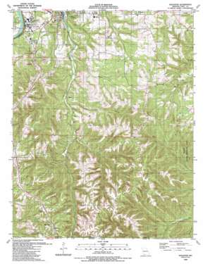
Hollister Topo Map Missouri
To zoom in, hover over the map of Hollister
USGS Topo Quad 36093e2 - 1:24,000 scale
| Topo Map Name: | Hollister |
| USGS Topo Quad ID: | 36093e2 |
| Print Size: | ca. 21 1/4" wide x 27" high |
| Southeast Coordinates: | 36.5° N latitude / 93.125° W longitude |
| Map Center Coordinates: | 36.5625° N latitude / 93.1875° W longitude |
| U.S. State: | MO |
| Filename: | o36093e2.jpg |
| Download Map JPG Image: | Hollister topo map 1:24,000 scale |
| Map Type: | Topographic |
| Topo Series: | 7.5´ |
| Map Scale: | 1:24,000 |
| Source of Map Images: | United States Geological Survey (USGS) |
| Alternate Map Versions: |
Hollister MO 1956, updated 1957 Download PDF Buy paper map Hollister MO 1956, updated 1974 Download PDF Buy paper map Hollister MO 1956, updated 1978 Download PDF Buy paper map Hollister MO 1989, updated 1989 Download PDF Buy paper map Hollister MO 2012 Download PDF Buy paper map Hollister MO 2015 Download PDF Buy paper map |
1:24,000 Topo Quads surrounding Hollister
> Back to 36093e1 at 1:100,000 scale
> Back to 36092a1 at 1:250,000 scale
> Back to U.S. Topo Maps home
Hollister topo map: Gazetteer
Hollister: Airports
M Graham Clark Airport elevation 269m 882′Hollister: Parks
Mincy Wildlife Area elevation 284m 931′Hollister: Populated Places
Hollister elevation 220m 721′Kirbyville elevation 306m 1003′
Melva elevation 263m 862′
Ridgedale elevation 422m 1384′
Hollister: Streams
Cooper Creek elevation 218m 715′Thorp Creek elevation 254m 833′
Hollister: Valleys
Big Hollow elevation 219m 718′Coalpit Hollow elevation 248m 813′
Happy Hollow elevation 235m 770′
Hollister digital topo map on disk
Buy this Hollister topo map showing relief, roads, GPS coordinates and other geographical features, as a high-resolution digital map file on DVD:


