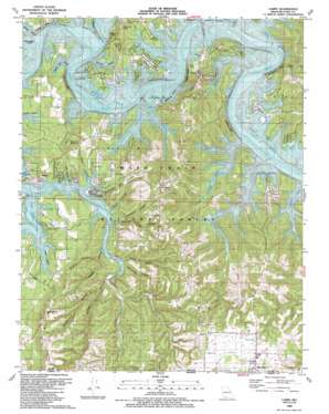
Lampe Topo Map Missouri
To zoom in, hover over the map of Lampe
USGS Topo Quad 36093e4 - 1:24,000 scale
| Topo Map Name: | Lampe |
| USGS Topo Quad ID: | 36093e4 |
| Print Size: | ca. 21 1/4" wide x 27" high |
| Southeast Coordinates: | 36.5° N latitude / 93.375° W longitude |
| Map Center Coordinates: | 36.5625° N latitude / 93.4375° W longitude |
| U.S. State: | MO |
| Filename: | o36093e4.jpg |
| Download Map JPG Image: | Lampe topo map 1:24,000 scale |
| Map Type: | Topographic |
| Topo Series: | 7.5´ |
| Map Scale: | 1:24,000 |
| Source of Map Images: | United States Geological Survey (USGS) |
| Alternate Map Versions: |
Lampe MO 1956, updated 1957 Download PDF Buy paper map Lampe MO 1956, updated 1972 Download PDF Buy paper map Lampe MO 1956, updated 1976 Download PDF Buy paper map Lampe MO 1989, updated 1989 Download PDF Buy paper map Lampe MO 1999, updated 2002 Download PDF Buy paper map Lampe MO 2012 Download PDF Buy paper map Lampe MO 2015 Download PDF Buy paper map |
| FStopo: | US Forest Service topo Lampe is available: Download FStopo PDF Download FStopo TIF |
1:24,000 Topo Quads surrounding Lampe
> Back to 36093e1 at 1:100,000 scale
> Back to 36092a1 at 1:250,000 scale
> Back to U.S. Topo Maps home
Lampe topo map: Gazetteer
Lampe: Airports
Kimberling Airways Airport elevation 306m 1003′Lampe: Bridges
Kimberling Bridge elevation 279m 915′Lampe: Cliffs
Cedar Bluff elevation 298m 977′Evans Bluff elevation 280m 918′
Logslide Bluff elevation 281m 921′
Mobley Bluff elevation 279m 915′
Philibert Bluff elevation 279m 915′
Whiterock Bluff elevation 288m 944′
Lampe: Parks
Baxter Public Use Area elevation 287m 941′Big Indian Public Use Area elevation 299m 980′
Cow Creek Park elevation 284m 931′
Cow Creek Public Use Area elevation 292m 958′
Joe Bald Park elevation 300m 984′
Mill Creek Park elevation 288m 944′
Mill Creek Public Use Area elevation 282m 925′
Lampe: Populated Places
Baxter elevation 300m 984′Coney Island elevation 298m 977′
Dorcas (historical) elevation 279m 915′
Homer elevation 396m 1299′
Lampe elevation 399m 1309′
Marmaros elevation 314m 1030′
Radical elevation 279m 915′
Lampe: Ridges
Black Oak Ridge elevation 374m 1227′Lampe: Streams
Cow Creek elevation 279m 915′Dogwood Creek elevation 286m 938′
Fisher Creek elevation 279m 915′
James River elevation 279m 915′
Kennel Branch elevation 279m 915′
Little Cow Creek elevation 279m 915′
Little Indian Creek elevation 273m 895′
Little Mill Creek elevation 279m 915′
Mill Creek elevation 279m 915′
Right Prong elevation 279m 915′
Schooner Creek elevation 279m 915′
Whites Branch elevation 279m 915′
Lampe: Summits
Bread Tray Mountain elevation 413m 1354′Little Joe Bald elevation 367m 1204′
Naked Joe Bald elevation 376m 1233′
Lampe: Valleys
Blowing Springs Hollow elevation 279m 915′Cedar Spring Hollow elevation 279m 915′
Company Hollow elevation 279m 915′
Fanncomb Hollow elevation 284m 931′
Goar Hollow elevation 279m 915′
Henderson Hollow elevation 292m 958′
Hobbs Hollow elevation 347m 1138′
Hoot Owl Hollow elevation 279m 915′
Jannings Hollow elevation 279m 915′
Little Wolfpen Hollow elevation 279m 915′
Poplar Hollow elevation 279m 915′
Porter Hollow elevation 281m 921′
Powell Mill Hollow elevation 279m 915′
Stillhouse Hollow elevation 279m 915′
Trace Hollow elevation 279m 915′
Waldon Hollow elevation 279m 915′
Wildcat Hollow elevation 286m 938′
Wolfpen Hollow elevation 279m 915′
Yocum Hollow elevation 279m 915′
Lampe digital topo map on disk
Buy this Lampe topo map showing relief, roads, GPS coordinates and other geographical features, as a high-resolution digital map file on DVD:


