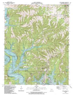
Reeds Spring Topo Map Missouri
To zoom in, hover over the map of Reeds Spring
USGS Topo Quad 36093f4 - 1:24,000 scale
| Topo Map Name: | Reeds Spring |
| USGS Topo Quad ID: | 36093f4 |
| Print Size: | ca. 21 1/4" wide x 27" high |
| Southeast Coordinates: | 36.625° N latitude / 93.375° W longitude |
| Map Center Coordinates: | 36.6875° N latitude / 93.4375° W longitude |
| U.S. State: | MO |
| Filename: | o36093f4.jpg |
| Download Map JPG Image: | Reeds Spring topo map 1:24,000 scale |
| Map Type: | Topographic |
| Topo Series: | 7.5´ |
| Map Scale: | 1:24,000 |
| Source of Map Images: | United States Geological Survey (USGS) |
| Alternate Map Versions: |
Reeds Spring MO 1956, updated 1968 Download PDF Buy paper map Reeds Spring MO 1989, updated 1989 Download PDF Buy paper map Reeds Spring MO 1999, updated 2002 Download PDF Buy paper map Reeds Spring MO 2012 Download PDF Buy paper map Reeds Spring MO 2015 Download PDF Buy paper map |
| FStopo: | US Forest Service topo Reeds Spring is available: Download FStopo PDF Download FStopo TIF |
1:24,000 Topo Quads surrounding Reeds Spring
> Back to 36093e1 at 1:100,000 scale
> Back to 36092a1 at 1:250,000 scale
> Back to U.S. Topo Maps home
Reeds Spring topo map: Gazetteer
Reeds Spring: Airports
Emerson Airport elevation 420m 1377′Reeds Spring: Cliffs
Morris Bluff elevation 279m 915′Oswalt Bluff elevation 309m 1013′
White Rock Bluff elevation 280m 918′
Reeds Spring: Lakes
Yocum Pond elevation 412m 1351′Reeds Spring: Parks
Aunts Creek Park elevation 304m 997′Aunts Creek Public Use Area elevation 300m 984′
Highway Thirteen Park elevation 293m 961′
Highway Thirteen Public Use Area elevation 279m 915′
Reeds Spring: Populated Places
Kimberling City elevation 290m 951′Reeds Spring elevation 360m 1181′
Stoneridge elevation 411m 1348′
Reeds Spring: Ridges
Wolf Ridge elevation 371m 1217′Reeds Spring: Springs
Reeds Spring elevation 362m 1187′Reeds Spring: Streams
Aunts Creek elevation 279m 915′Bear Den Creek elevation 279m 915′
Little Aunts Creek elevation 284m 931′
Peach Orchard Creek elevation 279m 915′
South Aunts Creek elevation 279m 915′
West Fisher Creek elevation 279m 915′
Reeds Spring: Summits
Sow Coon Mountain elevation 403m 1322′Reeds Spring: Valleys
Bear Den Hollow elevation 279m 915′Coon Creek Hollow elevation 286m 938′
Crane Hollow elevation 291m 954′
Devil Den Hollow elevation 279m 915′
Emerson Hollow elevation 279m 915′
Hodge Hollow elevation 279m 915′
Holt Hollow elevation 282m 925′
Jackson Hollow elevation 279m 915′
Saltpeter Hollow elevation 285m 935′
Reeds Spring digital topo map on disk
Buy this Reeds Spring topo map showing relief, roads, GPS coordinates and other geographical features, as a high-resolution digital map file on DVD:


