Lake Eucha East Topo Map Oklahoma
To zoom in, hover over the map of Lake Eucha East
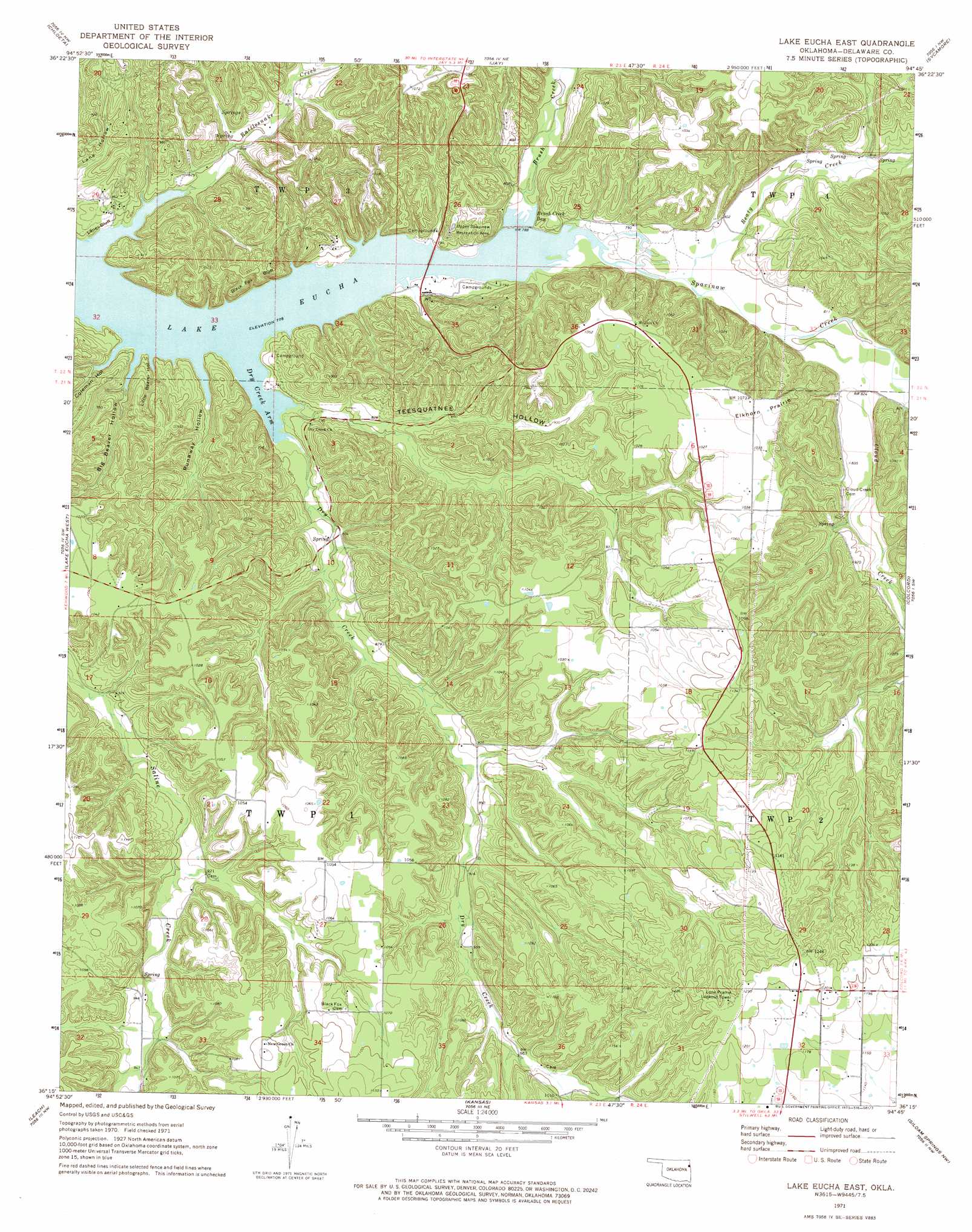
USGS Topo Quad 36094c7 - 1:24,000 scale
| Topo Map Name: | Lake Eucha East |
| USGS Topo Quad ID: | 36094c7 |
| Print Size: | ca. 21 1/4" wide x 27" high |
| Southeast Coordinates: | 36.25° N latitude / 94.75° W longitude |
| Map Center Coordinates: | 36.3125° N latitude / 94.8125° W longitude |
| U.S. State: | OK |
| Filename: | o36094c7.jpg |
| Download Map JPG Image: | Lake Eucha East topo map 1:24,000 scale |
| Map Type: | Topographic |
| Topo Series: | 7.5´ |
| Map Scale: | 1:24,000 |
| Source of Map Images: | United States Geological Survey (USGS) |
| Alternate Map Versions: |
Lake Eucha East OK 1971, updated 1973 Download PDF Buy paper map Lake Eucha East OK 2010 Download PDF Buy paper map Lake Eucha East OK 2012 Download PDF Buy paper map Lake Eucha East OK 2016 Download PDF Buy paper map |
1:24,000 Topo Quads surrounding Lake Eucha East
Ketchum |
Bernice |
Grove |
Dodge |
South West City |
Spavinaw |
Chloeta |
Jay |
Sycamore |
Colcord Ne |
Salina Se |
Lake Eucha West |
Lake Eucha East |
Colcord |
Cherokee City |
Rose |
Leach |
Kansas |
Siloam Springs Nw |
Siloam Springs |
Peggs |
Moodys |
Chewey |
Chance |
Watts |
> Back to 36094a1 at 1:100,000 scale
> Back to 36094a1 at 1:250,000 scale
> Back to U.S. Topo Maps home
Lake Eucha East topo map: Gazetteer
Lake Eucha East: Bays
Brush Creek Bay elevation 237m 777′Dry Creek Arm elevation 237m 777′
Lake Eucha East: Cliffs
Black Fox Bluff elevation 254m 833′Lanes Bluff elevation 243m 797′
Lake Eucha East: Flats
Elkhorn Prairie elevation 325m 1066′Lake Eucha East: Parks
Lake Eucha State Park elevation 271m 889′Upper Spavinaw Recreation Area elevation 277m 908′
Lake Eucha East: Populated Places
Cloud Creek elevation 364m 1194′Lake Eucha East: Streams
Beaty Creek elevation 241m 790′Beaty Creek elevation 241m 790′
Brush Creek elevation 237m 777′
Cloud Creek elevation 244m 800′
Dry Creek elevation 238m 780′
Rattlesnake Creek elevation 237m 777′
Lake Eucha East: Valleys
Big Beaver Hollow elevation 237m 777′Coleman Hollow elevation 237m 777′
Little Beaver Hollow elevation 237m 777′
Runaway Hollow elevation 237m 777′
Teesquatnee Hollow elevation 238m 780′
Lake Eucha East digital topo map on disk
Buy this Lake Eucha East topo map showing relief, roads, GPS coordinates and other geographical features, as a high-resolution digital map file on DVD: