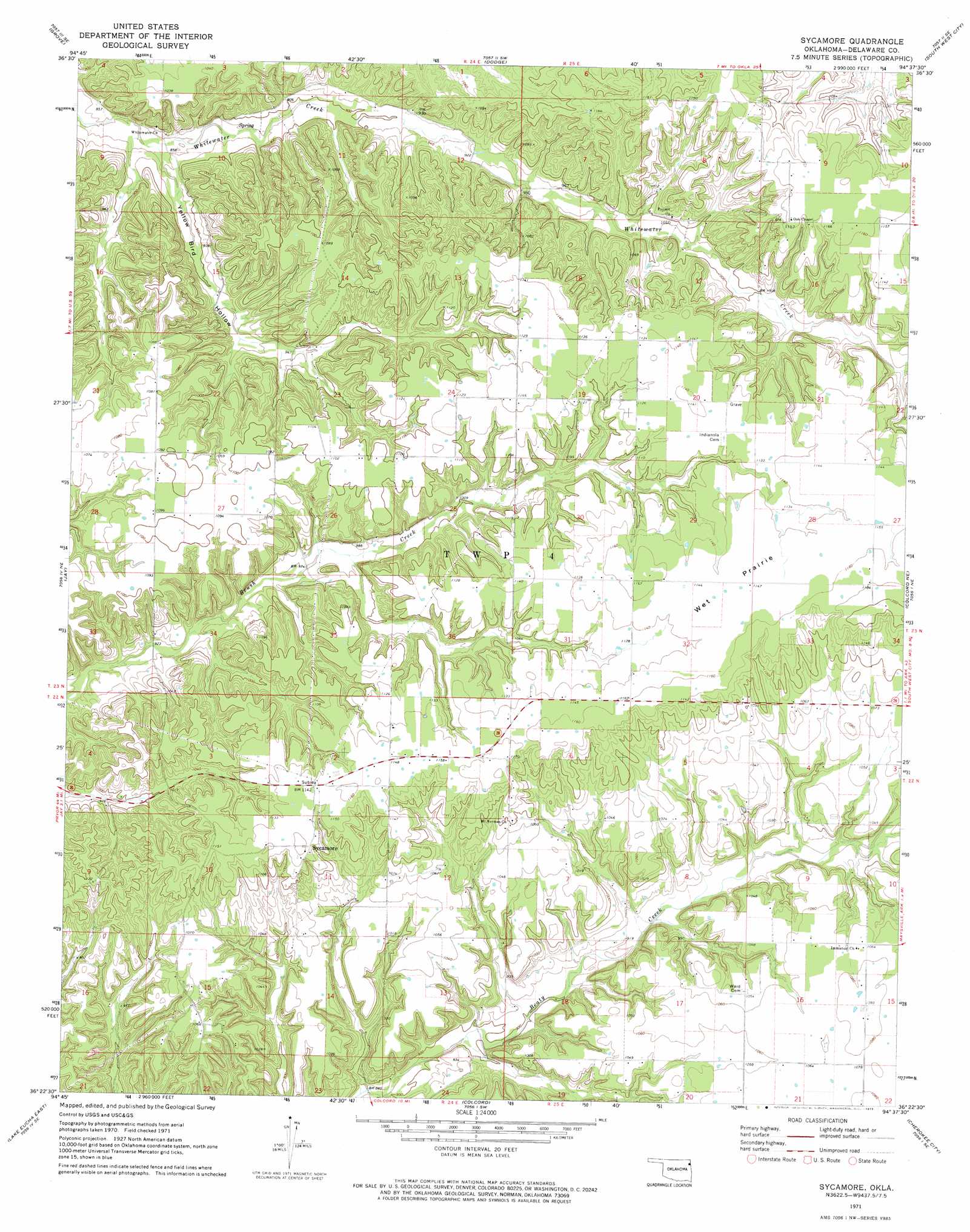
Sycamore Topo Map Oklahoma
To zoom in, hover over the map of Sycamore
USGS Topo Quad 36094d6 - 1:24,000 scale
| Topo Map Name: | Sycamore |
| USGS Topo Quad ID: | 36094d6 |
| Print Size: | ca. 21 1/4" wide x 27" high |
| Southeast Coordinates: | 36.375° N latitude / 94.625° W longitude |
| Map Center Coordinates: | 36.4375° N latitude / 94.6875° W longitude |
| U.S. State: | OK |
| Filename: | o36094d6.jpg |
| Download Map JPG Image: | Sycamore topo map 1:24,000 scale |
| Map Type: | Topographic |
| Topo Series: | 7.5´ |
| Map Scale: | 1:24,000 |
| Source of Map Images: | United States Geological Survey (USGS) |
| Alternate Map Versions: |
Sycamore OK 1971, updated 1973 Download PDF Buy paper map Sycamore OK 2010 Download PDF Buy paper map Sycamore OK 2012 Download PDF Buy paper map Sycamore OK 2016 Download PDF Buy paper map |
1:24,000 Topo Quads surrounding Sycamore
Afton |
Afton Ne |
Cayuga |
Tiff City |
Anderson |
Bernice |
Grove |
Dodge |
South West City |
Noel |
Chloeta |
Jay |
Sycamore |
Colcord Ne |
Gravette |
Lake Eucha West |
Lake Eucha East |
Colcord |
Cherokee City |
Gentry |
Leach |
Kansas |
Siloam Springs Nw |
Siloam Springs |
Gallatin |
> Back to 36094a1 at 1:100,000 scale
> Back to 36094a1 at 1:250,000 scale
> Back to U.S. Topo Maps home
Sycamore topo map: Gazetteer
Sycamore: Dams
Whitewater Creek Site 2 Dam elevation 297m 974′Whitewater Creek Site 3 Dam elevation 274m 898′
Sycamore: Flats
Wet Prairie elevation 348m 1141′Sycamore: Populated Places
Sycamore elevation 348m 1141′Sycamore: Reservoirs
Whitewater Creek Site 2 Reservoir elevation 297m 974′Whitewater Creek Site 3 Reservoir elevation 274m 898′
Sycamore: Streams
Carr Branch elevation 311m 1020′Sycamore: Valleys
Yellow Bird Hollow elevation 258m 846′Sycamore digital topo map on disk
Buy this Sycamore topo map showing relief, roads, GPS coordinates and other geographical features, as a high-resolution digital map file on DVD: