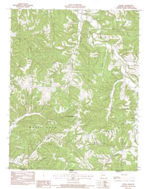
Powell Topo Map Missouri
To zoom in, hover over the map of Powell
USGS Topo Quad 36094e2 - 1:24,000 scale
| Topo Map Name: | Powell |
| USGS Topo Quad ID: | 36094e2 |
| Print Size: | ca. 21 1/4" wide x 27" high |
| Southeast Coordinates: | 36.5° N latitude / 94.125° W longitude |
| Map Center Coordinates: | 36.5625° N latitude / 94.1875° W longitude |
| U.S. State: | MO |
| Filename: | o36094e2.jpg |
| Download Map JPG Image: | Powell topo map 1:24,000 scale |
| Map Type: | Topographic |
| Topo Series: | 7.5´ |
| Map Scale: | 1:24,000 |
| Source of Map Images: | United States Geological Survey (USGS) |
| Alternate Map Versions: |
Powell MO 1982, updated 1982 Download PDF Buy paper map Powell MO 2012 Download PDF Buy paper map Powell MO 2015 Download PDF Buy paper map |
1:24,000 Topo Quads surrounding Powell
> Back to 36094e1 at 1:100,000 scale
> Back to 36094a1 at 1:250,000 scale
> Back to U.S. Topo Maps home
Powell topo map: Gazetteer
Powell: Parks
Powell Tower Site State Public Hunting Grounds elevation 397m 1302′Powell: Populated Places
Arnett elevation 416m 1364′Powell elevation 302m 990′
Powell: Post Offices
Powell Post Office elevation 302m 990′Powell: Ranges
Whittenburg Hills elevation 428m 1404′Powell: Ridges
Cooper Ridge elevation 389m 1276′Powell: Streams
Brush Creek elevation 337m 1105′Little Missouri Creek elevation 317m 1040′
Mikes Creek elevation 292m 958′
Pine Creek elevation 316m 1036′
Trent Creek elevation 312m 1023′
Powell: Summits
High Point elevation 385m 1263′Powell: Valleys
Arch Cave Hollow elevation 352m 1154′Bear Hollow elevation 320m 1049′
Bentonville Hollow elevation 299m 980′
Blackjack Hollow elevation 309m 1013′
Boundry Hollow elevation 319m 1046′
Brittle Hollow elevation 305m 1000′
Clements Hollow elevation 351m 1151′
Cooper Hollow elevation 312m 1023′
Dry Hollow elevation 358m 1174′
Little Missouri Hollow elevation 309m 1013′
Martin Hollow elevation 339m 1112′
Pea Ridge Hollow elevation 313m 1026′
Pea Ridge Hollow elevation 316m 1036′
Pea Ridge Hollow elevation 345m 1131′
Rose Spring Hollow elevation 335m 1099′
Rough Hollow elevation 333m 1092′
Sleepy Hollow elevation 357m 1171′
Water Fork Hollow elevation 329m 1079′
White Oak Hollow elevation 344m 1128′
Wild Onion Hollow elevation 343m 1125′
Woodard Hollow elevation 337m 1105′
Powell digital topo map on disk
Buy this Powell topo map showing relief, roads, GPS coordinates and other geographical features, as a high-resolution digital map file on DVD:


