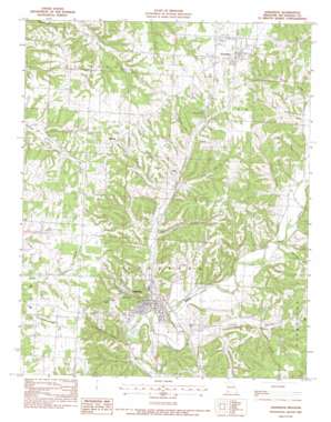
Anderson Topo Map Missouri
To zoom in, hover over the map of Anderson
USGS Topo Quad 36094f4 - 1:24,000 scale
| Topo Map Name: | Anderson |
| USGS Topo Quad ID: | 36094f4 |
| Print Size: | ca. 21 1/4" wide x 27" high |
| Southeast Coordinates: | 36.625° N latitude / 94.375° W longitude |
| Map Center Coordinates: | 36.6875° N latitude / 94.4375° W longitude |
| U.S. State: | MO |
| Filename: | o36094f4.jpg |
| Download Map JPG Image: | Anderson topo map 1:24,000 scale |
| Map Type: | Topographic |
| Topo Series: | 7.5´ |
| Map Scale: | 1:24,000 |
| Source of Map Images: | United States Geological Survey (USGS) |
| Alternate Map Versions: |
Anderson MO 1982, updated 1982 Download PDF Buy paper map Anderson MO 2012 Download PDF Buy paper map Anderson MO 2015 Download PDF Buy paper map |
1:24,000 Topo Quads surrounding Anderson
> Back to 36094e1 at 1:100,000 scale
> Back to 36094a1 at 1:250,000 scale
> Back to U.S. Topo Maps home
Anderson topo map: Gazetteer
Anderson: Populated Places
Anderson elevation 269m 882′Elliff elevation 309m 1013′
Goodman elevation 381m 1250′
Kelley Springs elevation 329m 1079′
Splitlog elevation 373m 1223′
Anderson: Streams
Beaver Branch elevation 268m 879′North Fork Beeman Branch elevation 313m 1026′
South Fork Beeman Branch elevation 313m 1026′
Anderson: Summits
Holloway Mountain elevation 367m 1204′Tatum Hill elevation 356m 1167′
Anderson: Valleys
Allison Hollow elevation 297m 974′Bunkum Hollow elevation 297m 974′
Chamberlain Hollow elevation 266m 872′
East Hollow elevation 303m 994′
Huffaker Hollow elevation 317m 1040′
Mud Springs Hollow elevation 280m 918′
Pole Cat Hollow elevation 276m 905′
Rocky Hollow elevation 297m 974′
Sellers Hollow elevation 290m 951′
Splitlog Hollow elevation 300m 984′
Thief Hollow elevation 274m 898′
Town Hollow elevation 298m 977′
Twin Springs Hollow elevation 322m 1056′
Walnut Hollow elevation 287m 941′
Anderson digital topo map on disk
Buy this Anderson topo map showing relief, roads, GPS coordinates and other geographical features, as a high-resolution digital map file on DVD:


