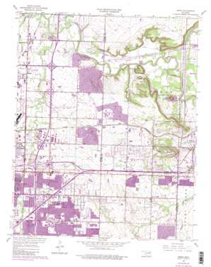
Mingo Topo Map Oklahoma
To zoom in, hover over the map of Mingo
USGS Topo Quad 36095b7 - 1:24,000 scale
| Topo Map Name: | Mingo |
| USGS Topo Quad ID: | 36095b7 |
| Print Size: | ca. 21 1/4" wide x 27" high |
| Southeast Coordinates: | 36.125° N latitude / 95.75° W longitude |
| Map Center Coordinates: | 36.1875° N latitude / 95.8125° W longitude |
| U.S. State: | OK |
| Filename: | o36095b7.jpg |
| Download Map JPG Image: | Mingo topo map 1:24,000 scale |
| Map Type: | Topographic |
| Topo Series: | 7.5´ |
| Map Scale: | 1:24,000 |
| Source of Map Images: | United States Geological Survey (USGS) |
| Alternate Map Versions: |
Mingo OK 1955, updated 1956 Download PDF Buy paper map Mingo OK 1955, updated 1968 Download PDF Buy paper map Mingo OK 1955, updated 1975 Download PDF Buy paper map Mingo OK 1955, updated 1982 Download PDF Buy paper map Mingo OK 2010 Download PDF Buy paper map Mingo OK 2012 Download PDF Buy paper map Mingo OK 2016 Download PDF Buy paper map |
1:24,000 Topo Quads surrounding Mingo
> Back to 36095a1 at 1:100,000 scale
> Back to 36094a1 at 1:250,000 scale
> Back to U.S. Topo Maps home
Mingo topo map: Gazetteer
Mingo: Airports
Harvey Young Airport elevation 231m 757′Mingo: Dams
Oknoname 143018 Dam elevation 204m 669′Vettie Cooley Dam elevation 195m 639′
Mingo: Populated Places
Garnett elevation 201m 659′Lynn Lane elevation 204m 669′
Mingo elevation 183m 600′
Tiger elevation 219m 718′
Mingo: Reservoirs
Cooley Lake elevation 195m 639′Lynn Lane Reservoir elevation 195m 639′
Oknoname 143018 Reservoir elevation 204m 669′
Vettie Cooley Lake elevation 195m 639′
Mingo: Streams
Elm Creek elevation 170m 557′Mill Creek elevation 186m 610′
Mingo Creek elevation 170m 557′
Ranch Creek elevation 174m 570′
Mingo: Summits
Goat Hill elevation 222m 728′Hooper Hill elevation 226m 741′
Indian Hills elevation 266m 872′
Round Mountain elevation 250m 820′
Mingo digital topo map on disk
Buy this Mingo topo map showing relief, roads, GPS coordinates and other geographical features, as a high-resolution digital map file on DVD:


