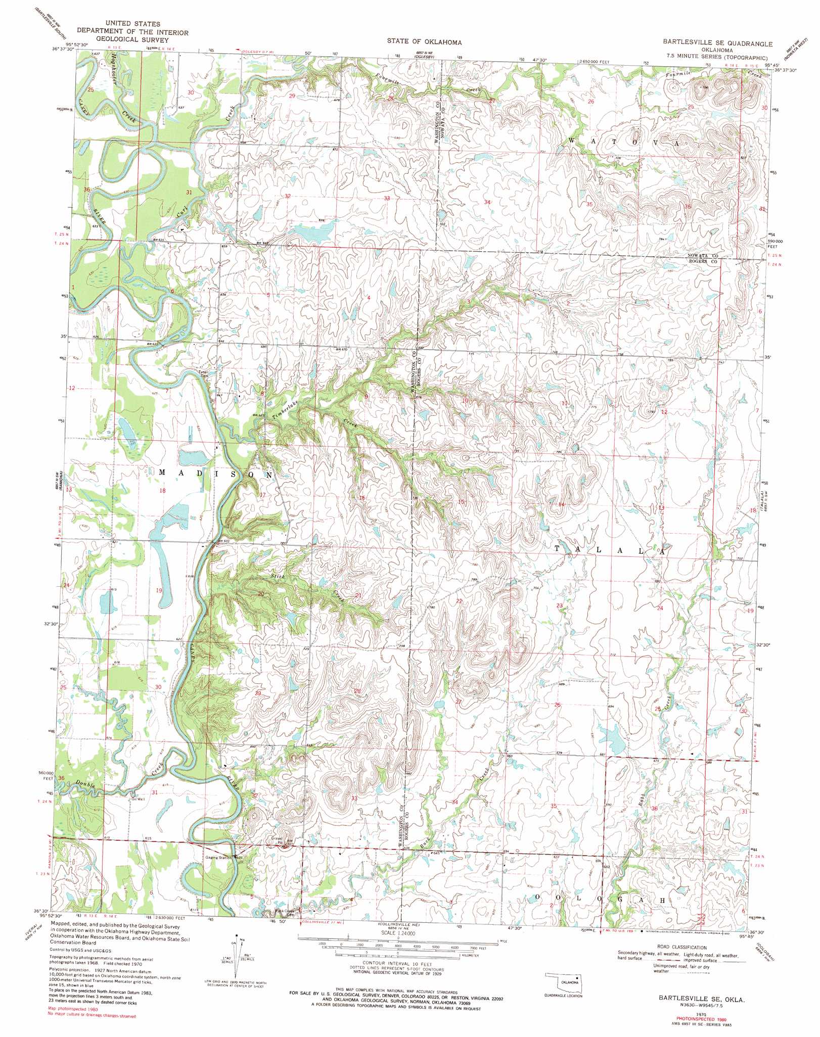
Bartlesville Se Topo Map Oklahoma
To zoom in, hover over the map of Bartlesville Se
USGS Topo Quad 36095e7 - 1:24,000 scale
| Topo Map Name: | Bartlesville Se |
| USGS Topo Quad ID: | 36095e7 |
| Print Size: | ca. 21 1/4" wide x 27" high |
| Southeast Coordinates: | 36.5° N latitude / 95.75° W longitude |
| Map Center Coordinates: | 36.5625° N latitude / 95.8125° W longitude |
| U.S. State: | OK |
| Filename: | o36095e7.jpg |
| Download Map JPG Image: | Bartlesville Se topo map 1:24,000 scale |
| Map Type: | Topographic |
| Topo Series: | 7.5´ |
| Map Scale: | 1:24,000 |
| Source of Map Images: | United States Geological Survey (USGS) |
| Alternate Map Versions: |
Bartlesville SE OK 1970, updated 1972 Download PDF Buy paper map Bartlesville SE OK 1970, updated 1987 Download PDF Buy paper map Bartlesville SE OK 2010 Download PDF Buy paper map Bartlesville SE OK 2012 Download PDF Buy paper map Bartlesville SE OK 2016 Download PDF Buy paper map |
1:24,000 Topo Quads surrounding Bartlesville Se
Bowring Se |
Bartlesville North |
Blue Mound |
Delaware |
Childers |
Woolaroc |
Bartlesville South |
Oglesby |
Nowata West |
Nowata East |
Wolco |
Ramona |
Bartlesville Se |
Talala |
Winganon |
Avant |
Vera |
Collinsville Ne |
Oologah |
Foyil |
Avant Se |
Sperry |
Collinsville |
Sageeyah |
Claremore |
> Back to 36095e1 at 1:100,000 scale
> Back to 36094a1 at 1:250,000 scale
> Back to U.S. Topo Maps home
Bartlesville Se topo map: Gazetteer
Bartlesville Se: Dams
Wagoner Lake Dam elevation 208m 682′Bartlesville Se: Reservoirs
Wagoner Lake elevation 208m 682′Bartlesville Se: Streams
Curl Creek elevation 186m 610′Double Creek elevation 182m 597′
Fourmile Creek elevation 192m 629′
Hogshooter Creek elevation 188m 616′
Stick Creek elevation 182m 597′
Timberlake Creek elevation 184m 603′
Bartlesville Se digital topo map on disk
Buy this Bartlesville Se topo map showing relief, roads, GPS coordinates and other geographical features, as a high-resolution digital map file on DVD: