Estella Topo Map Oklahoma
To zoom in, hover over the map of Estella
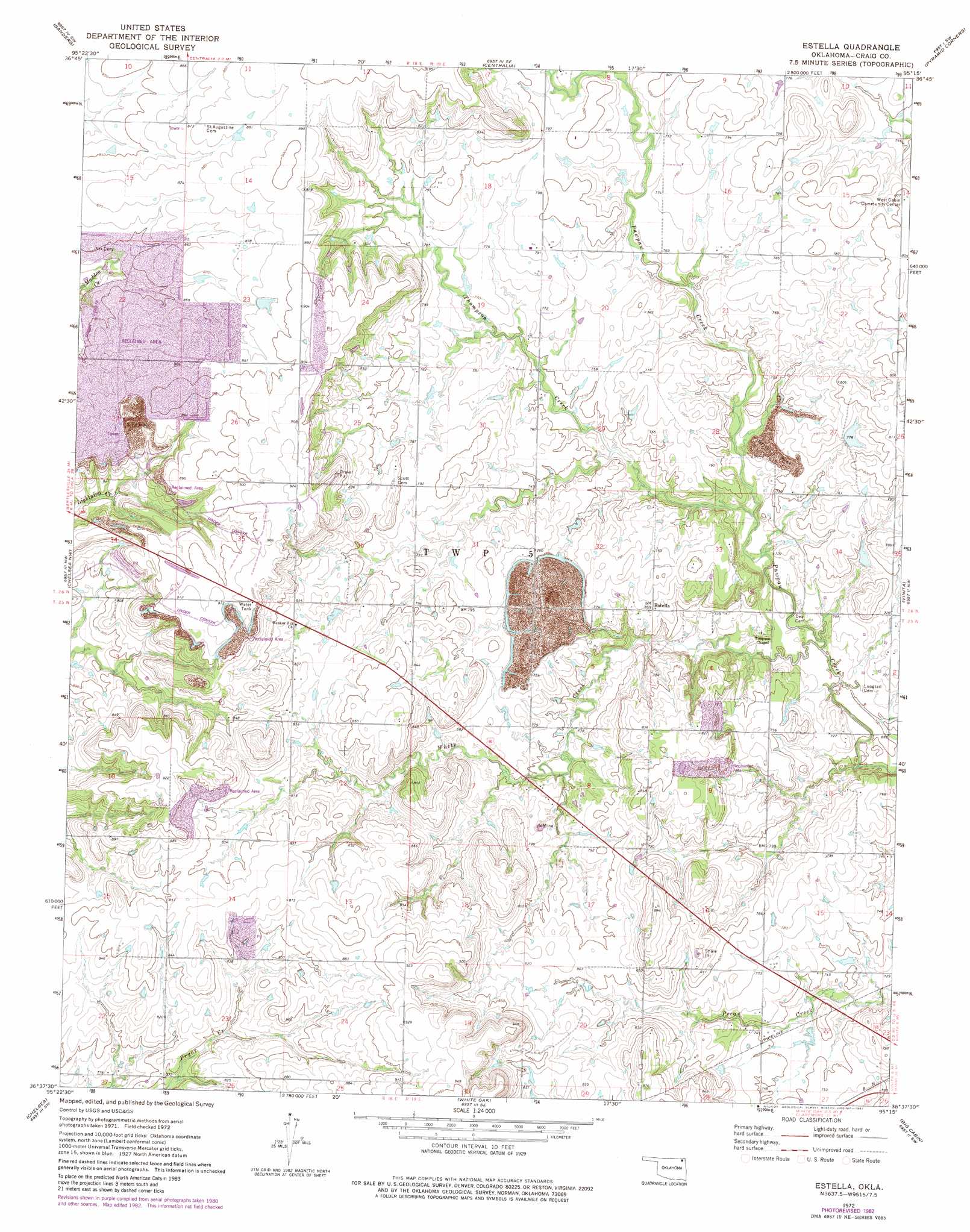
USGS Topo Quad 36095f3 - 1:24,000 scale
| Topo Map Name: | Estella |
| USGS Topo Quad ID: | 36095f3 |
| Print Size: | ca. 21 1/4" wide x 27" high |
| Southeast Coordinates: | 36.625° N latitude / 95.25° W longitude |
| Map Center Coordinates: | 36.6875° N latitude / 95.3125° W longitude |
| U.S. State: | OK |
| Filename: | o36095f3.jpg |
| Download Map JPG Image: | Estella topo map 1:24,000 scale |
| Map Type: | Topographic |
| Topo Series: | 7.5´ |
| Map Scale: | 1:24,000 |
| Source of Map Images: | United States Geological Survey (USGS) |
| Alternate Map Versions: |
Estella OK 1972, updated 1974 Download PDF Buy paper map Estella OK 1972, updated 1982 Download PDF Buy paper map Estella OK 2010 Download PDF Buy paper map Estella OK 2012 Download PDF Buy paper map Estella OK 2016 Download PDF Buy paper map |
1:24,000 Topo Quads surrounding Estella
South Coffeyville |
Hayrick Mound |
Hollow |
Welch Nw |
Welch North |
Childers |
Sanders |
Centralia |
Pyramid Corners |
Welch South |
Nowata East |
Chelsea Nw |
Estella |
Vinita |
Vinita Ne |
Winganon |
Chelsea |
White Oak |
Big Cabin |
Ketchum |
Foyil |
Bushyhead |
Adair |
Strang |
Spavinaw |
> Back to 36095e1 at 1:100,000 scale
> Back to 36094a1 at 1:250,000 scale
> Back to U.S. Topo Maps home
Estella topo map: Gazetteer
Estella: Populated Places
Estella elevation 234m 767′Estella: Streams
Thompson Creek elevation 219m 718′White Creek elevation 213m 698′
Estella digital topo map on disk
Buy this Estella topo map showing relief, roads, GPS coordinates and other geographical features, as a high-resolution digital map file on DVD: