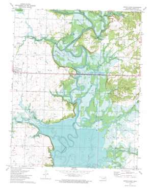
Nowata East Topo Map Oklahoma
To zoom in, hover over the map of Nowata East
USGS Topo Quad 36095f5 - 1:24,000 scale
| Topo Map Name: | Nowata East |
| USGS Topo Quad ID: | 36095f5 |
| Print Size: | ca. 21 1/4" wide x 27" high |
| Southeast Coordinates: | 36.625° N latitude / 95.5° W longitude |
| Map Center Coordinates: | 36.6875° N latitude / 95.5625° W longitude |
| U.S. State: | OK |
| Filename: | o36095f5.jpg |
| Download Map JPG Image: | Nowata East topo map 1:24,000 scale |
| Map Type: | Topographic |
| Topo Series: | 7.5´ |
| Map Scale: | 1:24,000 |
| Source of Map Images: | United States Geological Survey (USGS) |
| Alternate Map Versions: |
Nowata East OK 1972, updated 1974 Download PDF Buy paper map Nowata East OK 2010 Download PDF Buy paper map Nowata East OK 2013 Download PDF Buy paper map Nowata East OK 2016 Download PDF Buy paper map |
1:24,000 Topo Quads surrounding Nowata East
> Back to 36095e1 at 1:100,000 scale
> Back to 36094a1 at 1:250,000 scale
> Back to U.S. Topo Maps home
Nowata East topo map: Gazetteer
Nowata East: Cliffs
Coodys Bluff elevation 226m 741′Slate Bluff elevation 207m 679′
Nowata East: Flats
Overcup Bottoms elevation 199m 652′Nowata East: Lakes
Riley Lake elevation 199m 652′Nowata East: Populated Places
Coodys Bluff elevation 206m 675′Nowata East: Ranges
Coker Hills elevation 244m 800′Nowata East: Streams
Big Creek elevation 192m 629′Double Creek elevation 195m 639′
Kentucky Creek elevation 195m 639′
Little Salt Creek elevation 195m 639′
Panther Creek elevation 195m 639′
Salt Creek elevation 195m 639′
Western Branch Verdigris River elevation 192m 629′
Nowata East digital topo map on disk
Buy this Nowata East topo map showing relief, roads, GPS coordinates and other geographical features, as a high-resolution digital map file on DVD:


