Mannford Se Topo Map Oklahoma
To zoom in, hover over the map of Mannford Se
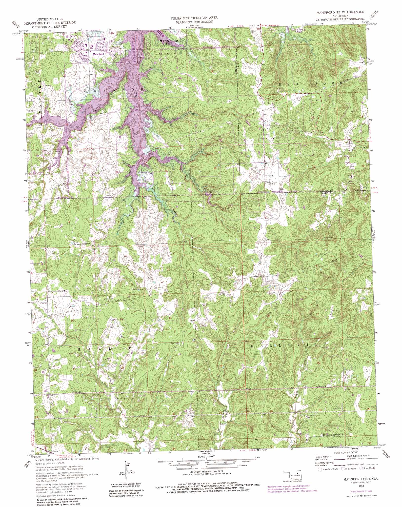
USGS Topo Quad 36096a3 - 1:24,000 scale
| Topo Map Name: | Mannford Se |
| USGS Topo Quad ID: | 36096a3 |
| Print Size: | ca. 21 1/4" wide x 27" high |
| Southeast Coordinates: | 36° N latitude / 96.25° W longitude |
| Map Center Coordinates: | 36.0625° N latitude / 96.3125° W longitude |
| U.S. State: | OK |
| Filename: | o36096a3.jpg |
| Download Map JPG Image: | Mannford Se topo map 1:24,000 scale |
| Map Type: | Topographic |
| Topo Series: | 7.5´ |
| Map Scale: | 1:24,000 |
| Source of Map Images: | United States Geological Survey (USGS) |
| Alternate Map Versions: |
Mannford SE OK 1958, updated 1959 Download PDF Buy paper map Mannford SE OK 1958, updated 1968 Download PDF Buy paper map Mannford SE OK 1958, updated 1983 Download PDF Buy paper map Mannford SE OK 2010 Download PDF Buy paper map Mannford SE OK 2012 Download PDF Buy paper map Mannford SE OK 2016 Download PDF Buy paper map |
1:24,000 Topo Quads surrounding Mannford Se
Blackburn |
Cleveland |
New Prue |
Avant Sw |
Avant Se |
Jennings |
Terlton |
Keystone Dam |
Wekiwa |
Sand Springs |
Oilton |
Olive |
Mannford Se |
Lake Sahoma |
Sapulpa North |
Drumright |
Bellvue |
Heyburn Reservoir |
Kellyville |
Sapulpa South |
Depew |
Bristow |
Slick |
Kiefer Sw |
Lake Boren |
> Back to 36096a1 at 1:100,000 scale
> Back to 36096a1 at 1:250,000 scale
> Back to U.S. Topo Maps home
Mannford Se topo map: Gazetteer
Mannford Se: Dams
Mannford Dam elevation 220m 721′Mannford Se: Populated Places
New Mannford elevation 249m 816′Mannford Se: Reservoirs
Mannford Reservoir elevation 221m 725′Mannford Water Supply Lake elevation 220m 721′
Mannford Se: Streams
Fish Creek elevation 222m 728′Little Salt Creek elevation 220m 721′
Mannford Se digital topo map on disk
Buy this Mannford Se topo map showing relief, roads, GPS coordinates and other geographical features, as a high-resolution digital map file on DVD: