Twin Mounds Topo Map Oklahoma
To zoom in, hover over the map of Twin Mounds
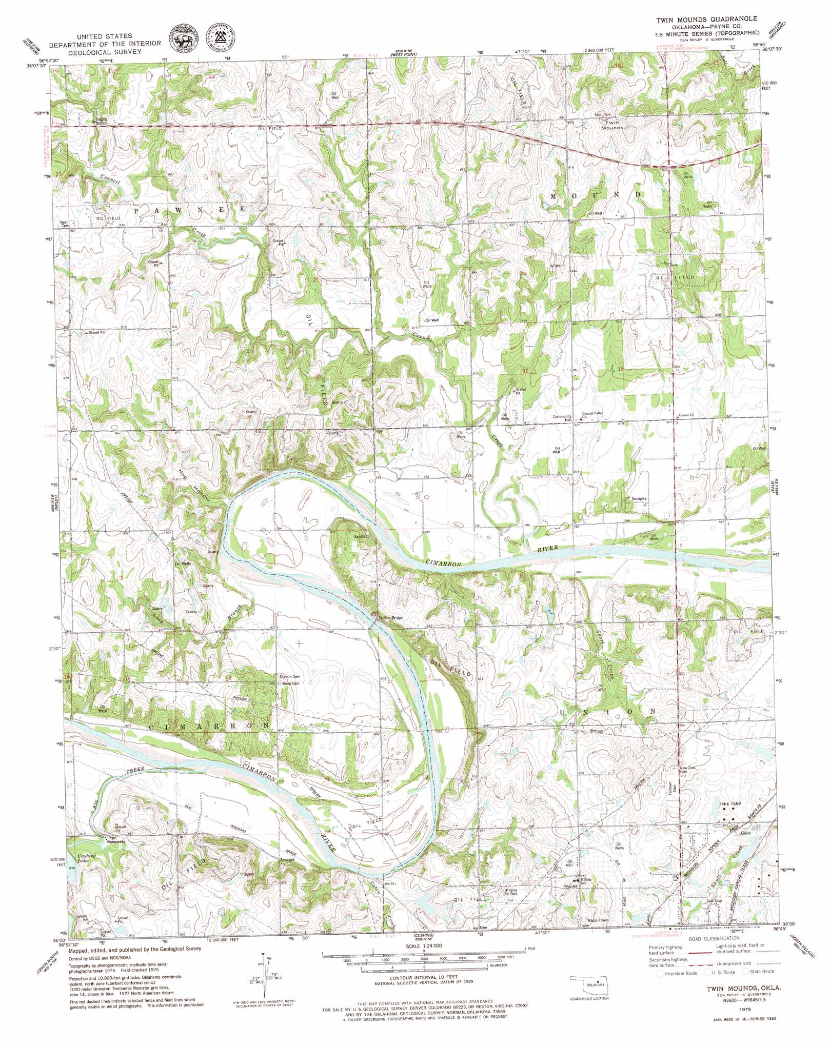
USGS Topo Quad 36096a7 - 1:24,000 scale
| Topo Map Name: | Twin Mounds |
| USGS Topo Quad ID: | 36096a7 |
| Print Size: | ca. 21 1/4" wide x 27" high |
| Southeast Coordinates: | 36° N latitude / 96.75° W longitude |
| Map Center Coordinates: | 36.0625° N latitude / 96.8125° W longitude |
| U.S. State: | OK |
| Filename: | o36096a7.jpg |
| Download Map JPG Image: | Twin Mounds topo map 1:24,000 scale |
| Map Type: | Topographic |
| Topo Series: | 7.5´ |
| Map Scale: | 1:24,000 |
| Source of Map Images: | United States Geological Survey (USGS) |
| Alternate Map Versions: |
Twin Mounds OK 1975, updated 1979 Download PDF Buy paper map Twin Mounds OK 2010 Download PDF Buy paper map Twin Mounds OK 2012 Download PDF Buy paper map Twin Mounds OK 2016 Download PDF Buy paper map |
1:24,000 Topo Quads surrounding Twin Mounds
Morrison |
Lela |
Pawnee |
Casey |
Blackburn |
Stillwater North |
Glencoe |
West Point |
Maramec |
Jennings |
Stillwater South |
Ripley |
Twin Mounds |
Yale |
Oilton |
Perkins |
Tryon North |
Cushing |
North Village |
Drumright |
Carney |
Tryon South |
Kendrick |
Stroud North |
Depew |
> Back to 36096a1 at 1:100,000 scale
> Back to 36096a1 at 1:250,000 scale
> Back to U.S. Topo Maps home
Twin Mounds topo map: Gazetteer
Twin Mounds: Bridges
Dunkin Bridge elevation 240m 787′Twin Mounds: Populated Places
Amabel elevation 249m 816′Gano elevation 260m 853′
Twin Mounds: Reservoirs
Cushing Lake elevation 256m 839′Twin Mounds: Streams
Big Creek elevation 244m 800′Cabin Creek elevation 244m 800′
Council Creek elevation 237m 777′
Long Branch elevation 240m 787′
Short Creek elevation 236m 774′
Twin Mounds: Summits
Twin Mounds elevation 314m 1030′Twin Mounds: Valleys
Hog Hollow elevation 243m 797′Twin Mounds digital topo map on disk
Buy this Twin Mounds topo map showing relief, roads, GPS coordinates and other geographical features, as a high-resolution digital map file on DVD: