Maramec Topo Map Oklahoma
To zoom in, hover over the map of Maramec
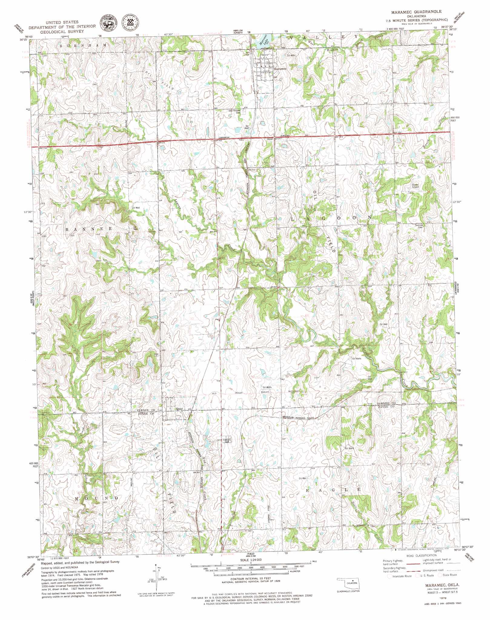
USGS Topo Quad 36096b6 - 1:24,000 scale
| Topo Map Name: | Maramec |
| USGS Topo Quad ID: | 36096b6 |
| Print Size: | ca. 21 1/4" wide x 27" high |
| Southeast Coordinates: | 36.125° N latitude / 96.625° W longitude |
| Map Center Coordinates: | 36.1875° N latitude / 96.6875° W longitude |
| U.S. State: | OK |
| Filename: | o36096b6.jpg |
| Download Map JPG Image: | Maramec topo map 1:24,000 scale |
| Map Type: | Topographic |
| Topo Series: | 7.5´ |
| Map Scale: | 1:24,000 |
| Source of Map Images: | United States Geological Survey (USGS) |
| Alternate Map Versions: |
Maramec OK 1978, updated 1979 Download PDF Buy paper map Maramec OK 2010 Download PDF Buy paper map Maramec OK 2012 Download PDF Buy paper map Maramec OK 2016 Download PDF Buy paper map |
1:24,000 Topo Quads surrounding Maramec
Watchorn |
Masham |
Skedee |
Bug Creek |
Hominy |
Lela |
Pawnee |
Casey |
Blackburn |
Cleveland |
Glencoe |
West Point |
Maramec |
Jennings |
Terlton |
Ripley |
Twin Mounds |
Yale |
Oilton |
Olive |
Tryon North |
Cushing |
North Village |
Drumright |
Bellvue |
> Back to 36096a1 at 1:100,000 scale
> Back to 36096a1 at 1:250,000 scale
> Back to U.S. Topo Maps home
Maramec topo map: Gazetteer
Maramec: Airports
Crystal Airport elevation 308m 1010′Maramec: Dams
Maramec Dam elevation 282m 925′Maramec: Populated Places
Maramec elevation 294m 964′Quay elevation 285m 935′
Maramec: Reservoirs
Maramec Lake elevation 285m 935′Maramec digital topo map on disk
Buy this Maramec topo map showing relief, roads, GPS coordinates and other geographical features, as a high-resolution digital map file on DVD: