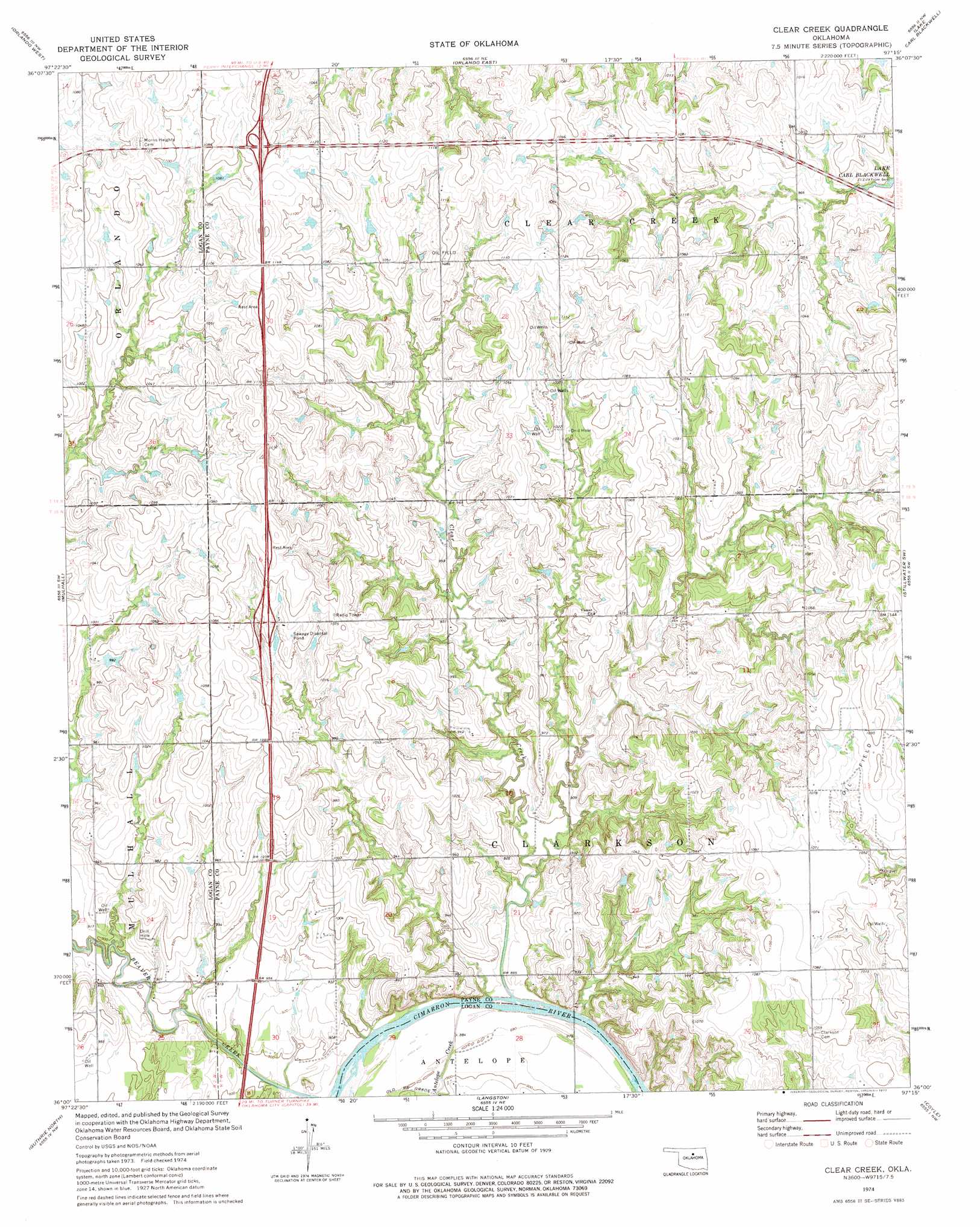
Clear Creek Topo Map Oklahoma
To zoom in, hover over the map of Clear Creek
USGS Topo Quad 36097a3 - 1:24,000 scale
| Topo Map Name: | Clear Creek |
| USGS Topo Quad ID: | 36097a3 |
| Print Size: | ca. 21 1/4" wide x 27" high |
| Southeast Coordinates: | 36° N latitude / 97.25° W longitude |
| Map Center Coordinates: | 36.0625° N latitude / 97.3125° W longitude |
| U.S. State: | OK |
| Filename: | o36097a3.jpg |
| Download Map JPG Image: | Clear Creek topo map 1:24,000 scale |
| Map Type: | Topographic |
| Topo Series: | 7.5´ |
| Map Scale: | 1:24,000 |
| Source of Map Images: | United States Geological Survey (USGS) |
| Alternate Map Versions: |
Clear Creek OK 1974, updated 1977 Download PDF Buy paper map Clear Creek OK 2009 Download PDF Buy paper map Clear Creek OK 2012 Download PDF Buy paper map Clear Creek OK 2016 Download PDF Buy paper map |
1:24,000 Topo Quads surrounding Clear Creek
Covington |
Lucien |
Perry |
Black Bear |
Morrison |
Marshall East |
Orlando West |
Orlando East |
Lake Carl Blackwell |
Stillwater North |
Bridge Creek |
Mulhall |
Clear Creek |
Stillwater Sw |
Stillwater South |
Crescent |
Guthrie North |
Langston |
Coyle |
Perkins |
Navina |
Guthrie South |
Guthrie Se |
Meridian |
Carney |
> Back to 36097a1 at 1:100,000 scale
> Back to 36096a1 at 1:250,000 scale
> Back to U.S. Topo Maps home
Clear Creek topo map: Gazetteer
Clear Creek: Streams
Antelope Creek elevation 268m 879′Beaver Creek elevation 268m 879′
Clear Creek elevation 265m 869′
Clear Creek digital topo map on disk
Buy this Clear Creek topo map showing relief, roads, GPS coordinates and other geographical features, as a high-resolution digital map file on DVD: