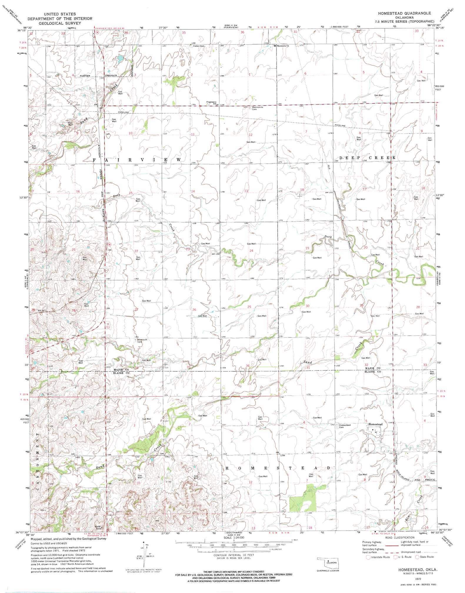
Homestead Topo Map Oklahoma
To zoom in, hover over the map of Homestead
USGS Topo Quad 36098b4 - 1:24,000 scale
| Topo Map Name: | Homestead |
| USGS Topo Quad ID: | 36098b4 |
| Print Size: | ca. 21 1/4" wide x 27" high |
| Southeast Coordinates: | 36.125° N latitude / 98.375° W longitude |
| Map Center Coordinates: | 36.1875° N latitude / 98.4375° W longitude |
| U.S. State: | OK |
| Filename: | o36098b4.jpg |
| Download Map JPG Image: | Homestead topo map 1:24,000 scale |
| Map Type: | Topographic |
| Topo Series: | 7.5´ |
| Map Scale: | 1:24,000 |
| Source of Map Images: | United States Geological Survey (USGS) |
| Alternate Map Versions: |
Homestead OK 1972, updated 1974 Download PDF Buy paper map Homestead OK 2010 Download PDF Buy paper map Homestead OK 2012 Download PDF Buy paper map Homestead OK 2016 Download PDF Buy paper map |
1:24,000 Topo Quads surrounding Homestead
Glass Mountains Nw |
Glass Mountains Ne |
Cleo Springs |
Fairview Ne |
Ringwood |
Glass Mountains Sw |
Glass Mountains |
Fairview |
Fairview Se |
Ringwood Sw |
Canton Nw |
Longdale |
Homestead |
Isabella |
Ames |
Canton Sw |
Canton |
Southard |
Okeene |
Parvin |
Oakwood |
Eagle City |
Watonga Lake |
Hitchcock |
Loyal Nw |
> Back to 36098a1 at 1:100,000 scale
> Back to 36098a1 at 1:250,000 scale
> Back to U.S. Topo Maps home
Homestead digital topo map on disk
Buy this Homestead topo map showing relief, roads, GPS coordinates and other geographical features, as a high-resolution digital map file on DVD: