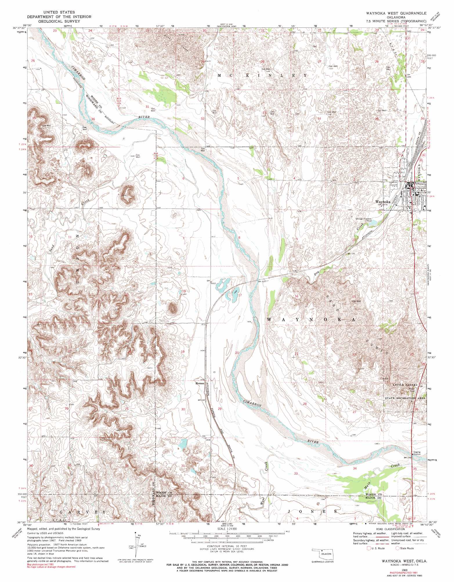
Waynoka West Topo Map Oklahoma
To zoom in, hover over the map of Waynoka West
USGS Topo Quad 36098e8 - 1:24,000 scale
| Topo Map Name: | Waynoka West |
| USGS Topo Quad ID: | 36098e8 |
| Print Size: | ca. 21 1/4" wide x 27" high |
| Southeast Coordinates: | 36.5° N latitude / 98.875° W longitude |
| Map Center Coordinates: | 36.5625° N latitude / 98.9375° W longitude |
| U.S. State: | OK |
| Filename: | o36098e8.jpg |
| Download Map JPG Image: | Waynoka West topo map 1:24,000 scale |
| Map Type: | Topographic |
| Topo Series: | 7.5´ |
| Map Scale: | 1:24,000 |
| Source of Map Images: | United States Geological Survey (USGS) |
| Alternate Map Versions: |
Waynoka West OK 1969, updated 1971 Download PDF Buy paper map Waynoka West OK 1969, updated 1991 Download PDF Buy paper map Waynoka West OK 2010 Download PDF Buy paper map Waynoka West OK 2012 Download PDF Buy paper map Waynoka West OK 2016 Download PDF Buy paper map |
1:24,000 Topo Quads surrounding Waynoka West
Edith |
Freedom |
Tegarden |
Tegarden Se |
Alva |
Alabaster Caverns |
Fairvalley |
Waynoka Nw |
Avard |
Hopeton |
Fairvalley Sw |
Fairvalley Se |
Waynoka West |
Waynoka East |
Dacoma Sw |
Mooreland |
Quinlan |
Belva |
Togo |
Glass Mountains Nw |
Mooreland Sw |
Mooreland Se |
Cedardale |
Phroso |
Glass Mountains Sw |
> Back to 36098e1 at 1:100,000 scale
> Back to 36098a1 at 1:250,000 scale
> Back to U.S. Topo Maps home
Waynoka West topo map: Gazetteer
Waynoka West: Parks
Little Sahara State Recreation Area elevation 459m 1505′Waynoka West: Populated Places
Heman elevation 427m 1400′Waynoka elevation 455m 1492′
Waynoka West: Streams
Dog Creek elevation 429m 1407′Main Creek elevation 419m 1374′
Sand Creek elevation 434m 1423′
West Creek elevation 421m 1381′
Waynoka West digital topo map on disk
Buy this Waynoka West topo map showing relief, roads, GPS coordinates and other geographical features, as a high-resolution digital map file on DVD: