Alva Nw Topo Map Oklahoma
To zoom in, hover over the map of Alva Nw
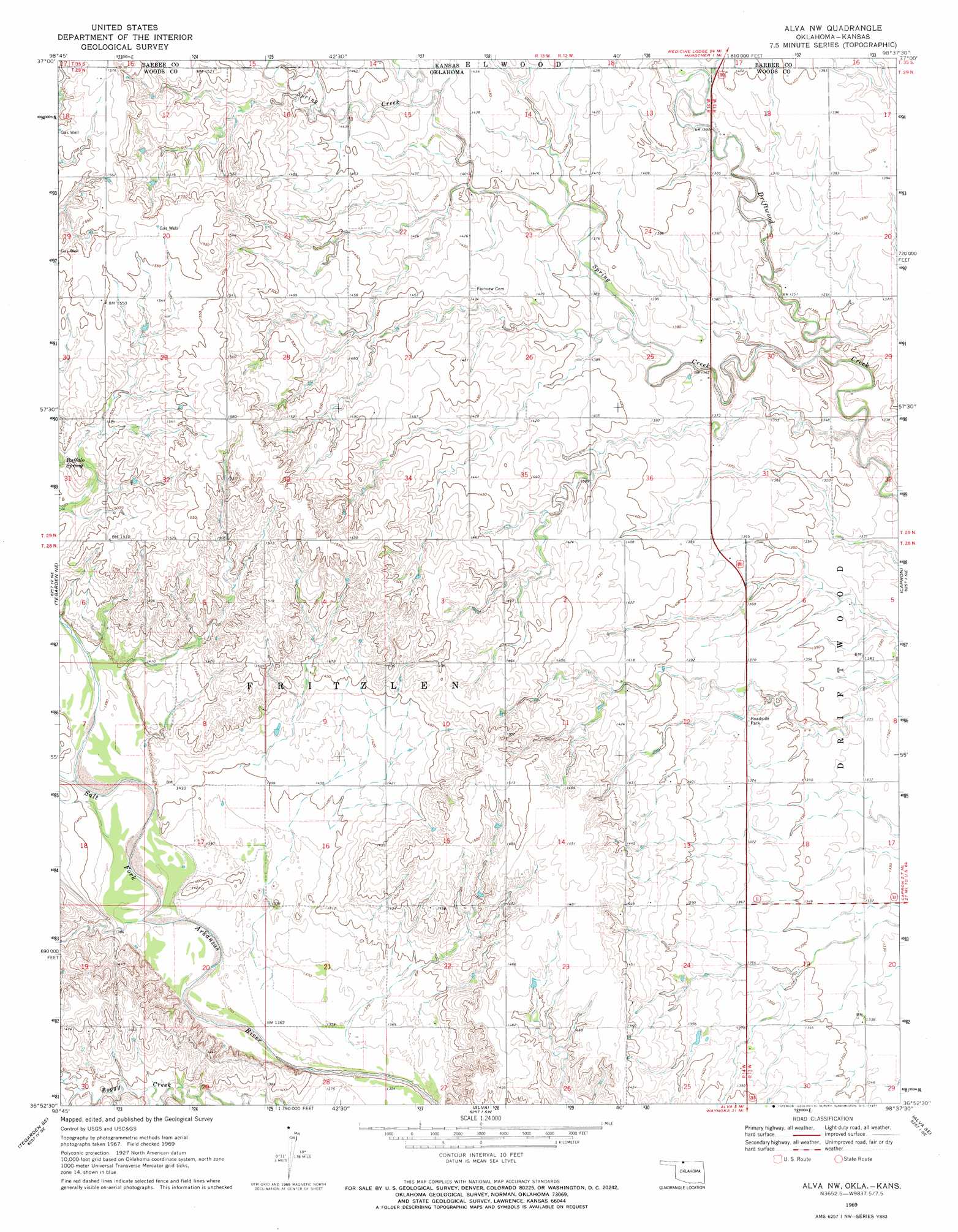
USGS Topo Quad 36098h6 - 1:24,000 scale
| Topo Map Name: | Alva Nw |
| USGS Topo Quad ID: | 36098h6 |
| Print Size: | ca. 21 1/4" wide x 27" high |
| Southeast Coordinates: | 36.875° N latitude / 98.625° W longitude |
| Map Center Coordinates: | 36.9375° N latitude / 98.6875° W longitude |
| U.S. States: | OK, KS |
| Filename: | o36098h6.jpg |
| Download Map JPG Image: | Alva Nw topo map 1:24,000 scale |
| Map Type: | Topographic |
| Topo Series: | 7.5´ |
| Map Scale: | 1:24,000 |
| Source of Map Images: | United States Geological Survey (USGS) |
| Alternate Map Versions: |
Alva NW OK 1969, updated 1971 Download PDF Buy paper map Alva NW OK 2010 Download PDF Buy paper map Alva NW OK 2012 Download PDF Buy paper map Alva NW OK 2016 Download PDF Buy paper map |
1:24,000 Topo Quads surrounding Alva Nw
Deerhead |
Pump Creek |
Hardtner Nw |
Gerlane |
Sharon South |
Aetna |
Hackberry Creek |
Hardtner |
Stubbs |
Kiowa |
Tegarden Nw |
Tegarden Ne |
Alva Nw |
Capron |
Burlington |
Tegarden |
Tegarden Se |
Alva |
Alva Se |
Ingersoll |
Waynoka Nw |
Avard |
Hopeton |
Dacoma |
Lambert |
> Back to 36098e1 at 1:100,000 scale
> Back to 36098a1 at 1:250,000 scale
> Back to U.S. Topo Maps home
Alva Nw topo map: Gazetteer
Alva Nw: Springs
Buffalo Spring elevation 450m 1476′Alva Nw: Streams
Spring Creek elevation 403m 1322′Alva Nw digital topo map on disk
Buy this Alva Nw topo map showing relief, roads, GPS coordinates and other geographical features, as a high-resolution digital map file on DVD: