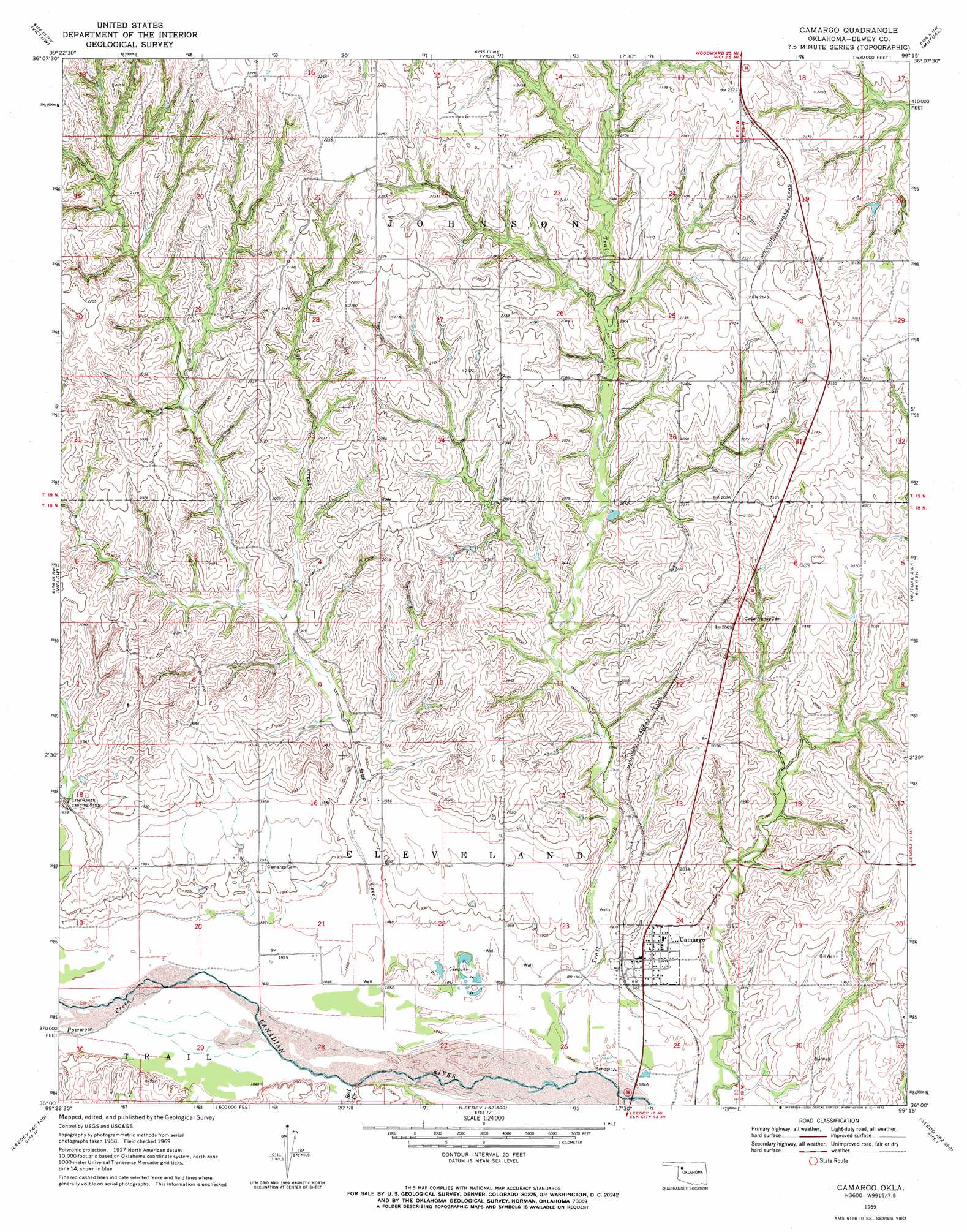
Camargo Topo Map Oklahoma
To zoom in, hover over the map of Camargo
USGS Topo Quad 36099a3 - 1:24,000 scale
| Topo Map Name: | Camargo |
| USGS Topo Quad ID: | 36099a3 |
| Print Size: | ca. 21 1/4" wide x 27" high |
| Southeast Coordinates: | 36° N latitude / 99.25° W longitude |
| Map Center Coordinates: | 36.0625° N latitude / 99.3125° W longitude |
| U.S. State: | OK |
| Filename: | o36099a3.jpg |
| Download Map JPG Image: | Camargo topo map 1:24,000 scale |
| Map Type: | Topographic |
| Topo Series: | 7.5´ |
| Map Scale: | 1:24,000 |
| Source of Map Images: | United States Geological Survey (USGS) |
| Alternate Map Versions: |
Camargo OK 1969, updated 1972 Download PDF Buy paper map Camargo OK 2010 Download PDF Buy paper map Camargo OK 2012 Download PDF Buy paper map Camargo OK 2016 Download PDF Buy paper map |
1:24,000 Topo Quads surrounding Camargo
Fargo Se |
Woodward Sw |
Sharon |
Mooreland Sw |
Mooreland Se |
Harmon |
Vici Nw |
Vici |
Mutual |
Mutual Ne |
Harmon Se |
Vici Sw |
Camargo |
Mutual Sw |
Lenora |
Roll Ne |
Flying Creek |
Trail |
Webb |
Aledo Nw |
Roll Se |
Leedey Sw |
Leedey |
Rhea |
Aledo |
> Back to 36099a1 at 1:100,000 scale
> Back to 36098a1 at 1:250,000 scale
> Back to U.S. Topo Maps home
Camargo topo map: Gazetteer
Camargo: Dams
Day Number 1 Dam elevation 592m 1942′Jeffrey Ecd 4 Dam elevation 616m 2020′
Camargo: Populated Places
Camargo elevation 591m 1938′Camargo: Reservoirs
Day Number 1 Reservoir elevation 592m 1942′Jeffrey Ecd 4 Reservoir elevation 616m 2020′
Camargo: Streams
Gyp Creek elevation 563m 1847′Powwow Creek elevation 564m 1850′
Red Creek elevation 562m 1843′
Trail Creek elevation 559m 1833′
Camargo digital topo map on disk
Buy this Camargo topo map showing relief, roads, GPS coordinates and other geographical features, as a high-resolution digital map file on DVD: