Vici Sw Topo Map Oklahoma
To zoom in, hover over the map of Vici Sw
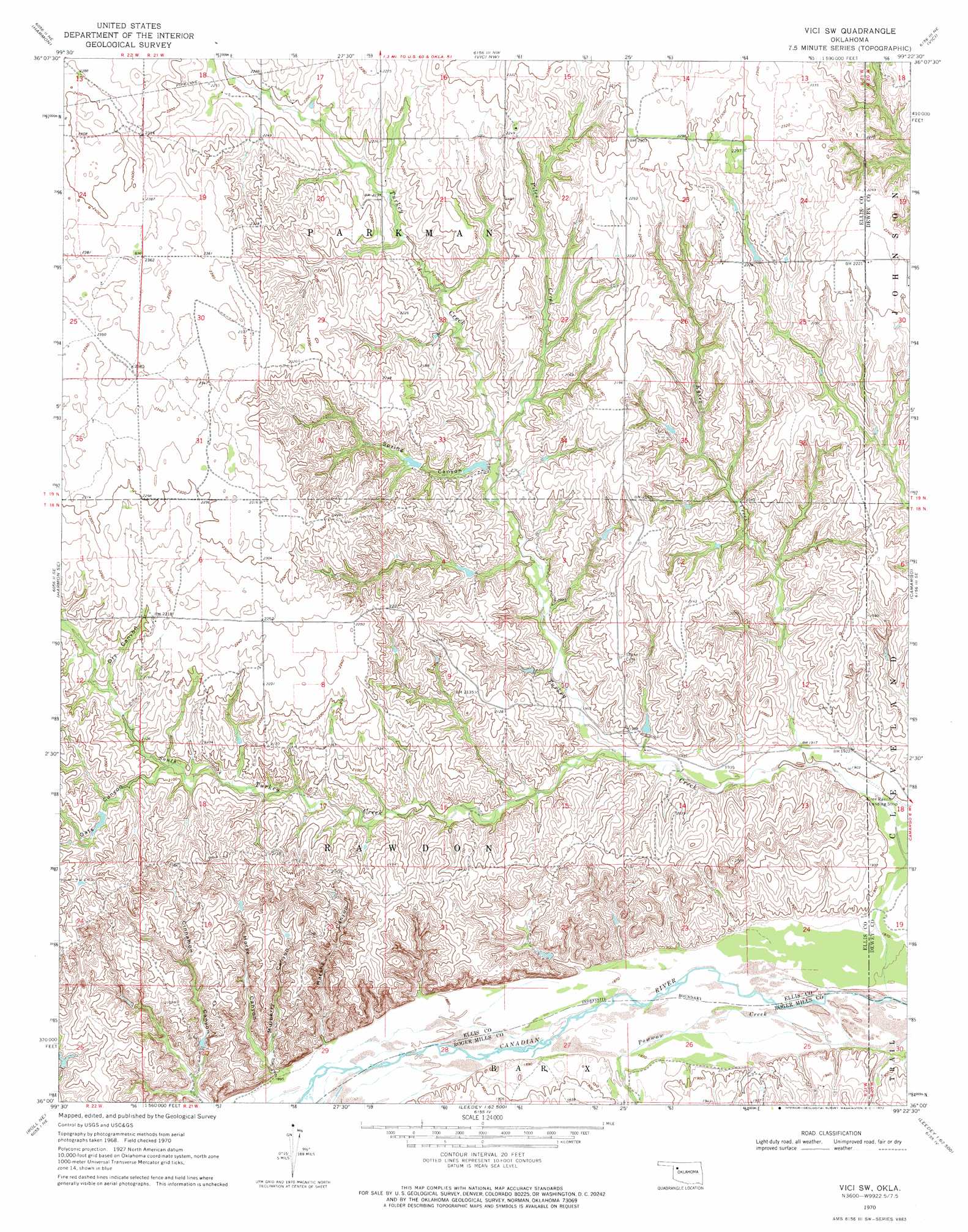
USGS Topo Quad 36099a4 - 1:24,000 scale
| Topo Map Name: | Vici Sw |
| USGS Topo Quad ID: | 36099a4 |
| Print Size: | ca. 21 1/4" wide x 27" high |
| Southeast Coordinates: | 36° N latitude / 99.375° W longitude |
| Map Center Coordinates: | 36.0625° N latitude / 99.4375° W longitude |
| U.S. State: | OK |
| Filename: | o36099a4.jpg |
| Download Map JPG Image: | Vici Sw topo map 1:24,000 scale |
| Map Type: | Topographic |
| Topo Series: | 7.5´ |
| Map Scale: | 1:24,000 |
| Source of Map Images: | United States Geological Survey (USGS) |
| Alternate Map Versions: |
Vici SW OK 1970, updated 1972 Download PDF Buy paper map Vici SW OK 2010 Download PDF Buy paper map Vici SW OK 2012 Download PDF Buy paper map Vici SW OK 2016 Download PDF Buy paper map |
1:24,000 Topo Quads surrounding Vici Sw
Fargo Sw |
Fargo Se |
Woodward Sw |
Sharon |
Mooreland Sw |
Harmon Nw |
Harmon |
Vici Nw |
Vici |
Mutual |
Harmon Sw |
Harmon Se |
Vici Sw |
Camargo |
Mutual Sw |
Roll Nw |
Roll Ne |
Flying Creek |
Trail |
Webb |
Roll |
Roll Se |
Leedey Sw |
Leedey |
Rhea |
> Back to 36099a1 at 1:100,000 scale
> Back to 36098a1 at 1:250,000 scale
> Back to U.S. Topo Maps home
Vici Sw topo map: Gazetteer
Vici Sw: Dams
Hutchison Number 1 Dam elevation 611m 2004′Hutchison Number 2 Dam elevation 597m 1958′
Hutchison Number 5 Dam elevation 620m 2034′
Vici Sw: Reservoirs
Hutchison Number 1 Reservoir elevation 611m 2004′Hutchison Number 2 Reservoir elevation 597m 1958′
Hutchison Number 5 Reservoir elevation 620m 2034′
Vici Sw: Streams
Kyser Creek elevation 579m 1899′Piles Creek elevation 621m 2037′
South Turkey Creek elevation 588m 1929′
Turkey Creek elevation 567m 1860′
Vici Sw: Valleys
Cinnamon Canyon elevation 585m 1919′Dry Canyon elevation 645m 2116′
Harsha Canyon elevation 576m 1889′
Horse Canyon elevation 578m 1896′
Mulberry Canyon elevation 577m 1893′
Oats Canyon elevation 634m 2080′
Spring Canyon elevation 616m 2020′
Vici Sw digital topo map on disk
Buy this Vici Sw topo map showing relief, roads, GPS coordinates and other geographical features, as a high-resolution digital map file on DVD: