Fargo Topo Map Oklahoma
To zoom in, hover over the map of Fargo
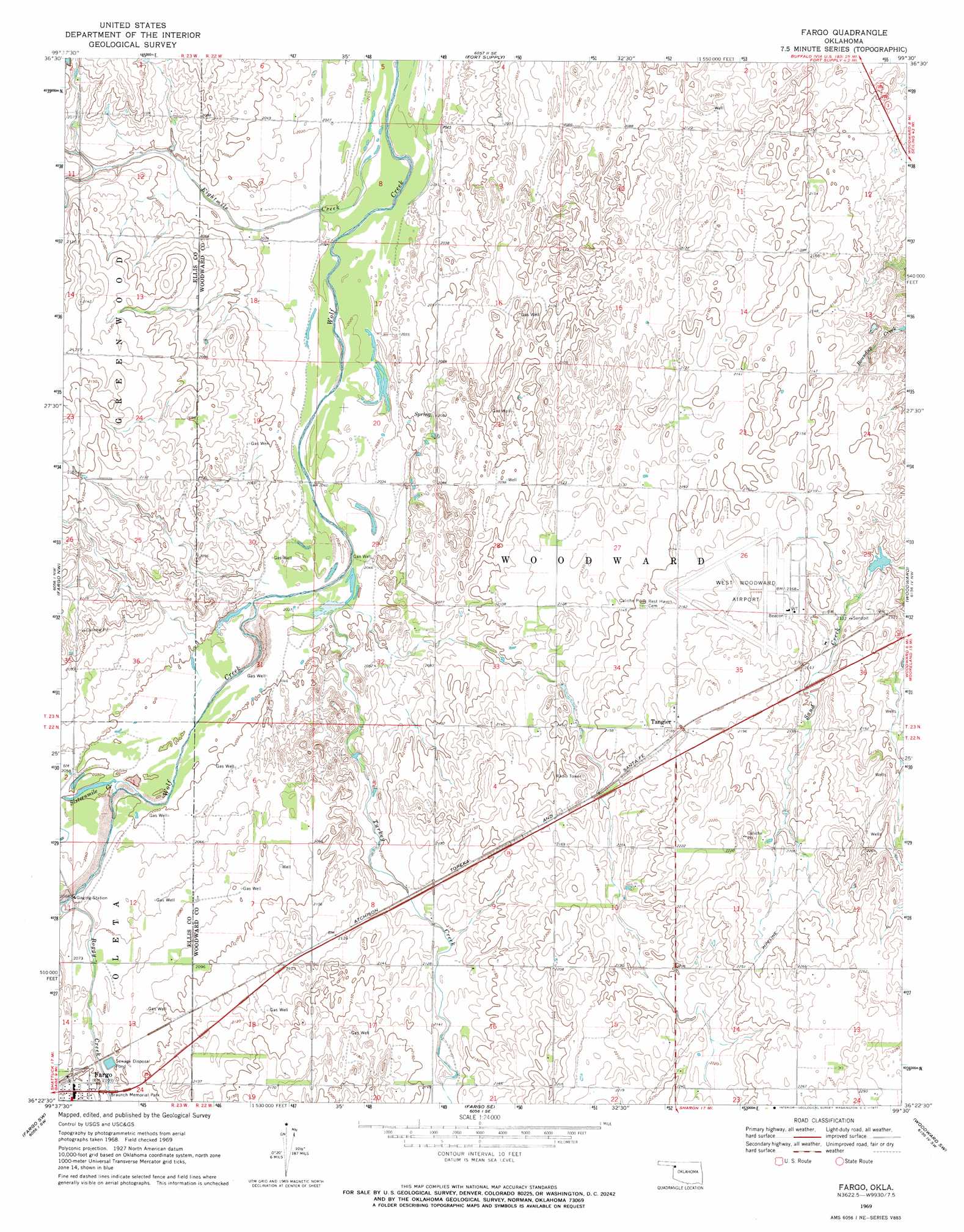
USGS Topo Quad 36099d5 - 1:24,000 scale
| Topo Map Name: | Fargo |
| USGS Topo Quad ID: | 36099d5 |
| Print Size: | ca. 21 1/4" wide x 27" high |
| Southeast Coordinates: | 36.375° N latitude / 99.5° W longitude |
| Map Center Coordinates: | 36.4375° N latitude / 99.5625° W longitude |
| U.S. State: | OK |
| Filename: | o36099d5.jpg |
| Download Map JPG Image: | Fargo topo map 1:24,000 scale |
| Map Type: | Topographic |
| Topo Series: | 7.5´ |
| Map Scale: | 1:24,000 |
| Source of Map Images: | United States Geological Survey (USGS) |
| Alternate Map Versions: |
Fargo OK 1969, updated 1971 Download PDF Buy paper map Fargo OK 2010 Download PDF Buy paper map Fargo OK 2012 Download PDF Buy paper map Fargo OK 2016 Download PDF Buy paper map |
1:24,000 Topo Quads surrounding Fargo
Laverne Ne |
Fort Supply Nw |
Fort Supply Ne |
Sleeping Bear Creek Nw |
Sleeping Bear Creek |
May West |
May East |
Fort Supply |
Sleeping Bear Creek Sw |
Sleeping Bear Creek Se |
Shattuck Ne |
Fargo Nw |
Fargo |
Woodward |
Woodward Ne |
Gage |
Fargo Sw |
Fargo Se |
Woodward Sw |
Sharon |
Arnett |
Harmon Nw |
Harmon |
Vici Nw |
Vici |
> Back to 36099a1 at 1:100,000 scale
> Back to 36098a1 at 1:250,000 scale
> Back to U.S. Topo Maps home
Fargo topo map: Gazetteer
Fargo: Airports
West Woodward Airport elevation 662m 2171′Fargo: Populated Places
Fargo elevation 643m 2109′Tangier elevation 668m 2191′
Fargo: Streams
Boggy Creek elevation 627m 2057′Eightmile Creek elevation 613m 2011′
Sixteenmile Creek elevation 624m 2047′
Turkey Creek elevation 622m 2040′
Fargo digital topo map on disk
Buy this Fargo topo map showing relief, roads, GPS coordinates and other geographical features, as a high-resolution digital map file on DVD: