Freedom Topo Map Oklahoma
To zoom in, hover over the map of Freedom
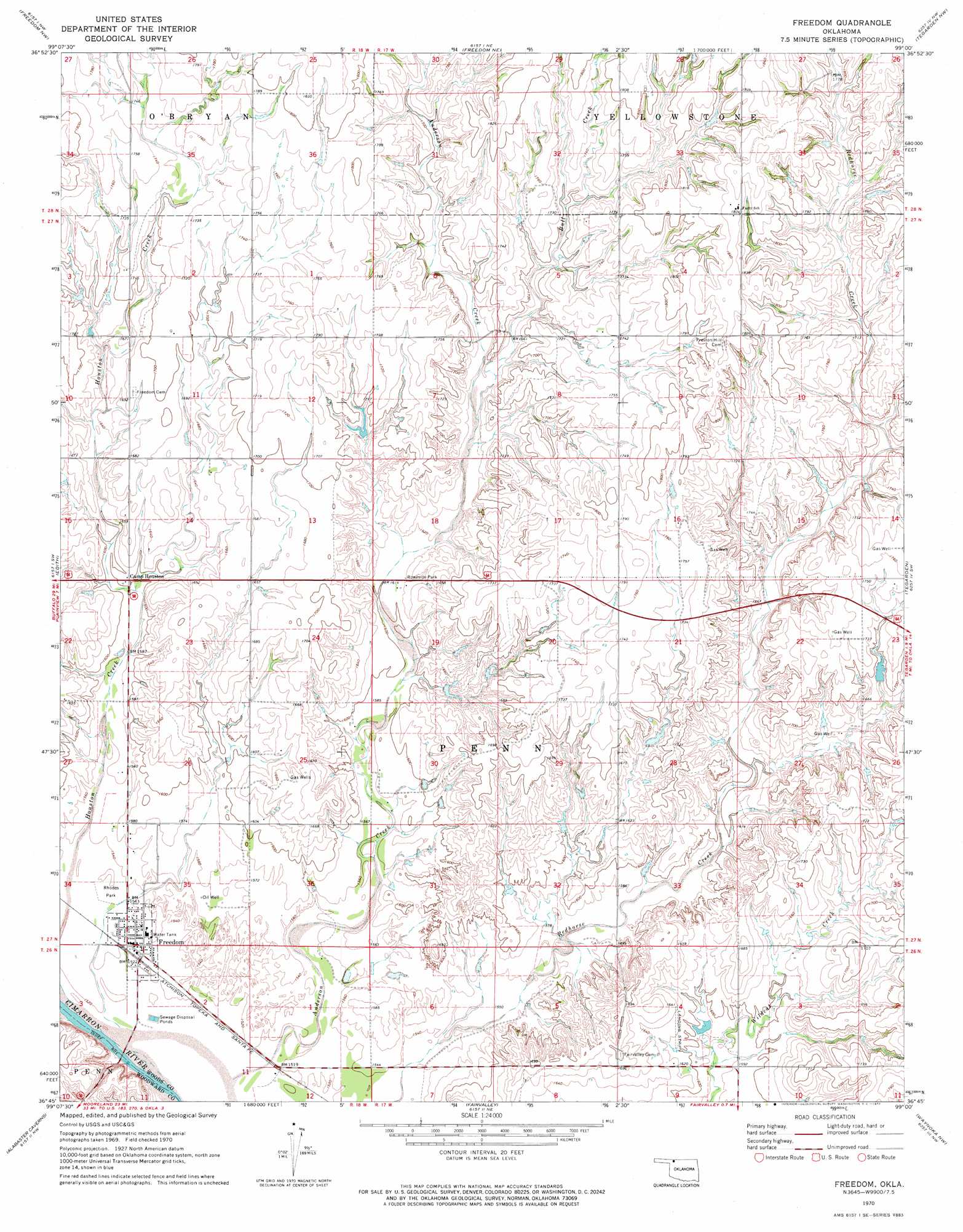
USGS Topo Quad 36099g1 - 1:24,000 scale
| Topo Map Name: | Freedom |
| USGS Topo Quad ID: | 36099g1 |
| Print Size: | ca. 21 1/4" wide x 27" high |
| Southeast Coordinates: | 36.75° N latitude / 99° W longitude |
| Map Center Coordinates: | 36.8125° N latitude / 99.0625° W longitude |
| U.S. State: | OK |
| Filename: | o36099g1.jpg |
| Download Map JPG Image: | Freedom topo map 1:24,000 scale |
| Map Type: | Topographic |
| Topo Series: | 7.5´ |
| Map Scale: | 1:24,000 |
| Source of Map Images: | United States Geological Survey (USGS) |
| Alternate Map Versions: |
Freedom OK 1970, updated 1972 Download PDF Buy paper map Freedom OK 2010 Download PDF Buy paper map Freedom OK 2012 Download PDF Buy paper map Freedom OK 2016 Download PDF Buy paper map |
1:24,000 Topo Quads surrounding Freedom
Buttermilk |
Nescatunga Creek South |
Fancy Canyon |
Aetna |
Hackberry Creek |
Lookout |
Freedom Nw |
Freedom Ne |
Tegarden Nw |
Tegarden Ne |
Selman Se |
Edith |
Freedom |
Tegarden |
Tegarden Se |
Sleeping Bear Creek |
Alabaster Caverns |
Fairvalley |
Waynoka Nw |
Avard |
Sleeping Bear Creek Se |
Fairvalley Sw |
Fairvalley Se |
Waynoka West |
Waynoka East |
> Back to 36099e1 at 1:100,000 scale
> Back to 36098a1 at 1:250,000 scale
> Back to U.S. Topo Maps home
Freedom topo map: Gazetteer
Freedom: Airports
Eden Ranch Airport elevation 495m 1624′Freedom Municipal Airport elevation 463m 1519′
Freedom: Dams
Benson Number 3 Dam elevation 511m 1676′Oknoname 151002 Dam elevation 532m 1745′
Freedom: Parks
Rhodes Park elevation 469m 1538′Freedom: Populated Places
Freedom elevation 468m 1535′Freedom: Reservoirs
Benson Number 3 Reservoir elevation 511m 1676′Oknoname 151002 Reservoir elevation 532m 1745′
Freedom: Streams
Anderson Creek elevation 461m 1512′Bull Creek elevation 497m 1630′
Girl Creek elevation 460m 1509′
Freedom digital topo map on disk
Buy this Freedom topo map showing relief, roads, GPS coordinates and other geographical features, as a high-resolution digital map file on DVD: