Rosston Nw Topo Map Oklahoma
To zoom in, hover over the map of Rosston Nw
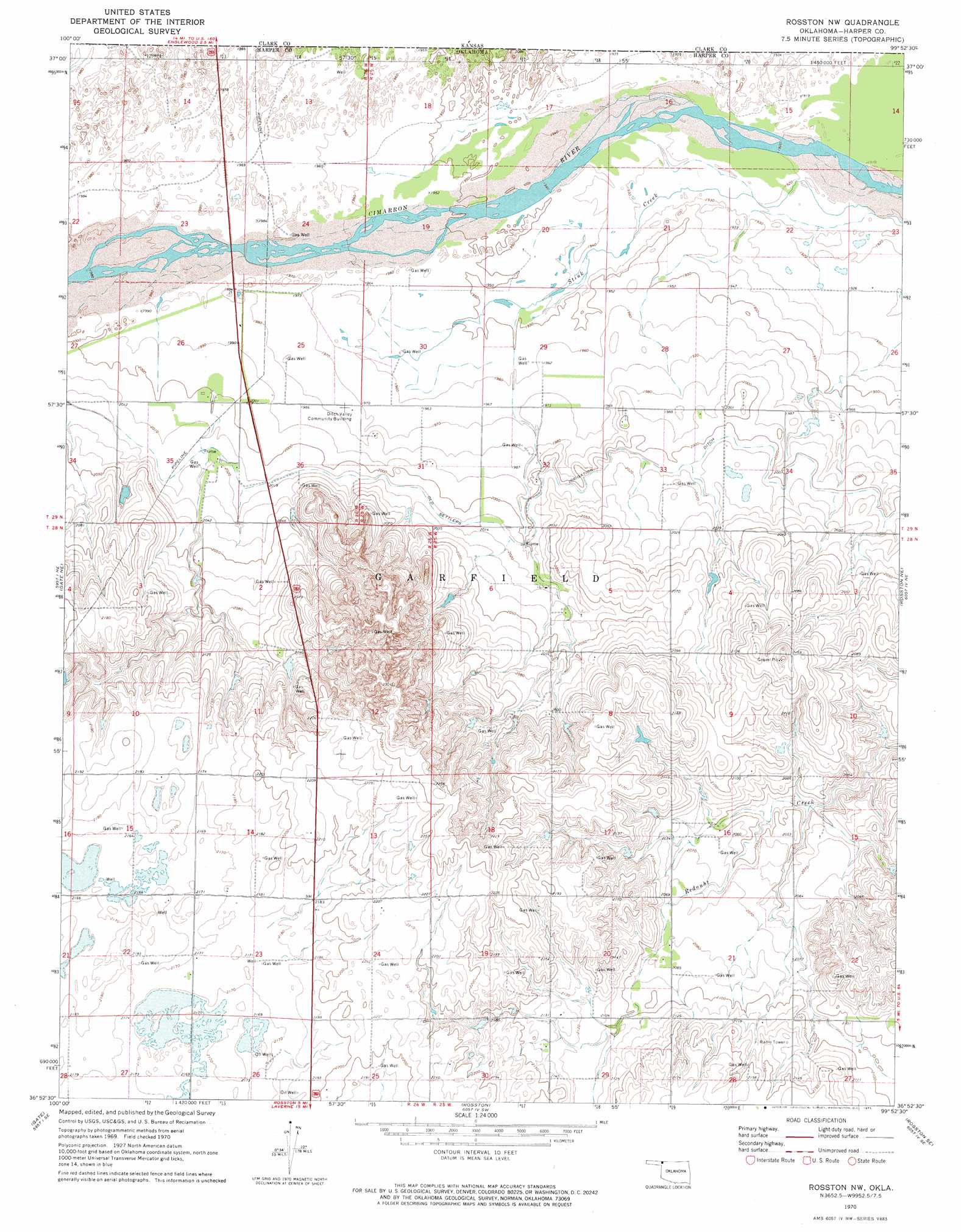
USGS Topo Quad 36099h8 - 1:24,000 scale
| Topo Map Name: | Rosston Nw |
| USGS Topo Quad ID: | 36099h8 |
| Print Size: | ca. 21 1/4" wide x 27" high |
| Southeast Coordinates: | 36.875° N latitude / 99.875° W longitude |
| Map Center Coordinates: | 36.9375° N latitude / 99.9375° W longitude |
| U.S. State: | OK |
| Filename: | o36099h8.jpg |
| Download Map JPG Image: | Rosston Nw topo map 1:24,000 scale |
| Map Type: | Topographic |
| Topo Series: | 7.5´ |
| Map Scale: | 1:24,000 |
| Source of Map Images: | United States Geological Survey (USGS) |
| Alternate Map Versions: |
Rosston NW OK 1970, updated 1973 Download PDF Buy paper map Rosston NW OK 2010 Download PDF Buy paper map Rosston NW OK 2012 Download PDF Buy paper map Rosston NW OK 2016 Download PDF Buy paper map |
1:24,000 Topo Quads surrounding Rosston Nw
Proffitt Lake Nw |
Proffitt Lake |
Ashland Nw |
Ashland |
Sitka |
Proffitt Lake Sw |
Mount Helen |
Englewood |
Ashland Se |
Sitka Sw |
Gate Nw |
Gate Ne |
Rosston Nw |
Rosston Ne |
Buffalo Nw |
Knowles |
Gate |
Rosston |
Rosston Se |
Buffalo |
Logan Nw |
Logan Ne |
Laverne |
Laverne Ne |
Fort Supply Nw |
> Back to 36099e1 at 1:100,000 scale
> Back to 36098a1 at 1:250,000 scale
> Back to U.S. Topo Maps home
Rosston Nw topo map: Gazetteer
Rosston Nw: Canals
Old Settlers Irrigation Ditch elevation 614m 2014′Rosston Nw: Dams
Casey 1 Dam elevation 626m 2053′Oknoname 05901 Dam elevation 627m 2057′
Oknoname 059037 Dam elevation 632m 2073′
Oknoname 059038 Dam elevation 642m 2106′
Oknoname 059043 Dam elevation 619m 2030′
Rosston Nw: Reservoirs
Casey 1 Reservoir elevation 626m 2053′Oknoname 05901 Reservoir elevation 627m 2057′
Oknoname 059037 Reservoir elevation 632m 2073′
Oknoname 059038 Reservoir elevation 642m 2106′
Oknoname 059043 Reservoir elevation 619m 2030′
Rosston Nw digital topo map on disk
Buy this Rosston Nw topo map showing relief, roads, GPS coordinates and other geographical features, as a high-resolution digital map file on DVD: