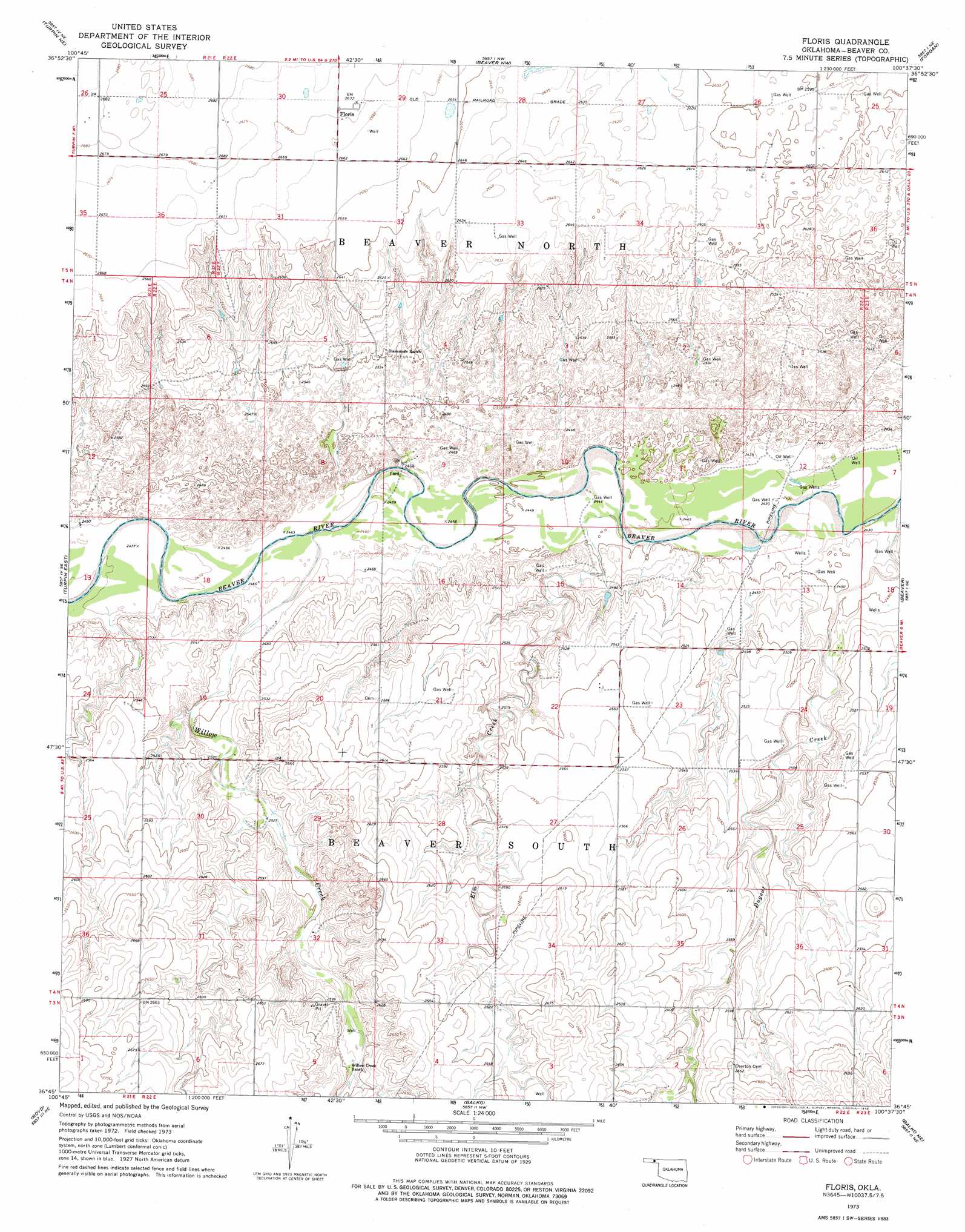
Floris Topo Map Oklahoma
To zoom in, hover over the map of Floris
USGS Topo Quad 36100g6 - 1:24,000 scale
| Topo Map Name: | Floris |
| USGS Topo Quad ID: | 36100g6 |
| Print Size: | ca. 21 1/4" wide x 27" high |
| Southeast Coordinates: | 36.75° N latitude / 100.625° W longitude |
| Map Center Coordinates: | 36.8125° N latitude / 100.6875° W longitude |
| U.S. State: | OK |
| Filename: | o36100g6.jpg |
| Download Map JPG Image: | Floris topo map 1:24,000 scale |
| Map Type: | Topographic |
| Topo Series: | 7.5´ |
| Map Scale: | 1:24,000 |
| Source of Map Images: | United States Geological Survey (USGS) |
| Alternate Map Versions: |
Floris OK 1973, updated 1976 Download PDF Buy paper map Floris OK 2010 Download PDF Buy paper map Floris OK 2012 Download PDF Buy paper map Floris OK 2016 Download PDF Buy paper map |
1:24,000 Topo Quads surrounding Floris
Liberal |
Hayne |
Kismet Sw |
Kismet Se |
Irish Flats |
Little Ponderosa |
Turpin Ne |
Beaver Nw |
Forgan |
Mocane Nw |
Turpin West |
Turpin East |
Floris |
Beaver |
Mocane Sw |
Red Horse Creek |
Boyd |
Balko |
Balko Ne |
Clear Lake Nw |
Bryans Corner Sw |
Bryans Corner |
Balko Sw |
Elmwood |
Clear Lake Sw |
> Back to 36100e1 at 1:100,000 scale
> Back to 36100a1 at 1:250,000 scale
> Back to U.S. Topo Maps home
Floris topo map: Gazetteer
Floris: Airports
T Bar T Ranch Airport elevation 788m 2585′Floris: Dams
Davis Number 5 Dam elevation 771m 2529′Floris: Parks
Beaver River Wildlife Management Area elevation 777m 2549′Floris: Populated Places
Floris elevation 815m 2673′Floris: Reservoirs
Davis Number 5 Reservoir elevation 771m 2529′Floris: Streams
Dugout Creek elevation 740m 2427′Elm Creek elevation 743m 2437′
Willow Creek elevation 750m 2460′
Floris digital topo map on disk
Buy this Floris topo map showing relief, roads, GPS coordinates and other geographical features, as a high-resolution digital map file on DVD: