Turpin West Topo Map Oklahoma
To zoom in, hover over the map of Turpin West
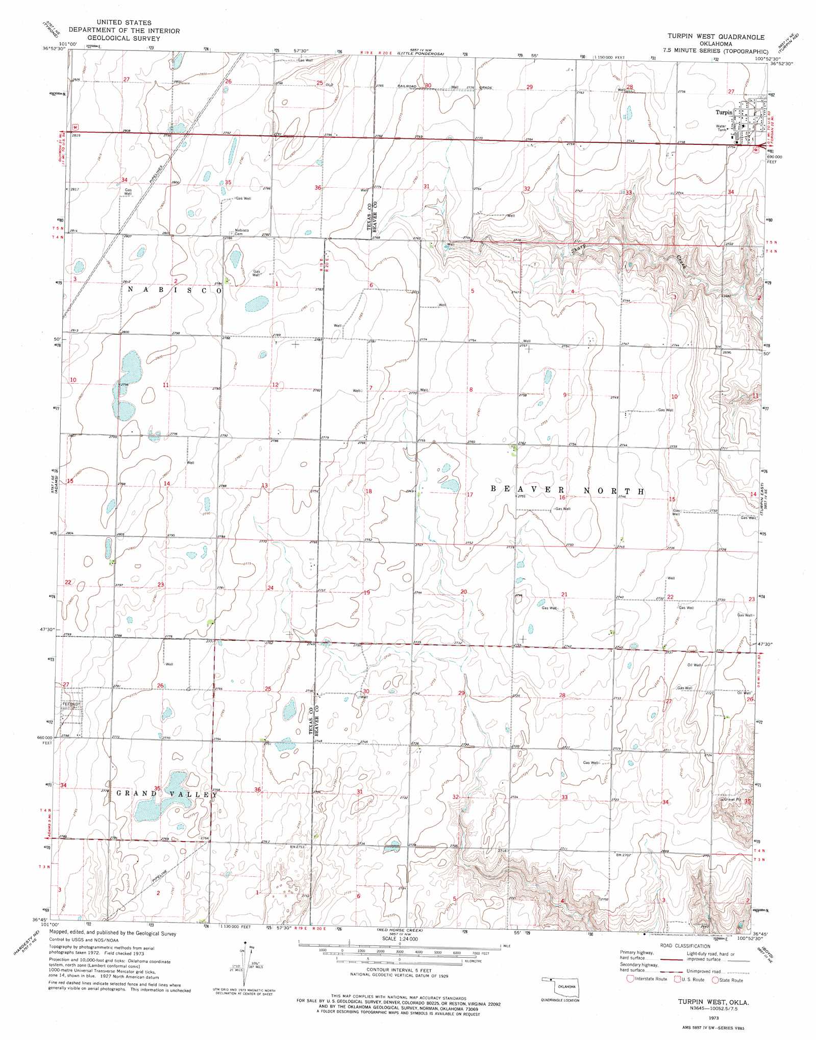
USGS Topo Quad 36100g8 - 1:24,000 scale
| Topo Map Name: | Turpin West |
| USGS Topo Quad ID: | 36100g8 |
| Print Size: | ca. 21 1/4" wide x 27" high |
| Southeast Coordinates: | 36.75° N latitude / 100.875° W longitude |
| Map Center Coordinates: | 36.8125° N latitude / 100.9375° W longitude |
| U.S. State: | OK |
| Filename: | o36100g8.jpg |
| Download Map JPG Image: | Turpin West topo map 1:24,000 scale |
| Map Type: | Topographic |
| Topo Series: | 7.5´ |
| Map Scale: | 1:24,000 |
| Source of Map Images: | United States Geological Survey (USGS) |
| Alternate Map Versions: |
Turpin West OK 1973, updated 1976 Download PDF Buy paper map Turpin West OK 2010 Download PDF Buy paper map Turpin West OK 2012 Download PDF Buy paper map Turpin West OK 2016 Download PDF Buy paper map |
1:24,000 Topo Quads surrounding Turpin West
Woods Sw |
Woods Se |
Liberal |
Hayne |
Kismet Sw |
Hooker Nw |
Tyrone |
Little Ponderosa |
Turpin Ne |
Beaver Nw |
Hooker |
Adams |
Turpin West |
Turpin East |
Floris |
Optima Dam |
Hardesty Ne |
Red Horse Creek |
Boyd |
Balko |
Hardesty |
Hardesty Se |
Bryans Corner Sw |
Bryans Corner |
Balko Sw |
> Back to 36100e1 at 1:100,000 scale
> Back to 36100a1 at 1:250,000 scale
> Back to U.S. Topo Maps home
Turpin West digital topo map on disk
Buy this Turpin West topo map showing relief, roads, GPS coordinates and other geographical features, as a high-resolution digital map file on DVD: