Kimball Topo Map Texas
To zoom in, hover over the map of Kimball
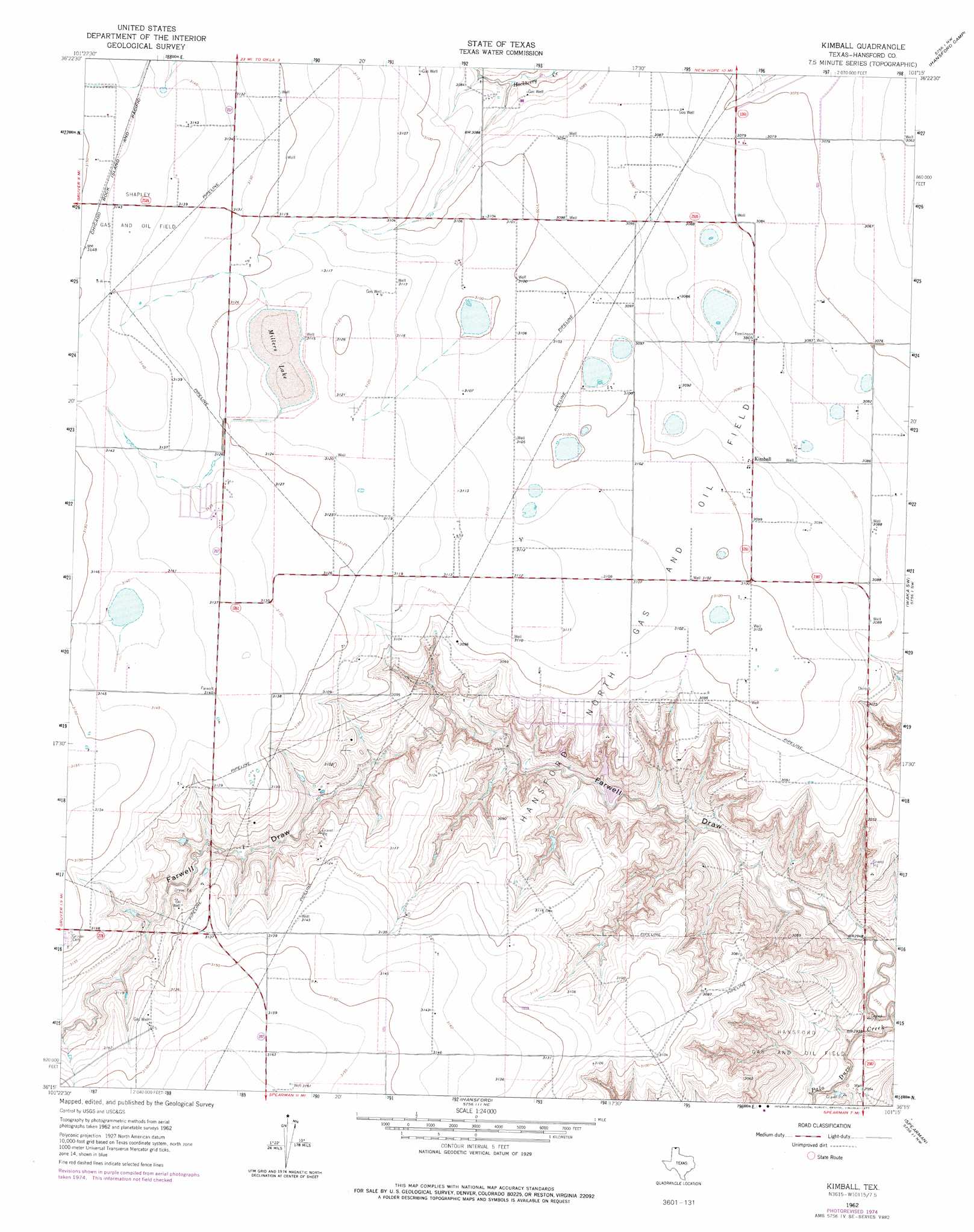
USGS Topo Quad 36101c3 - 1:24,000 scale
| Topo Map Name: | Kimball |
| USGS Topo Quad ID: | 36101c3 |
| Print Size: | ca. 21 1/4" wide x 27" high |
| Southeast Coordinates: | 36.25° N latitude / 101.25° W longitude |
| Map Center Coordinates: | 36.3125° N latitude / 101.3125° W longitude |
| U.S. State: | TX |
| Filename: | o36101c3.jpg |
| Download Map JPG Image: | Kimball topo map 1:24,000 scale |
| Map Type: | Topographic |
| Topo Series: | 7.5´ |
| Map Scale: | 1:24,000 |
| Source of Map Images: | United States Geological Survey (USGS) |
| Alternate Map Versions: |
Kimball TX 1962, updated 1965 Download PDF Buy paper map Kimball TX 1962, updated 1977 Download PDF Buy paper map Kimball TX 2010 Download PDF Buy paper map Kimball TX 2012 Download PDF Buy paper map Kimball TX 2016 Download PDF Buy paper map |
1:24,000 Topo Quads surrounding Kimball
Goodwell Se |
Guymon Sw |
Guymon Se |
Hardesty |
Hardesty Se |
Sunray 1 Ne |
Phillips Camp |
Bernstein |
Hansford Camp |
Horseshoe Hill |
Sunray 1 Se |
Gruver |
Kimball |
Waka Sw |
Waka |
Hannas Draw West |
Hannas Draw East |
Hansford |
Spearman |
Spearman Ne |
Capps Switch Se |
Morse |
Morse Se |
Holt |
Spearman Se |
> Back to 36101a1 at 1:100,000 scale
> Back to 36100a1 at 1:250,000 scale
> Back to U.S. Topo Maps home
Kimball topo map: Gazetteer
Kimball: Dams
Cargill Industries Lake Dam elevation 935m 3067′Kimball: Lakes
Millers Lake elevation 949m 3113′Kimball: Oilfields
Hansford North Gas and Oil Field elevation 947m 3106′Shapley Gas and Oil Field elevation 958m 3143′
Kimball: Populated Places
Kimball elevation 944m 3097′Kimball: Reservoirs
Cargill Industries Lake elevation 935m 3067′Kimball: Valleys
Farwell Draw elevation 887m 2910′Kimball digital topo map on disk
Buy this Kimball topo map showing relief, roads, GPS coordinates and other geographical features, as a high-resolution digital map file on DVD: