Guymon Topo Map Oklahoma
To zoom in, hover over the map of Guymon
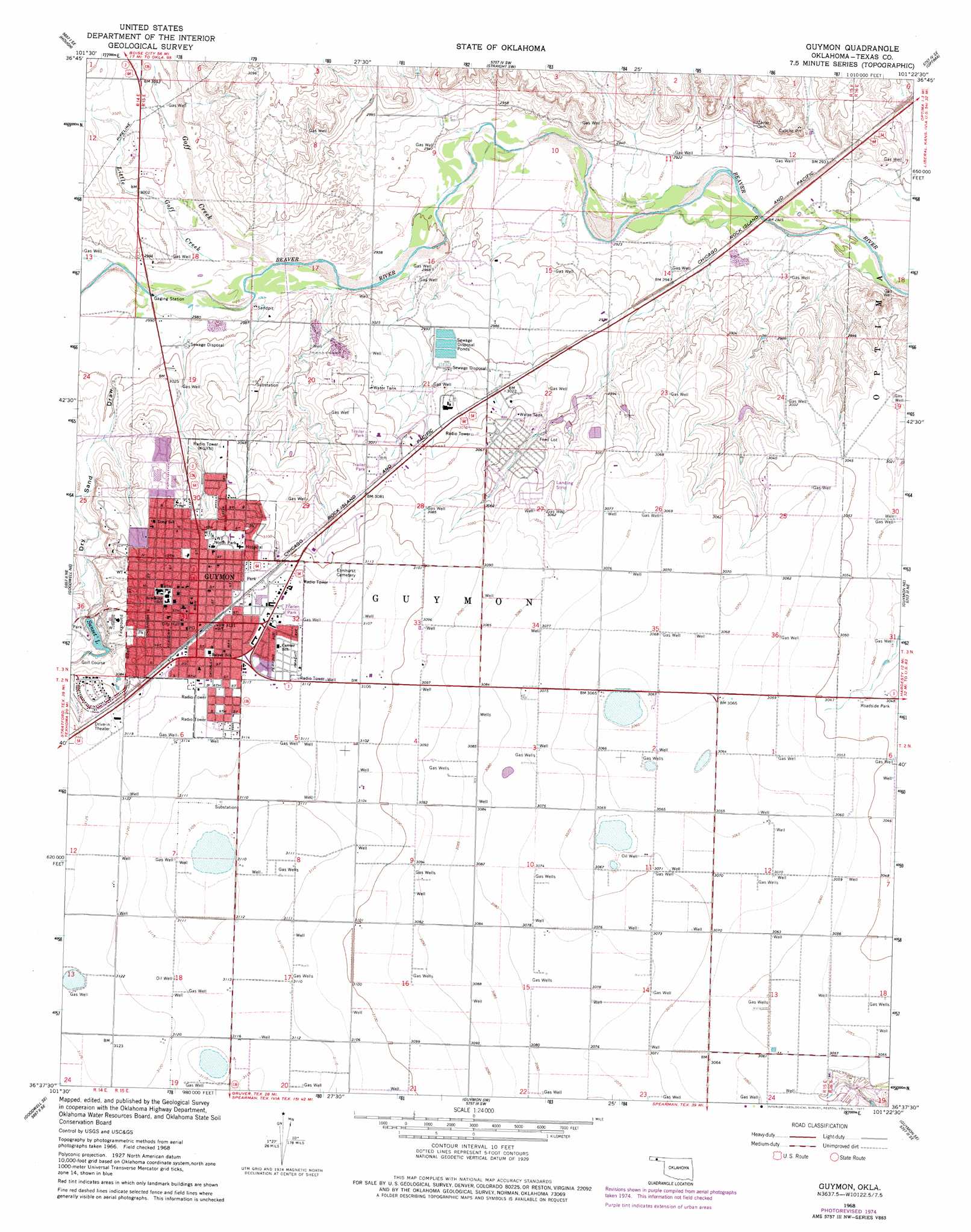
USGS Topo Quad 36101f4 - 1:24,000 scale
| Topo Map Name: | Guymon |
| USGS Topo Quad ID: | 36101f4 |
| Print Size: | ca. 21 1/4" wide x 27" high |
| Southeast Coordinates: | 36.625° N latitude / 101.375° W longitude |
| Map Center Coordinates: | 36.6875° N latitude / 101.4375° W longitude |
| U.S. State: | OK |
| Filename: | o36101f4.jpg |
| Download Map JPG Image: | Guymon topo map 1:24,000 scale |
| Map Type: | Topographic |
| Topo Series: | 7.5´ |
| Map Scale: | 1:24,000 |
| Source of Map Images: | United States Geological Survey (USGS) |
| Alternate Map Versions: |
Guymon OK 1968, updated 1970 Download PDF Buy paper map Guymon OK 1968, updated 1977 Download PDF Buy paper map Guymon OK 2010 Download PDF Buy paper map Guymon OK 2012 Download PDF Buy paper map Guymon OK 2016 Download PDF Buy paper map |
1:24,000 Topo Quads surrounding Guymon
Hough Nw |
Hough Ne |
Straight |
Straight Ne |
Hooker Nw |
Hough Sw |
Hough |
Straight Sw |
Optima |
Hooker |
Goodwell Nw |
Goodwell Ne |
Guymon |
Guymon Ne |
Optima Dam |
Goodwell |
Goodwell Se |
Guymon Sw |
Guymon Se |
Hardesty |
Sunray 1 Nw |
Sunray 1 Ne |
Phillips Camp |
Bernstein |
Hansford Camp |
> Back to 36101e1 at 1:100,000 scale
> Back to 36100a1 at 1:250,000 scale
> Back to U.S. Topo Maps home
Guymon topo map: Gazetteer
Guymon: Dams
Sunset Lake Dam elevation 929m 3047′Guymon: Parks
North Park elevation 952m 3123′Guymon: Populated Places
Guymon elevation 952m 3123′Guymon: Reservoirs
Sunset Lake elevation 931m 3054′Guymon: Streams
Goff Creek elevation 903m 2962′Little Goff Creek elevation 906m 2972′
Guymon: Valleys
Dry Sand Draw elevation 915m 3001′Guymon digital topo map on disk
Buy this Guymon topo map showing relief, roads, GPS coordinates and other geographical features, as a high-resolution digital map file on DVD: