Hooker Topo Map Oklahoma
To zoom in, hover over the map of Hooker
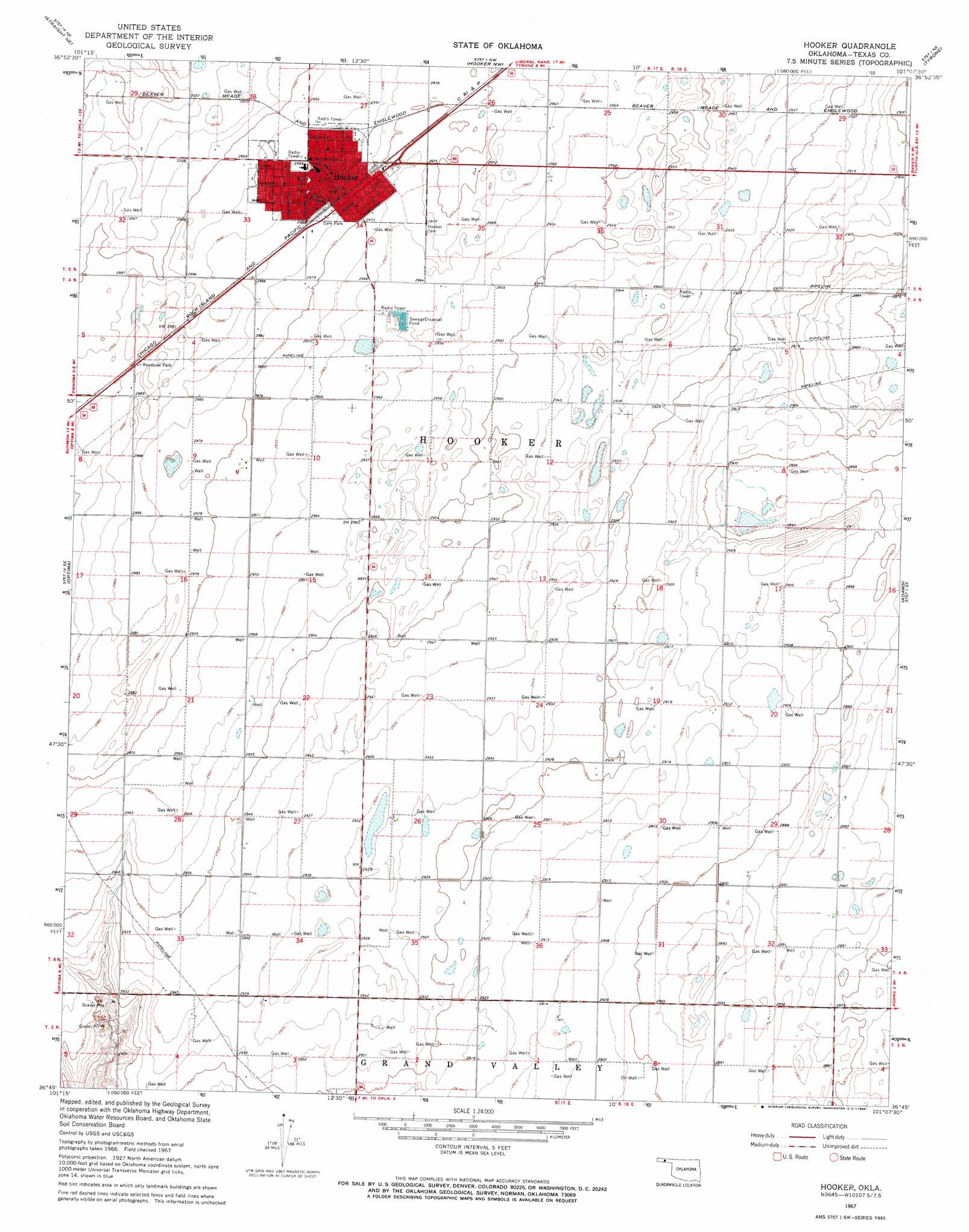
USGS Topo Quad 36101g2 - 1:24,000 scale
| Topo Map Name: | Hooker |
| USGS Topo Quad ID: | 36101g2 |
| Print Size: | ca. 21 1/4" wide x 27" high |
| Southeast Coordinates: | 36.75° N latitude / 101.125° W longitude |
| Map Center Coordinates: | 36.8125° N latitude / 101.1875° W longitude |
| U.S. State: | OK |
| Filename: | o36101g2.jpg |
| Download Map JPG Image: | Hooker topo map 1:24,000 scale |
| Map Type: | Topographic |
| Topo Series: | 7.5´ |
| Map Scale: | 1:24,000 |
| Source of Map Images: | United States Geological Survey (USGS) |
| Alternate Map Versions: |
Hooker OK 1967, updated 1968 Download PDF Buy paper map Hooker OK 2010 Download PDF Buy paper map Hooker OK 2012 Download PDF Buy paper map Hooker OK 2016 Download PDF Buy paper map |
1:24,000 Topo Quads surrounding Hooker
Hugoton Sw |
Hugoton Se |
Woods Sw |
Woods Se |
Liberal |
Straight |
Straight Ne |
Hooker Nw |
Tyrone |
Little Ponderosa |
Straight Sw |
Optima |
Hooker |
Adams |
Turpin West |
Guymon |
Guymon Ne |
Optima Dam |
Hardesty Ne |
Red Horse Creek |
Guymon Sw |
Guymon Se |
Hardesty |
Hardesty Se |
Bryans Corner Sw |
> Back to 36101e1 at 1:100,000 scale
> Back to 36100a1 at 1:250,000 scale
> Back to U.S. Topo Maps home
Hooker topo map: Gazetteer
Hooker: Airports
Hooker Municipal Airport elevation 913m 2995′Hooker: Populated Places
Hooker elevation 910m 2985′Hooker digital topo map on disk
Buy this Hooker topo map showing relief, roads, GPS coordinates and other geographical features, as a high-resolution digital map file on DVD: