Stratford Topo Map Texas
To zoom in, hover over the map of Stratford
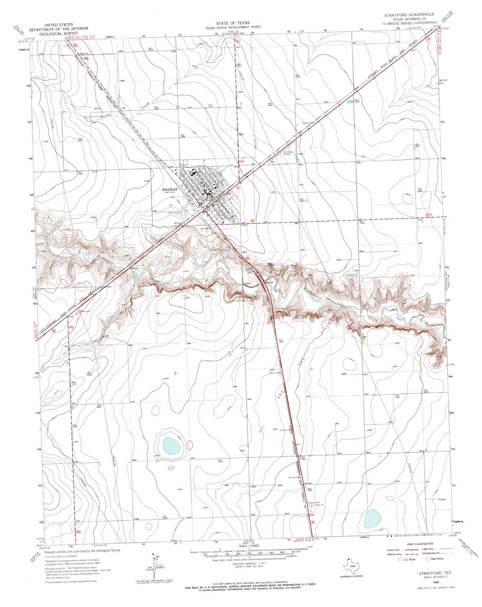
USGS Topo Quad 36102c1 - 1:24,000 scale
| Topo Map Name: | Stratford |
| USGS Topo Quad ID: | 36102c1 |
| Print Size: | ca. 21 1/4" wide x 27" high |
| Southeast Coordinates: | 36.25° N latitude / 102° W longitude |
| Map Center Coordinates: | 36.3125° N latitude / 102.0625° W longitude |
| U.S. State: | TX |
| Filename: | o36102c1.jpg |
| Download Map JPG Image: | Stratford topo map 1:24,000 scale |
| Map Type: | Topographic |
| Topo Series: | 7.5´ |
| Map Scale: | 1:24,000 |
| Source of Map Images: | United States Geological Survey (USGS) |
| Alternate Map Versions: |
Stratford TX 1964, updated 1966 Download PDF Buy paper map Stratford TX 2010 Download PDF Buy paper map Stratford TX 2012 Download PDF Buy paper map Stratford TX 2016 Download PDF Buy paper map |
1:24,000 Topo Quads surrounding Stratford
Conrad |
Griggs Sw |
Griggs |
Texhoma Sw |
Texhoma North |
Stratford 2 Ne |
Kerrick |
Stratford Ne |
Stevens |
Texhoma South |
Stratford 2 Se |
Brickel |
Stratford |
Stevens Sw |
Stevens Se |
Wilco Ne |
Conlen |
Lautz |
Spurlock Chapel |
Pleasure Pond |
Wilco |
Exum |
Cactus West |
Cactus East |
Sunray |
> Back to 36102a1 at 1:100,000 scale
> Back to 36102a1 at 1:250,000 scale
> Back to U.S. Topo Maps home
Stratford topo map: Gazetteer
Stratford: Airports
Stratford Field elevation 1115m 3658′Stratford: Dams
Stratford Feeders Reservoir Dam elevation 1095m 3592′Stratford: Populated Places
Stratford elevation 1125m 3690′Stratford: Reservoirs
Stratford Feeders Reservoir elevation 1095m 3592′Stratford digital topo map on disk
Buy this Stratford topo map showing relief, roads, GPS coordinates and other geographical features, as a high-resolution digital map file on DVD: