Buffalo Springs Topo Map Texas
To zoom in, hover over the map of Buffalo Springs
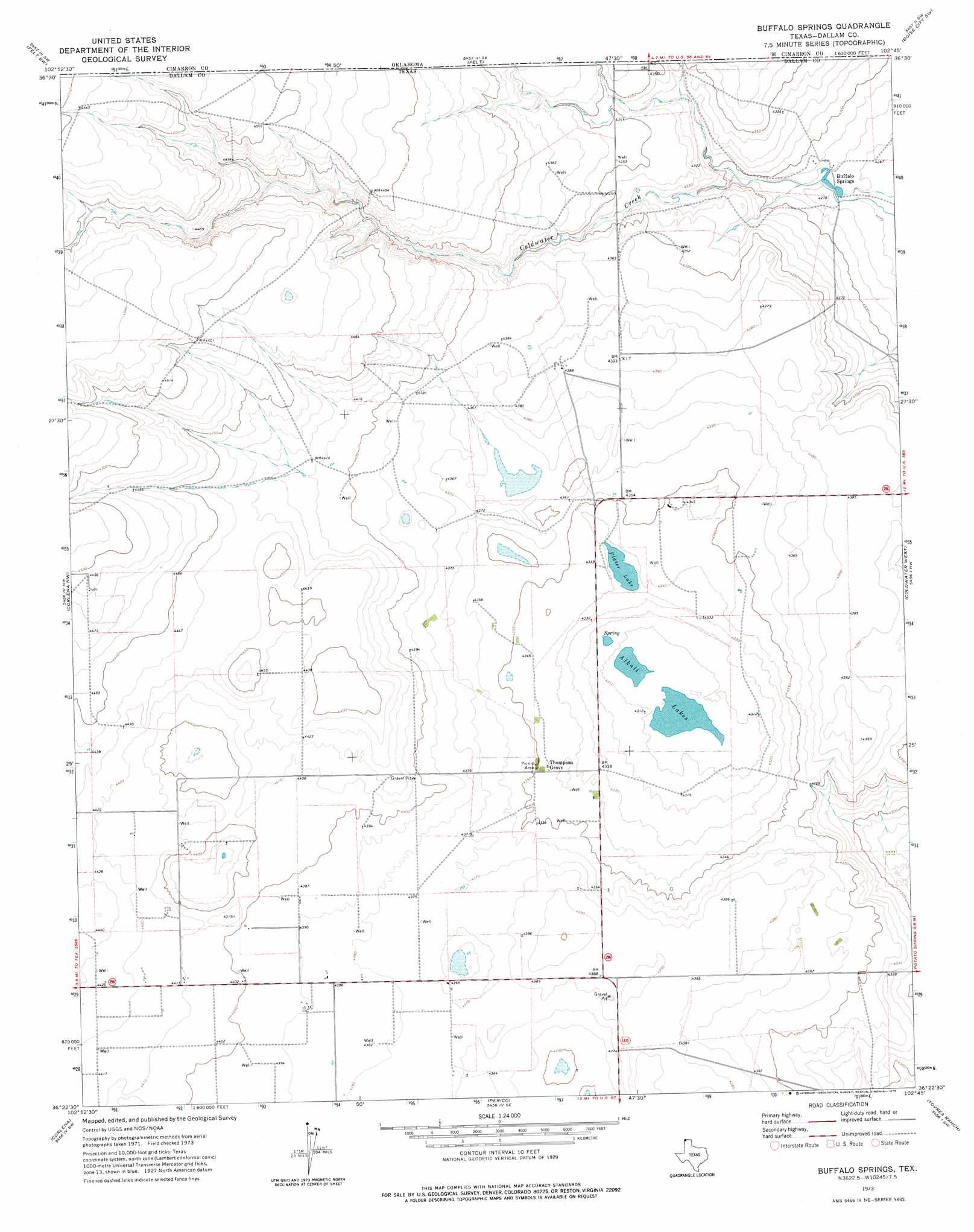
USGS Topo Quad 36102d7 - 1:24,000 scale
| Topo Map Name: | Buffalo Springs |
| USGS Topo Quad ID: | 36102d7 |
| Print Size: | ca. 21 1/4" wide x 27" high |
| Southeast Coordinates: | 36.375° N latitude / 102.75° W longitude |
| Map Center Coordinates: | 36.4375° N latitude / 102.8125° W longitude |
| U.S. State: | TX |
| Filename: | o36102d7.jpg |
| Download Map JPG Image: | Buffalo Springs topo map 1:24,000 scale |
| Map Type: | Topographic |
| Topo Series: | 7.5´ |
| Map Scale: | 1:24,000 |
| Source of Map Images: | United States Geological Survey (USGS) |
| Alternate Map Versions: |
Buffalo Springs TX 1973, updated 1975 Download PDF Buy paper map Buffalo Springs TX 1998, updated 2001 Download PDF Buy paper map Buffalo Springs TX 2011 Download PDF Buy paper map Buffalo Springs TX 2012 Download PDF Buy paper map Buffalo Springs TX 2016 Download PDF Buy paper map |
| FStopo: | US Forest Service topo Buffalo Springs is available: Download FStopo PDF Download FStopo TIF |
1:24,000 Topo Quads surrounding Buffalo Springs
Moses |
Wheeless |
Felt Ne |
Boise City Nw |
Boise City |
Rardin Hill |
Felt Sw |
Felt |
Boise City Sw |
Boise City Se |
Texline North |
Corlena Nw |
Buffalo Springs |
Coldwater West |
Coldwater East |
Texline South |
Corlena |
Perico |
Tovrea Ranch |
Pritchard Ranch |
Sedan Ne |
Windy Hill Nw |
Wharton Ranch |
Bolin |
Bolin Ne |
> Back to 36102a1 at 1:100,000 scale
> Back to 36102a1 at 1:250,000 scale
> Back to U.S. Topo Maps home
Buffalo Springs topo map: Gazetteer
Buffalo Springs: Lakes
Alkali Lakes elevation 1312m 4304′Flater Lake elevation 1322m 4337′
Buffalo Springs: Populated Places
Buffalo Springs elevation 1305m 4281′Thompson Grove elevation 1325m 4347′
Buffalo Springs: Springs
Buffalo Springs elevation 1328m 4356′Buffalo Springs digital topo map on disk
Buy this Buffalo Springs topo map showing relief, roads, GPS coordinates and other geographical features, as a high-resolution digital map file on DVD: