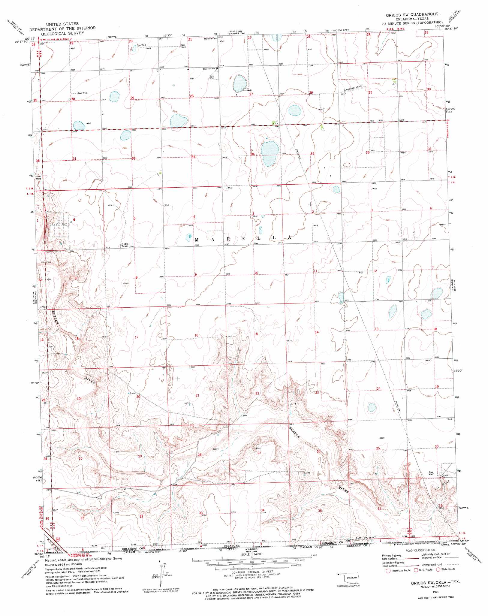
Griggs Sw Topo Map Oklahoma
To zoom in, hover over the map of Griggs Sw
USGS Topo Quad 36102e2 - 1:24,000 scale
| Topo Map Name: | Griggs Sw |
| USGS Topo Quad ID: | 36102e2 |
| Print Size: | ca. 21 1/4" wide x 27" high |
| Southeast Coordinates: | 36.5° N latitude / 102.125° W longitude |
| Map Center Coordinates: | 36.5625° N latitude / 102.1875° W longitude |
| U.S. States: | OK, TX |
| Filename: | o36102e2.jpg |
| Download Map JPG Image: | Griggs Sw topo map 1:24,000 scale |
| Map Type: | Topographic |
| Topo Series: | 7.5´ |
| Map Scale: | 1:24,000 |
| Source of Map Images: | United States Geological Survey (USGS) |
| Alternate Map Versions: |
Griggs SW OK 1971, updated 1973 Download PDF Buy paper map Griggs SW OK 2011 Download PDF Buy paper map Griggs SW OK 2012 Download PDF Buy paper map Griggs SW OK 2016 Download PDF Buy paper map |
| FStopo: | US Forest Service topo Griggs SW is available: Download FStopo PDF Download FStopo TIF |
1:24,000 Topo Quads surrounding Griggs Sw
Keyes Sw |
Keyes West |
Keyes East |
Hopkins |
Eva |
Conrad Nw |
Sampsel Lake |
Griggs Nw |
Griggs Ne |
Texhoma Nw |
Conrad Sw |
Conrad |
Griggs Sw |
Griggs |
Texhoma Sw |
Stratford 2 Nw |
Stratford 2 Ne |
Kerrick |
Stratford Ne |
Stevens |
Stratford 2 Sw |
Stratford 2 Se |
Brickel |
Stratford |
Stevens Sw |
> Back to 36102e1 at 1:100,000 scale
> Back to 36102a1 at 1:250,000 scale
> Back to U.S. Topo Maps home
Griggs Sw topo map: Gazetteer
Griggs Sw: Dams
Cimarron Feeders Number 1 Dam elevation 1158m 3799′Griggs Sw: Reservoirs
Cimarron Feeders Number 1 Reservoir elevation 1158m 3799′Griggs Sw digital topo map on disk
Buy this Griggs Sw topo map showing relief, roads, GPS coordinates and other geographical features, as a high-resolution digital map file on DVD: