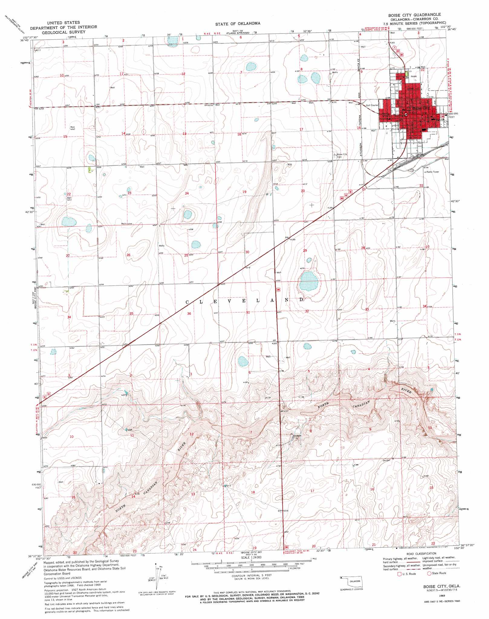
Boise City Topo Map Oklahoma
To zoom in, hover over the map of Boise City
USGS Topo Quad 36102f5 - 1:24,000 scale
| Topo Map Name: | Boise City |
| USGS Topo Quad ID: | 36102f5 |
| Print Size: | ca. 21 1/4" wide x 27" high |
| Southeast Coordinates: | 36.625° N latitude / 102.5° W longitude |
| Map Center Coordinates: | 36.6875° N latitude / 102.5625° W longitude |
| U.S. State: | OK |
| Filename: | o36102f5.jpg |
| Download Map JPG Image: | Boise City topo map 1:24,000 scale |
| Map Type: | Topographic |
| Topo Series: | 7.5´ |
| Map Scale: | 1:24,000 |
| Source of Map Images: | United States Geological Survey (USGS) |
| Alternate Map Versions: |
Boise City OK 1969, updated 1971 Download PDF Buy paper map Boise City OK 2010 Download PDF Buy paper map Boise City OK 2012 Download PDF Buy paper map Boise City OK 2016 Download PDF Buy paper map |
1:24,000 Topo Quads surrounding Boise City
Kenton Ne |
Autograph Cliff Nw |
Razor Blade Mesa |
Keyes Nw |
Keyes Ne |
Kenton Se |
Autograph Cliff |
Flagg Springs |
Keyes Sw |
Keyes West |
Felt Ne |
Boise City Nw |
Boise City |
Conrad Nw |
Sampsel Lake |
Felt |
Boise City Sw |
Boise City Se |
Conrad Sw |
Conrad |
Buffalo Springs |
Coldwater West |
Coldwater East |
Stratford 2 Nw |
Stratford 2 Ne |
> Back to 36102e1 at 1:100,000 scale
> Back to 36102a1 at 1:250,000 scale
> Back to U.S. Topo Maps home
Boise City digital topo map on disk
Buy this Boise City topo map showing relief, roads, GPS coordinates and other geographical features, as a high-resolution digital map file on DVD: