Kenton Ne Topo Map Oklahoma
To zoom in, hover over the map of Kenton Ne
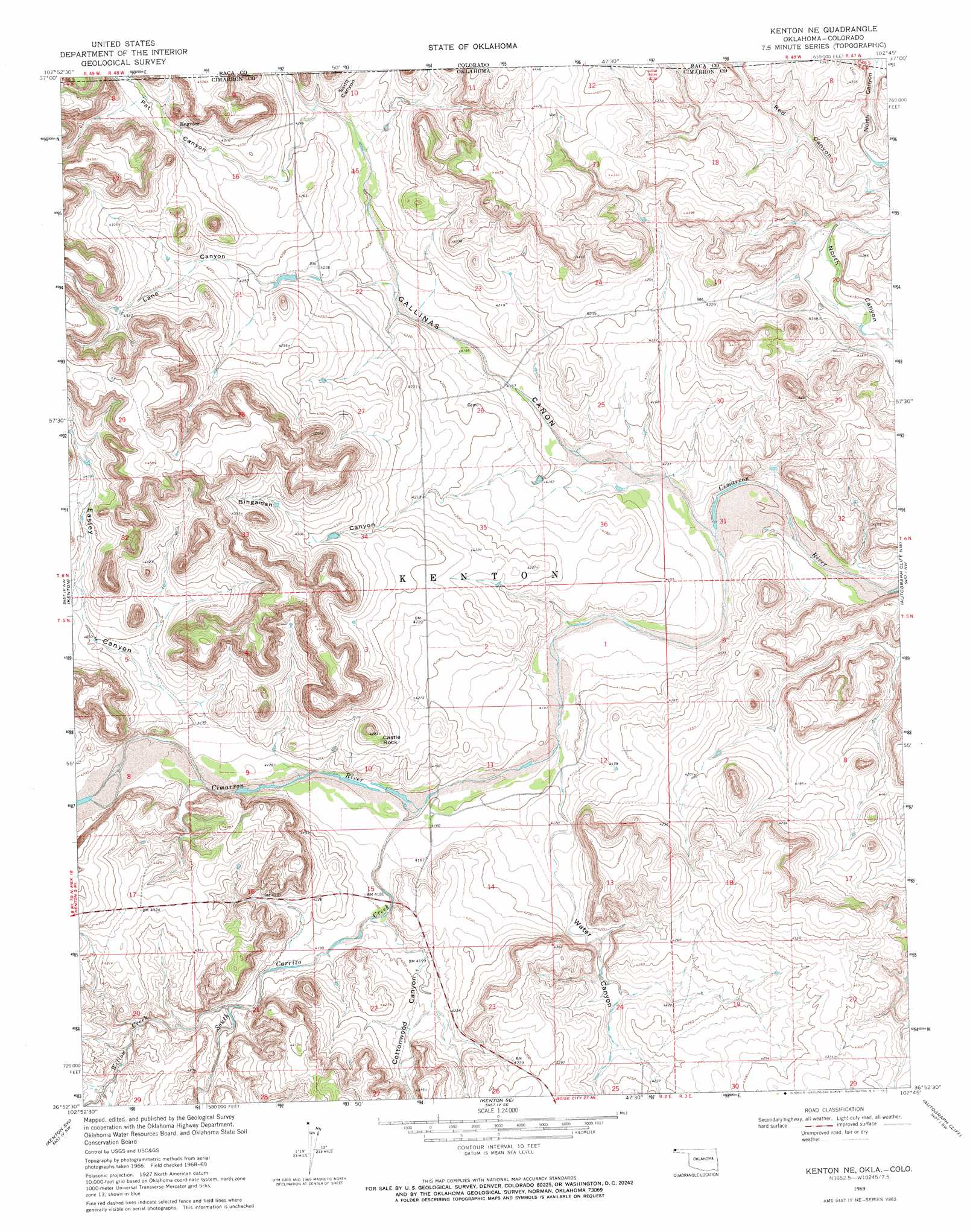
USGS Topo Quad 36102h7 - 1:24,000 scale
| Topo Map Name: | Kenton Ne |
| USGS Topo Quad ID: | 36102h7 |
| Print Size: | ca. 21 1/4" wide x 27" high |
| Southeast Coordinates: | 36.875° N latitude / 102.75° W longitude |
| Map Center Coordinates: | 36.9375° N latitude / 102.8125° W longitude |
| U.S. States: | OK, CO |
| Filename: | o36102h7.jpg |
| Download Map JPG Image: | Kenton Ne topo map 1:24,000 scale |
| Map Type: | Topographic |
| Topo Series: | 7.5´ |
| Map Scale: | 1:24,000 |
| Source of Map Images: | United States Geological Survey (USGS) |
| Alternate Map Versions: |
Kenton NE OK 1969, updated 1971 Download PDF Buy paper map Kenton NE OK 2011 Download PDF Buy paper map Kenton NE OK 2012 Download PDF Buy paper map Kenton NE OK 2016 Download PDF Buy paper map |
| FStopo: | US Forest Service topo Kenton NE is available: Download FStopo PDF Download FStopo TIF |
1:24,000 Topo Quads surrounding Kenton Ne
Carrizo Mountain |
Reader Lake |
Edler |
Campo Nw |
Campo Ne |
Furnish Canyon East |
Big Hole Canyon |
Tubs Springs |
Campo Sw |
Campo |
Goodson School |
Kenton |
Kenton Ne |
Autograph Cliff Nw |
Razor Blade Mesa |
Greendailey Canyon |
Kenton Sw |
Kenton Se |
Autograph Cliff |
Flagg Springs |
Moses |
Wheeless |
Felt Ne |
Boise City Nw |
Boise City |
> Back to 36102e1 at 1:100,000 scale
> Back to 36102a1 at 1:250,000 scale
> Back to U.S. Topo Maps home
Kenton Ne topo map: Gazetteer
Kenton Ne: Pillars
Castle Rock elevation 1307m 4288′Kenton Ne: Populated Places
Regnier elevation 1313m 4307′Kenton Ne: Streams
South Carrizo Creek elevation 1265m 4150′Willow Creek elevation 1278m 4192′
Kenton Ne: Valleys
Bingaman Canyon elevation 1262m 4140′Cañon Gallinas elevation 1253m 4110′
Cottonwood Canyon elevation 1276m 4186′
Easley Canyon elevation 1282m 4206′
Holt Canyon elevation 1275m 4183′
Holt Canyon elevation 1276m 4186′
Lane Canyon elevation 1276m 4186′
Pat Canyon elevation 1293m 4242′
Pat Canyon elevation 1299m 4261′
Sand Canyon elevation 1291m 4235′
Sand Canyon elevation 1290m 4232′
Water Canyon elevation 1264m 4146′
Kenton Ne digital topo map on disk
Buy this Kenton Ne topo map showing relief, roads, GPS coordinates and other geographical features, as a high-resolution digital map file on DVD: