Beenham Sw Topo Map New Mexico
To zoom in, hover over the map of Beenham Sw
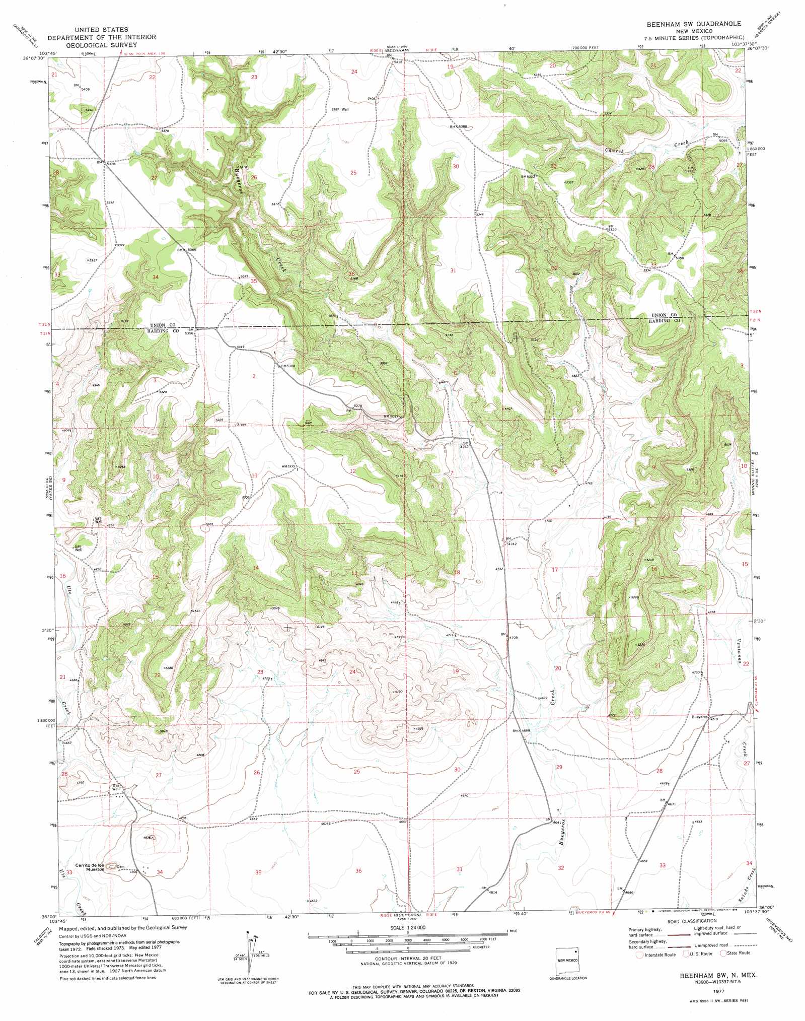
USGS Topo Quad 36103a6 - 1:24,000 scale
| Topo Map Name: | Beenham Sw |
| USGS Topo Quad ID: | 36103a6 |
| Print Size: | ca. 21 1/4" wide x 27" high |
| Southeast Coordinates: | 36° N latitude / 103.625° W longitude |
| Map Center Coordinates: | 36.0625° N latitude / 103.6875° W longitude |
| U.S. State: | NM |
| Filename: | o36103a6.jpg |
| Download Map JPG Image: | Beenham Sw topo map 1:24,000 scale |
| Map Type: | Topographic |
| Topo Series: | 7.5´ |
| Map Scale: | 1:24,000 |
| Source of Map Images: | United States Geological Survey (USGS) |
| Alternate Map Versions: |
Beenham SW NM 1977, updated 1978 Download PDF Buy paper map Beenham SW NM 2010 Download PDF Buy paper map Beenham SW NM 2013 Download PDF Buy paper map Beenham SW NM 2017 Download PDF Buy paper map |
1:24,000 Topo Quads surrounding Beenham Sw
Gladstone |
Romero Spring |
Pennington |
Goat Canyon |
Tate School |
Yates |
Aragon Hill |
Beenham |
Garcia Creek |
Car Top Butte |
Valencia Spring |
Yates Se |
Beenham Sw |
Minnie Butte |
Pedernal Creek |
Sabino |
Albert |
Bueyeros |
Bueyeros Ne |
Cottonwood Springs |
Mosquero |
Arroyo Del Alamo |
Circle Bar Ranch |
Indian Bathtub |
Rosebud |
> Back to 36103a1 at 1:100,000 scale
> Back to 36102a1 at 1:250,000 scale
> Back to U.S. Topo Maps home
Beenham Sw topo map: Gazetteer
Beenham Sw: Airports
Bueyeros CO2 Plant Airport elevation 1434m 4704′Beenham Sw: Mines
Adams Number Two Gonzales elevation 1477m 4845′Neill Number One Stake elevation 1436m 4711′
Powers Number One Timmons elevation 1431m 4694′
Timmons Number One Kerlin elevation 1439m 4721′
Beenham Sw: Streams
Ventanas Creek elevation 1409m 4622′Beenham Sw: Summits
Cerrito de los Muertos elevation 1477m 4845′Beenham Sw digital topo map on disk
Buy this Beenham Sw topo map showing relief, roads, GPS coordinates and other geographical features, as a high-resolution digital map file on DVD: