Valencia Spring Topo Map New Mexico
To zoom in, hover over the map of Valencia Spring
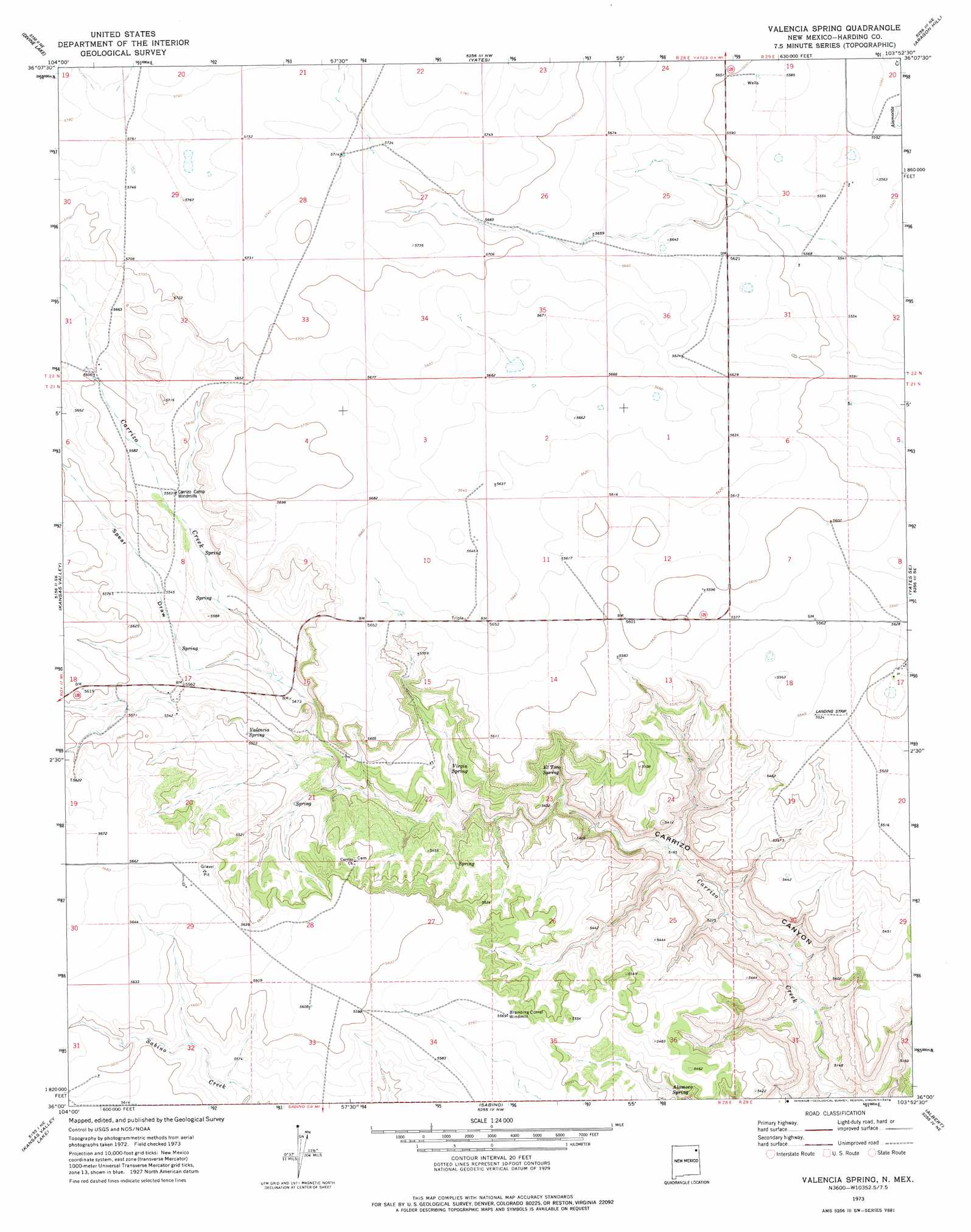
USGS Topo Quad 36103a8 - 1:24,000 scale
| Topo Map Name: | Valencia Spring |
| USGS Topo Quad ID: | 36103a8 |
| Print Size: | ca. 21 1/4" wide x 27" high |
| Southeast Coordinates: | 36° N latitude / 103.875° W longitude |
| Map Center Coordinates: | 36.0625° N latitude / 103.9375° W longitude |
| U.S. State: | NM |
| Filename: | o36103a8.jpg |
| Download Map JPG Image: | Valencia Spring topo map 1:24,000 scale |
| Map Type: | Topographic |
| Topo Series: | 7.5´ |
| Map Scale: | 1:24,000 |
| Source of Map Images: | United States Geological Survey (USGS) |
| Alternate Map Versions: |
Valencia Spring NM 1973, updated 1978 Download PDF Buy paper map Valencia Spring NM 1998, updated 2001 Download PDF Buy paper map Valencia Spring NM 2011 Download PDF Buy paper map Valencia Spring NM 2013 Download PDF Buy paper map Valencia Spring NM 2017 Download PDF Buy paper map |
| FStopo: | US Forest Service topo Valencia Spring is available: Download FStopo PDF Download FStopo TIF |
1:24,000 Topo Quads surrounding Valencia Spring
Ingram Lake |
Farley |
Gladstone |
Romero Spring |
Pennington |
Spear Hills |
Divine Lake |
Yates |
Aragon Hill |
Beenham |
Mills East |
Kansas Valley |
Valencia Spring |
Yates Se |
Beenham Sw |
Roy |
Kansas Valley Lake |
Sabino |
Albert |
Bueyeros |
La Cinta Canyon |
Solano |
Mosquero |
Arroyo Del Alamo |
Circle Bar Ranch |
> Back to 36103a1 at 1:100,000 scale
> Back to 36102a1 at 1:250,000 scale
> Back to U.S. Topo Maps home
Valencia Spring topo map: Gazetteer
Valencia Spring: Springs
Alamoso Spring elevation 1635m 5364′El Toro Spring elevation 1657m 5436′
Valencia Spring elevation 1671m 5482′
Virgin Spring elevation 1641m 5383′
Valencia Spring: Valleys
Spear Draw elevation 1672m 5485′Valencia Spring digital topo map on disk
Buy this Valencia Spring topo map showing relief, roads, GPS coordinates and other geographical features, as a high-resolution digital map file on DVD: