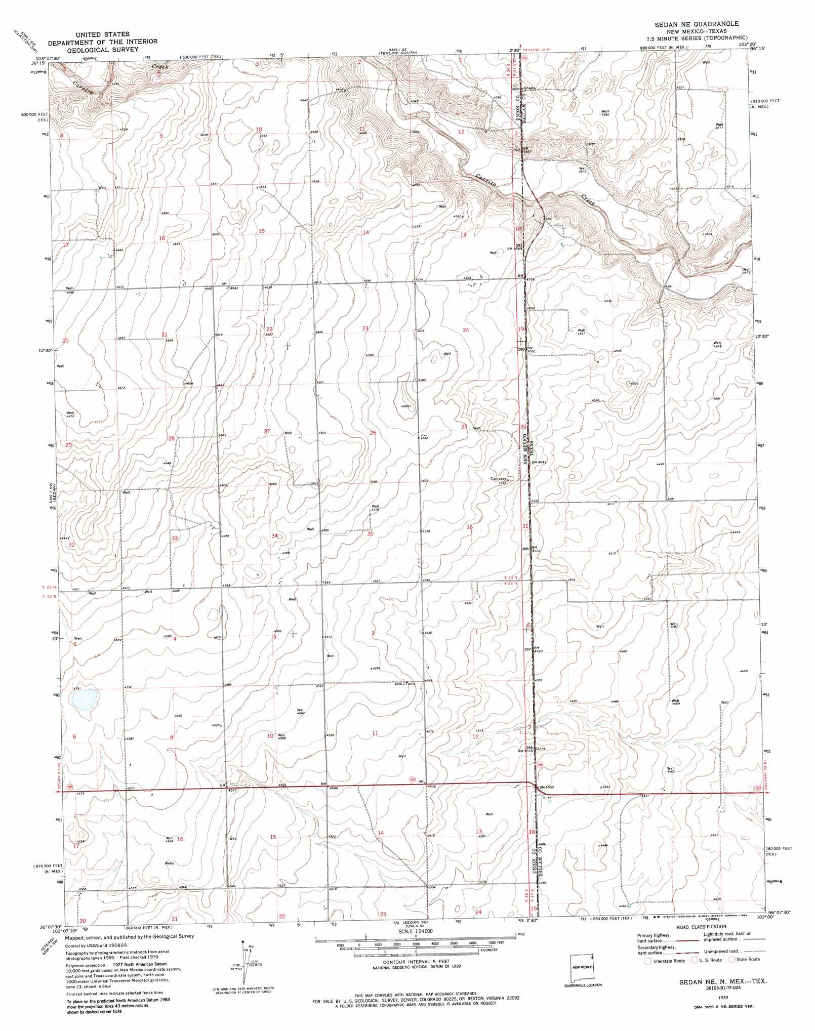
Sedan Ne Topo Map New Mexico
To zoom in, hover over the map of Sedan Ne
USGS Topo Quad 36103b1 - 1:24,000 scale
| Topo Map Name: | Sedan Ne |
| USGS Topo Quad ID: | 36103b1 |
| Print Size: | ca. 21 1/4" wide x 27" high |
| Southeast Coordinates: | 36.125° N latitude / 103° W longitude |
| Map Center Coordinates: | 36.1875° N latitude / 103.0625° W longitude |
| U.S. States: | NM, TX |
| Filename: | o36103b1.jpg |
| Download Map JPG Image: | Sedan Ne topo map 1:24,000 scale |
| Map Type: | Topographic |
| Topo Series: | 7.5´ |
| Map Scale: | 1:24,000 |
| Source of Map Images: | United States Geological Survey (USGS) |
| Alternate Map Versions: |
Sedan NE NM 1970, updated 1973 Download PDF Buy paper map Sedan NE NM 1970, updated 1984 Download PDF Buy paper map Sedan NE NM 1998, updated 2001 Download PDF Buy paper map Sedan NE NM 2011 Download PDF Buy paper map Sedan NE NM 2013 Download PDF Buy paper map Sedan NE NM 2017 Download PDF Buy paper map |
| FStopo: | US Forest Service topo Sedan NE is available: Download FStopo PDF Download FStopo TIF |
1:24,000 Topo Quads surrounding Sedan Ne
Royce |
Clayton |
Texline North |
Corlena Nw |
Buffalo Springs |
Sand Hill |
Clayton Sw |
Texline South |
Corlena |
Perico |
Clapham |
Sedan |
Sedan Ne |
Windy Hill Nw |
Wharton Ranch |
Skull Mesa |
Stead |
Sedan Se |
Windy Hill |
Wells Ranch |
Hayden |
Amistad |
Koger Ranch |
Beck Ranch |
Syndicate Hills |
> Back to 36103a1 at 1:100,000 scale
> Back to 36102a1 at 1:250,000 scale
> Back to U.S. Topo Maps home
No gazetteer data is available for the Sedan Ne topo map sheet.
Sedan Ne digital topo map on disk
Buy this Sedan Ne topo map showing relief, roads, GPS coordinates and other geographical features, as a high-resolution digital map file on DVD: