Yates Topo Map New Mexico
To zoom in, hover over the map of Yates
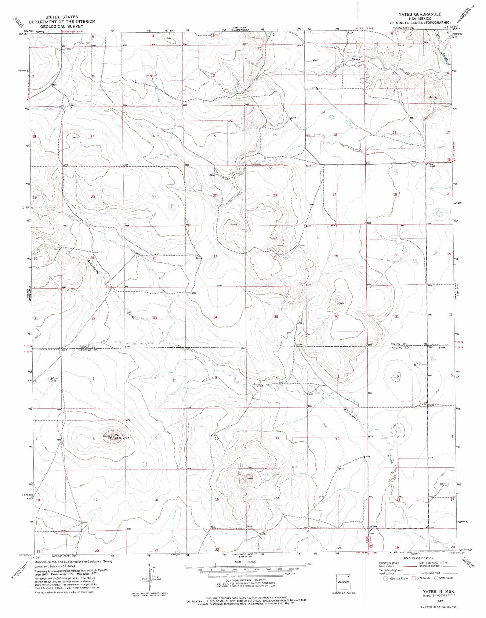
USGS Topo Quad 36103b8 - 1:24,000 scale
| Topo Map Name: | Yates |
| USGS Topo Quad ID: | 36103b8 |
| Print Size: | ca. 21 1/4" wide x 27" high |
| Southeast Coordinates: | 36.125° N latitude / 103.875° W longitude |
| Map Center Coordinates: | 36.1875° N latitude / 103.9375° W longitude |
| U.S. State: | NM |
| Filename: | o36103b8.jpg |
| Download Map JPG Image: | Yates topo map 1:24,000 scale |
| Map Type: | Topographic |
| Topo Series: | 7.5´ |
| Map Scale: | 1:24,000 |
| Source of Map Images: | United States Geological Survey (USGS) |
| Alternate Map Versions: |
Yates NM 1977, updated 1978 Download PDF Buy paper map Yates NM 2010 Download PDF Buy paper map Yates NM 2013 Download PDF Buy paper map Yates NM 2017 Download PDF Buy paper map |
1:24,000 Topo Quads surrounding Yates
Point Of Rocks Mesa |
Lawrence Arroyo |
Gladstone Nw |
Sofia |
Tripod Mountain |
Ingram Lake |
Farley |
Gladstone |
Romero Spring |
Pennington |
Spear Hills |
Divine Lake |
Yates |
Aragon Hill |
Beenham |
Mills East |
Kansas Valley |
Valencia Spring |
Yates Se |
Beenham Sw |
Roy |
Kansas Valley Lake |
Sabino |
Albert |
Bueyeros |
> Back to 36103a1 at 1:100,000 scale
> Back to 36102a1 at 1:250,000 scale
> Back to U.S. Topo Maps home
Yates topo map: Gazetteer
Yates: Lakes
Island Lake elevation 1786m 5859′Yates: Populated Places
Yates elevation 1710m 5610′Yates: Post Offices
Yates Post Office (historical) elevation 1710m 5610′Yates: Summits
Cerro de la Cruz elevation 1887m 6190′Yates digital topo map on disk
Buy this Yates topo map showing relief, roads, GPS coordinates and other geographical features, as a high-resolution digital map file on DVD: