Goat Canyon Topo Map New Mexico
To zoom in, hover over the map of Goat Canyon
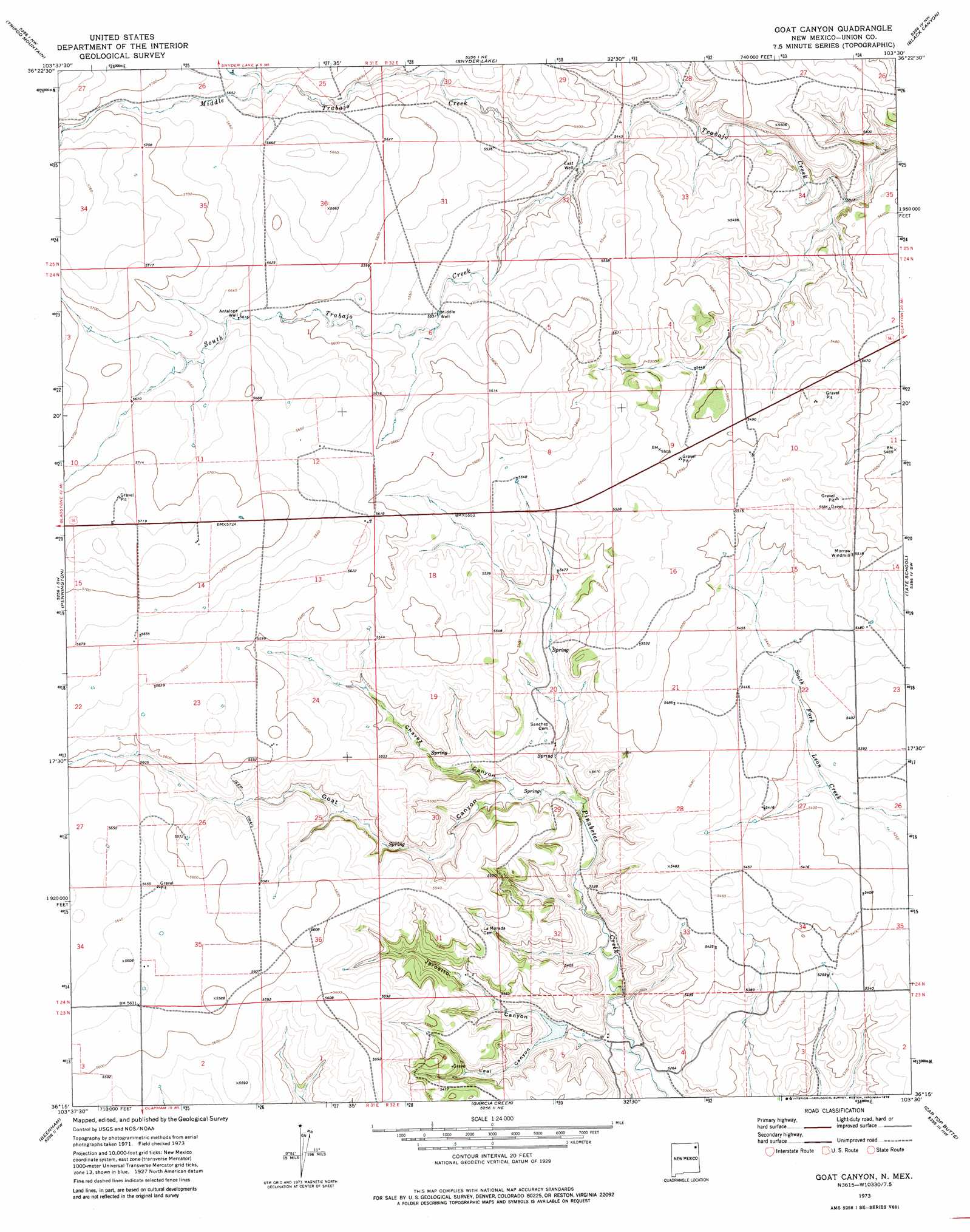
USGS Topo Quad 36103c5 - 1:24,000 scale
| Topo Map Name: | Goat Canyon |
| USGS Topo Quad ID: | 36103c5 |
| Print Size: | ca. 21 1/4" wide x 27" high |
| Southeast Coordinates: | 36.25° N latitude / 103.5° W longitude |
| Map Center Coordinates: | 36.3125° N latitude / 103.5625° W longitude |
| U.S. State: | NM |
| Filename: | o36103c5.jpg |
| Download Map JPG Image: | Goat Canyon topo map 1:24,000 scale |
| Map Type: | Topographic |
| Topo Series: | 7.5´ |
| Map Scale: | 1:24,000 |
| Source of Map Images: | United States Geological Survey (USGS) |
| Alternate Map Versions: |
Goat Canyon NM 1973, updated 1978 Download PDF Buy paper map Goat Canyon NM 2010 Download PDF Buy paper map Goat Canyon NM 2013 Download PDF Buy paper map Goat Canyon NM 2017 Download PDF Buy paper map |
1:24,000 Topo Quads surrounding Goat Canyon
Cow Mountain |
Grenville Sw |
Grenville |
Mount Dora |
Bible Top Butte |
Sofia |
Tripod Mountain |
Snyder Lake |
Black Canyon |
Royce |
Romero Spring |
Pennington |
Goat Canyon |
Tate School |
Sand Hill |
Aragon Hill |
Beenham |
Garcia Creek |
Car Top Butte |
Clapham |
Yates Se |
Beenham Sw |
Minnie Butte |
Pedernal Creek |
Skull Mesa |
> Back to 36103a1 at 1:100,000 scale
> Back to 36102a1 at 1:250,000 scale
> Back to U.S. Topo Maps home
Goat Canyon topo map: Gazetteer
Goat Canyon: Dams
Gardner Reservoir Dam elevation 1630m 5347′Goat Canyon: Streams
Middle Trabajo Creek elevation 1662m 5452′South Trabajo Creek elevation 1662m 5452′
Goat Canyon: Valleys
Chavez Canyon elevation 1644m 5393′Goat Canyon elevation 1633m 5357′
Jarosito Canyon elevation 1606m 5269′
Leal Canyon elevation 1620m 5314′
Goat Canyon: Wells
Antelope Well elevation 1713m 5620′East Well elevation 1666m 5465′
Middle Well elevation 1689m 5541′
Goat Canyon digital topo map on disk
Buy this Goat Canyon topo map showing relief, roads, GPS coordinates and other geographical features, as a high-resolution digital map file on DVD: