Black Canyon Topo Map New Mexico
To zoom in, hover over the map of Black Canyon
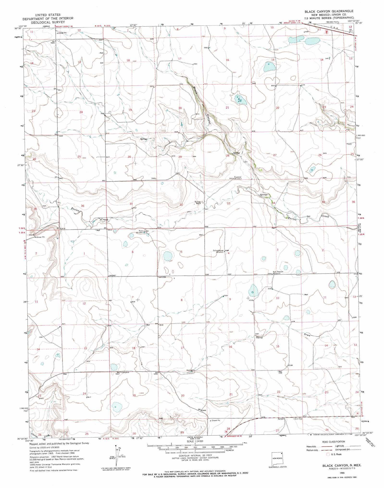
USGS Topo Quad 36103d4 - 1:24,000 scale
| Topo Map Name: | Black Canyon |
| USGS Topo Quad ID: | 36103d4 |
| Print Size: | ca. 21 1/4" wide x 27" high |
| Southeast Coordinates: | 36.375° N latitude / 103.375° W longitude |
| Map Center Coordinates: | 36.4375° N latitude / 103.4375° W longitude |
| U.S. State: | NM |
| Filename: | o36103d4.jpg |
| Download Map JPG Image: | Black Canyon topo map 1:24,000 scale |
| Map Type: | Topographic |
| Topo Series: | 7.5´ |
| Map Scale: | 1:24,000 |
| Source of Map Images: | United States Geological Survey (USGS) |
| Alternate Map Versions: |
Black Canyon NM 1966, updated 1968 Download PDF Buy paper map Black Canyon NM 2010 Download PDF Buy paper map Black Canyon NM 2013 Download PDF Buy paper map |
1:24,000 Topo Quads surrounding Black Canyon
Wetherly Lake |
Blind Gap |
Boiler Gap |
Mclaughlin Bridge |
Seneca |
Grenville Sw |
Grenville |
Mount Dora |
Bible Top Butte |
Rabbit Ear Mountain |
Tripod Mountain |
Snyder Lake |
Black Canyon |
Royce |
Clayton |
Pennington |
Goat Canyon |
Tate School |
Sand Hill |
Clayton Sw |
Beenham |
Garcia Creek |
Car Top Butte |
Clapham |
Sedan |
> Back to 36103a1 at 1:100,000 scale
> Back to 36102a1 at 1:250,000 scale
> Back to U.S. Topo Maps home
Black Canyon topo map: Gazetteer
Black Canyon: Mines
Jones Pit elevation 1721m 5646′Black Canyon: Valleys
Black Canyon elevation 1612m 5288′Black Canyon digital topo map on disk
Buy this Black Canyon topo map showing relief, roads, GPS coordinates and other geographical features, as a high-resolution digital map file on DVD: